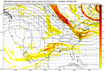
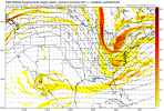
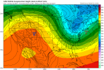
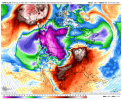
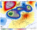
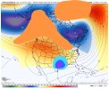
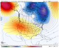
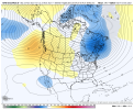
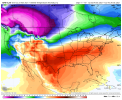
GFS heading in wrong direction, flatter ridge and NE shift with energy. Let's hope GFS still sucks lol
-
Hello, please take a minute to check out our awesome content, contributed by the wonderful members of our community. We hope you'll add your own thoughts and opinions by making a free account!
You are using an out of date browser. It may not display this or other websites correctly.
You should upgrade or use an alternative browser.
You should upgrade or use an alternative browser.
Pattern Novemburrr
- Thread starter SD
- Start date
Meh, next... Lol


It's a good track on the icon and the early Sunday timing isn't bad at all but the sub 850 layer isn't that great. If we are going to have to cool from the sfc to 900 we are going to need a strong wave that can generate banded heavy precip. A marginal wave with mainly light precip is going to end up with a lot of 37 and light rain reportsLet's see what the GFS tries to do with our energy. ICON nice little shift, pac ridge smidge taller, separation from northern energy and decent sw shift
View attachment 95667
Something tells me a NAM run will give us the rates we need .. might not actually happen but I’m sure it’ll show us something we want to see ?It's a good track on the icon and the early Sunday timing isn't bad at all but the sub 850 layer isn't that great. If we are going to have to cool from the sfc to 900 we are going to need a strong wave that can generate banded heavy precip. A marginal wave with mainly light precip is going to end up with a lot of 37 and light rain reports
smast16
Member
Does anyone know where to check local PWS for temps this morning? NWS showed GSO at 29, and I read 23. I know UHI, but it's never that much of a difference. Usually 2-3, not 6.
smast16
Member
This is the stuff of weather nerd wet dreams.I'd take my chances with thisView attachment 95661
And broken hearts.
cyclogent
Member
Been dry this month - current MTD in Chattanooga stands at 0.70", and even the wettest ensemble in the GEFS plumes through month end only has an additional 0.26". The last time we finished a month under 1" was back in October 2013, and it hasn't happened in the month of November since 1953! Also, our daily max MTD is only 0.25" which is the lowest in a November since 1917!
Its really not that far away tbh and if we were in the heart of winter the icon probably isn't rain. Given the time of year though with still marginally cold air masses we gotta get help aloft. Take the same icon track but strengthen/close the upper wave and you get a stripe of snow along and north of 40.Something tells me a NAM run will give us the rates we need .. might not actually happen but I’m sure it’ll show us something we want to see ?
Last edited:
Is it too early to talk about the ICON warm bias? LolIts really not that far away tbh and if we were in the heart of winter the icon probably isn't rain. Given the time of year though with still marginally cold air masses and we gotta get help aloft. Take the same icon track but strengthen/close the upper wave and you get a stripe of snow along and north of 40.
I was going to go with the wave hasn't been sampled yetIs it too early to talk about the ICON warm bias? Lol
Yesterday mornings rain was a great example of FGEN/DPVA enhanced rates that was sort of a surprise, I’d watch for something similar if our energy cooperates this weekend
Close but no cigar?? ?? ? going to try to pull some craziness
View attachment 95671
SS energy? Niña my a**?? ?? ? going to try to pull some craziness
View attachment 95671
Webberweather53
Meteorologist

