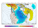
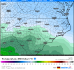
ForsythSnow
Moderator
25.9 this morning, coldest of the season so far
Yeah didn't like seeing that energy out west flattening the pac ridge, was surprised it trended SW considering that but the NE confluence trending stronger and SW, not sure which way it budges on the 12z runEuro is still inching SWView attachment 95649
But with the low at 850/700 initially to our N we get into a mid level waa pattern so anything that falls during the day Sunday would be rain.
View attachment 95650
But as the low starts to redevelop off of the nc coast CAA takes over and the column crashes
View attachment 95651
the question then becomes is there any moisture available to help erode the warm in the 925 to sfc layers which are still warm as CAA is slower weaker in these levels
View attachment 95652
View attachment 95653
View attachment 95654
The slightly banded/convective look makes it seem like it wouldn't be impossible to get a few flakes
View attachment 95655
All of this though presumes the euro is correct. My concern is we see the euro start inching NE in time. We will see
Do we have 06z euro updates? Also ensembles for euro?

Hard to be disappointed with a Hudson Bay vortex, usually gives us something to work withI'd take my chances with thisView attachment 95661
ICON 12z said GIDDEUP with our early season clipper!View attachment 95663View attachment 95665View attachment 95664
I think we easily see some wet snow mixed in verbatim what the ICON hasYay! Cold drizzle for the Carolinas.
Sent from my iPhone using Tapatalk
850s not bad, BL too warm but I like the trend and at least appears just maybe the 12z suite not shifting in the wrong direction (hopefully)ICON 12z said GIDDEUP with our early season clipper!View attachment 95663View attachment 95665View attachment 95664

I wouldn't say "easily", potential is there but need decent rates and a colder BL. Not out of the question to see a late blooming coastal, to which I'm not opposed lolI think we easily see some wet snow mixed in verbatim what the ICON has
Yessir it would certainly not amount to anything but bragging rights on first flakes of the season!850s not bad, BL too warm but I like the trend and at least appears just maybe the 12z suite not shifting in the wrong direction (hopefully)
View attachment 95666
There’s gotta be a euro ensemble member with a pasty 4 inches over us right?I wouldn't say "easily", potential is there but need decent rates and a colder BL. Not out of the question to see a late blooming coastal, to which I'm not opposed lol
Nope noneThere’s gotta be a euro ensemble member with a pasty 4 inches over us right?
Give me NAM or give me DEATHLet's see what the GFS tries to do with our energy. ICON nice little shift, pac ridge smidge taller, separation from northern energy and decent sw shift
View attachment 95667
