• Hello, please take a minute to check out our awesome content, contributed by the wonderful members of our community. We hope you'll add your own thoughts and opinions by making a free account!

Pattern November Knock-Out

That sounds like a good sign. And for everyone already freaking out about storms or not, it's November. Anything at this this time of year is just bonus until January or December really.Until something realistic and consistent shows up its all fantasy, so let's have fun with those for now.
 
That sounds like a good sign. And for everyone already freaking out about storms or not, it's November. Anything at this this time of year is just bonus until January or December really.Until something realistic and consistent shows up its all fantasy, so let's have fun with those for now.
FS,
Welcome to the chorus!
Phil
 
That sounds like a good sign. And for everyone already freaking out about storms or not, it's November. Anything at this this time of year is just bonus until January or December really.Until something realistic and consistent shows up its all fantasy, so let's have fun with those for now.

THIS^^^


Sent from my iPhone using Tapatalk
 
The 0z was boring but at least around average, 6z was the first time it threw really warm temps in a while, and webb gives me hope that none of this really matters in the end.
 
EPS looks very NINO-like near the very tail end of the month w/ a big vortex over the Aleutians, ridging out west... and troughing underneath over the SE US and eastern seaboard...
View attachment 1533

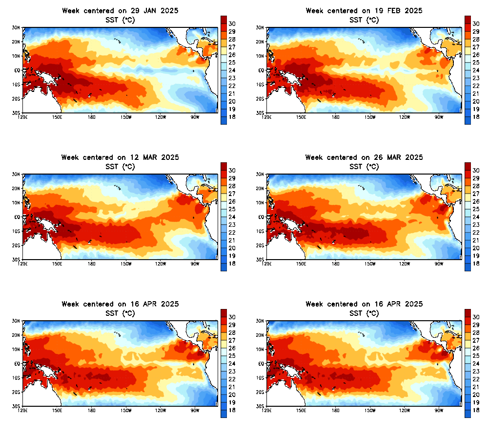
As long as that warmer pool stays off west coast of Mexico, it handicaps the cooler water futher west (nina) normal effects downstream in the NH. Disrupts the ability for a west coast trough to position itself where it normally would and you end up with higher pressures that location.get a nino background.

Here in Greensboro and raleigh we are -1 to -2 below for the month of November and all but guranteed to come in BN for the month. Been atleast 9-10 days in a row BN at Greensboro.
 
Last edited:
seems to me to the east of the west coast of mexico is mexico NOT water and further east is the gulf of mexico.....
 
sstanim.gif


Heres what I was referncing. cold pool is at equator SH, but the warm pool up against mexico coast is promoting ridging as oppossed to troughiness on west coast.
 
sstanim.gif


Heres what I was referncing. cold pool is at equator SH, but the warm pool up against mexico coast is promoting ridging as oppossed to troughiness on west coast.

The extremely anomalous equatorial warming that's occurring just off the equator in the Pacific is contributing to the expanding Hadley Cell, and is certainly not hurting these brief NINO-esque respites in a large-scale sense, because the warm water changes the diabatic heating budget directly over these regions ultimately impacting the placement, intensity, and movement of Rossby Waves downstream in the mid latitudes. The warm water in the subtropical N Pacific is essentially a lower frequency "scar" or imprint if you will that was left by the most recent super El Nino. Similar changes in SST were observed in the subtropical Pacific after the 1997-98 Super event but not to this magnitude and that may be due in part to AGW and the fact that the most recent NINO lasted much longer while being of comparable intensity...

You can clearly see in this equatorial pacific SST hovmoller below how much the subtropical eastern pacific sticks out like a sore thumb after the big NINO event. This warm anomaly is not adequately captured in any analog package and I've yet to see few, if any mention, much less explain what this actually can do to their seasonal winter outlooks, but is certainly an important dynamical adjustment that forecasters should make imo.
sst.month.anom.pacific.lat.gif
 
AGW is throwing a wrench into a lot of things because we don’t understand all the effects.


Sent from my iPhone using Tapatalk
 
Back
Top