Bigedd09
Member
Does it have any precip making it over the mountains?
Does it have any precip making it over the mountains?
On the OP 6z euro it does have spotty precip making it over the mtns.Does it have any precip making it over the mountains?
THIS is (Believable), RE: Bald Head Island & immediately off the Coast (second attachment & #3).. Sorta a Lake/Ocean Effect Snow(s) & Flurries At/Off or Right on the coastal area(s) with a NE & NW Wind(s)..And then there's the Ukmet: Programed by Fro to jackpot his Backyard:
View attachment 176147
No need to post GFS, hardly has anything for even the mtns. Out to lunch still. The Short Range models will get to start taking a bite at things latter today.
There’s still some signal for very light precip east of the mtns Monday PM-overnight, but the best odds I saw at 6z was ~50% chance of seeing QPF 0.01” or more for mainly I-40 corridor in central NC. This seems like a “someone in Forsyth co gets floodlight flurries” deal to me at the momentDoes it have any precip making it over the mountains?
childhood shattered
View attachment 176164
Thank you. That one is the oldest continuously published periodical in the US.Just to clarify it's not the old almanac with Ben Franklin on it from 1792
The one I remember from childhood
Haha I led with that in my video today. I wanted to put the pizza buffet on it but didn't have time.
Thank you. That one is the oldest continuously published periodical in the US.
Is this model reliable?Good looking pass of the upper wave incoming on the 12z RGEM with 925s crashing. Strong height falls and PVA would likely develop some lee side snow showers/flurries as the evening progressed.
View attachment 176168
View attachment 176169
View attachment 176167
IMHO, RGEM is best inside 60 hours. That said, it is in agreement with other global solutions (Euro/UKMet/Icon) at H5, which is a good sign.Is this model reliable?
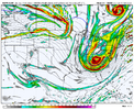
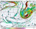
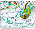
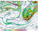
Oh that jackpot is south of Fro. That little spot of blue is right over MBY. It doesn’t matter, Brad P says zero chance of flakes east of the mountainsOvernight Euro
View attachment 176145
What the Germans are spiting out this a.m.. Lake effect snow Pamlico/Albermarle sound style:
View attachment 176146
And then there's the Ukmet: Programed by Fro to jackpot his Backyard:
View attachment 176147
No need to post GFS, hardly has anything for even the mtns. Out to lunch still. The Short Range models will get to start taking a bite at things latter today.
sigh alright i guess we have to pay attention for real at some point. i said it a few days ago though when you got a trough this silly you can make some BS happen. helps that, as we've said, the big ol euro vort max is lagging well behind the cold push. just that little bit deeper trough and little bit more dig made a big difference for wnc
Snow showers all the way down to Atlanta would be something. Of course I’m not here to see it (traveling) so I’m sure something epic will happen! Sigh.
I was out of town for the December 2010 snowstormSnow showers all the way down to Atlanta would be something. Of course I’m not here to see it (traveling) so I’m sure something epic will happen! Sigh.
Anyone else feel like the craziest weather each year in your town happens the one week you’re on vacation somewhere else? Tale as old as time for me
You’ve got my cold air! They said 850s here would be about -45 by Sunday or so.
that correlates with harsher start to winter, milder in the middle, and a bit of a reversal again towards the end, right?Just saw a wooly worm with a lot of black on the head and a little in the tail. Lines up with a lot of forecasts this year.
Looks like even RDU should hit freezing Monday night. A but late but I was wondering how long it was going to take.33 this morning, coldest yet but still haven't touched freezing. Better frost though and Monday night I'll probably finally have to turn the heat on
I think so but I’m not well versed. We never had them growing up but I see them every year up here.that correlates with harsher start to winter, milder in the middle, and a bit of a reversal again towards the end, right?
