-
Hello, please take a minute to check out our awesome content, contributed by the wonderful members of our community. We hope you'll add your own thoughts and opinions by making a free account!
You are using an out of date browser. It may not display this or other websites correctly.
You should upgrade or use an alternative browser.
You should upgrade or use an alternative browser.
Pattern November 2022
- Thread starter Metwannabe
- Start date
- Status
- Not open for further replies.
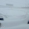
The game was moved to Detroit's Ford Field because of the conditions!Bulls browns game tomorrow. If only it were today or yesterday. Epic conditions View attachment 123963
This out Buffaloed Buffalo....
Theres an official 77” total now!!??I saw a 65 inch report at 10pm last night. No doubt someone could eclipse 72 inch mark before all is said and done. Saw one youtube video of a chaser in chest deep snow.
@ Orchard Park , NY. Per TWC
Last edited:
LickWx
Member
Whats happening in Buffalo is nuts! They are getting some 2/3rd of their annual snowfall in one storm! Wow! That would be the equivalent of us getting a 3 inch snowstorm! I can not imagine getting 75% of my annual snowfall avg in one snow. Crazy stuff. `
Most people in the south get 75% of their yearly snowfall in one event. GSP is line 5” a year, so one snow will do herWhats happening in Buffalo is nuts! They are getting some 2/3rd of their annual snowfall in one storm! Wow! That would be the equivalent of us getting a 3 inch snowstorm! I can not imagine getting 75% of my annual snowfall avg in one snow. Crazy stuff. `
L
Logan Is An Idiot 02
Guest
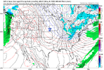
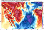
12z gfs says what cold shot next weekend??
Sent from my iPhone using Tapatalk
Sent from my iPhone using Tapatalk
L
Logan Is An Idiot 02
Guest

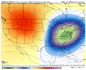
Ragin -PNA
Sent from my iPhone using Tapatalk
Sheesh it’s only November and it’s already begun lol ^
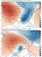
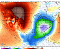
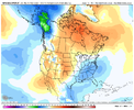
Anyways still like week 1-2 for December of a change, do think we’ll have to contend with a +EPO as the pacific jet May overextend sending the okhotsk low all the way to Alaska and it merges with some sort of TPV. But once it starts to retrograde any bit out of Alaska directly over the Aleutian Islands, it’ll be pretty easy to get a +PNA. Might see a shallow western ridge/+EPO zonal sort of look at first as the pacific jet goes into overdrive
Anyways still like week 1-2 for December of a change, do think we’ll have to contend with a +EPO as the pacific jet May overextend sending the okhotsk low all the way to Alaska and it merges with some sort of TPV. But once it starts to retrograde any bit out of Alaska directly over the Aleutian Islands, it’ll be pretty easy to get a +PNA. Might see a shallow western ridge/+EPO zonal sort of look at first as the pacific jet goes into overdrive
accu35
Member
- Joined
- Jan 5, 2017
- Messages
- 8,448
- Reaction score
- 9,973
Ok, we get it.
Ragin -PNA
Sent from my iPhone using Tapatalk
We get some of our biggest cold outbreaks with the WAR nudging into the Carolinas
After seeing 72” of snow in Watertown this weekend, nothing the south has to offer will ever be the same lol.
Drizzle Snizzle
Member
i'll take 6" of snow in my back yard, over 72" in another person's back yard. Snow in your yard is more special.After seeing 72” of snow in Watertown this weekend, nothing the south has to offer will ever be the same lol.
L
Logan Is An Idiot 02
Guest
Notre dame game is pretty aweosme right now
Sent from my iPhone using Tapatalk
Sent from my iPhone using Tapatalk
hyperactive pac jet + -NAO and shallow western ridge = trapped pacific polar energy. To much pacific jet. Until we get a -EPO with a retreating AK vortex (should happen as MJO propagates forward and starts to weaken but don’t think that happens till 2nd week of December) this is a marginal marginal look. 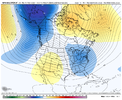


- Status
- Not open for further replies.

