-
Hello, please take a minute to check out our awesome content, contributed by the wonderful members of our community. We hope you'll add your own thoughts and opinions by making a free account!
You are using an out of date browser. It may not display this or other websites correctly.
You should upgrade or use an alternative browser.
You should upgrade or use an alternative browser.
Tropical Melissa
- Thread starter SD
- Start date
Saw post of 241 mph gust. Anyone confirm,
GeorgiaGirl
Member
Just came across this, nice shot:
Some insane videos. Whole thread is worth a look
Melissa is wobbling quite a bit. Looks to have completed a full mini circle. 
Definitely interesting movement this evening, any continued westward jog could be a blessing. Anything to help minimize the catastrophe about to happen would be great, anythingMelissa is wobbling quite a bit. Looks to have completed a full mini circle.
Track keeps sliding west. If I were in Jamaica I’d be driving toward Kingston right now. Should be plenty enough east for some refuge
Looks to have stalled, N turn about to commence unfortunately
Clouds tops are cooling, dang looks like it's still intensifying while just sitting there 
Also, local couple trapped in Jamaica (the young lady is friends with my daughter)

 www.wral.com
Also, local couple trapped in Jamaica (the young lady is friends with my daughter)

Paramedics' vacation could turn to work as they hunker down in Jamaica, await Hurricane Melissa
One year ago, Wayne and Bridgette Todd were newlyweds, celebrating their wedding surrounded by family and friends. Now, one year later, the couple from our area is spending their first anniversary hunkered down in Jamaica, as Hurricane Melissa, now a Category 5 storm, heads straight for the island.
BHS1975
Member
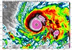
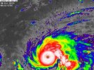
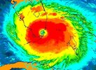
This my is first time seeing the cyan ring completely covering the CDO.
May not see something like this in the Atlantic again for many, many years.This my is first time seeing the cyan ring completely covering the CDO.
Shaggy
Member
The last 10 years or so has been full of big monsters. We probably thought the same thing with Dorian, Micheal, Irma, Marie, IanMay not see something like this in the Atlantic again for many, many years.
BHS1975
Member
If it does happen that would be the most likely area for it to do it with the extremely high OHC.May not see something like this in the Atlantic again for many, many years.
its a little surreal. I've been tracking tropical cyclones for near two decades now and that is something i only see on WestPac typhoons.This my is first time seeing the cyan ring completely covering the CDO.
Stormsfury
Member
A full season of undisturbed Caribbean waters until Melissa... pressures havent reflected it yet, but the simple fact that bathwater down to 60 meters, even with a slow moving beast cant upwell colder waters effectively at all in this part of the basin.
Brent
Member
Looks like 906-907
Still strengthening for sure
I see no signs of an EWRC
Still strengthening for sure
I see no signs of an EWRC
Stormsfury
Member
Brent
Member
902.8 mb!
View attachment 175733
Yeah I dunno the extrap has been too low before
Botn the dropsondes were 906-907 from different planes but did they both miss the center?
Shaggy
Member
One drop only has 5kt windsYeah I dunno the extrap has been too low before
Botn the dropsondes were 906-907 from different planes but did they both miss the center?
Brent
Member
One drop only has 5kt winds
Right it doesn't seem like they missed anything
And again I've seen the extrap be too low many times
Doesnt seem like much change otherwise
Stormsfury
Member
Crazy thing is that 902.8mb looks like it was in 20kts of wind. Melissa has completely stalled again after a tight cyclonic loop. Last SMFR pass has an unflagged 165kt.Yeah I dunno the extrap has been too low before
Botn the dropsondes were 906-907 from different planes but did they both miss the center?
Could be a wobble but last couple of frames looks like starting to move NNE, long awaited turnCrazy thing is that 902.8mb looks like it was in 20kts of wind. Melissa has completely stalled again after a tight cyclonic loop. Last SMFR pass has an unflagged 165kt.
Brent
Member
Definitely more NE it appears
Don't be surprised if this pulls back to the right as it recurves. Well probably see one final run at strengthening during that too
Don't be surprised if this pulls back to the right as it recurves. Well probably see one final run at strengthening during that too
ThomeWx
Member
Stormsfury
Member
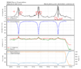
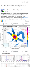
It did, thanks for this graphic which I think confirms my suspicion. The merger completed when the western eyewall exploded completing the "break", cloud tops cooled and within an hour, full deep pink ring.I think the system may have done another merger EWRC this evening. I think theres a good chance 140-150 kts is locked in for landfall. View attachment 175735
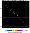
163 kt flight level winds in the SW side.
399
URNT15 KNHC 280232
AF301 2213A MELISSA HDOB 35 20251028
022330 1610N 07859W 6970 03061 //// +081 //// 308052 053 039 007 01
022400 1612N 07857W 6972 03054 //// +082 //// 307055 055 038 010 01
022430 1613N 07856W 6969 03050 //// +085 //// 309057 057 044 007 01
022500 1614N 07855W 6964 03053 //// +093 //// 309062 063 045 006 01
022530 1615N 07853W 6966 03045 //// +090 //// 303063 065 043 010 01
022600 1617N 07852W 6966 03040 //// +085 //// 305067 068 049 014 01
022630 1618N 07851W 6961 03036 //// +079 //// 304068 070 054 034 01
022700 1619N 07849W 6966 03014 //// +082 //// 308075 078 058 044 01
022730 1620N 07848W 6964 02998 //// +087 //// 314070 073 065 021 01
022800 1621N 07847W 6972 02970 //// +101 //// 310073 074 069 007 01
022830 1623N 07845W 6969 02957 //// +104 //// 308075 076 069 008 01
022900 1624N 07844W 6965 02942 //// +111 //// 308078 082 073 005 01
022930 1625N 07843W 6963 02916 //// +118 //// 308088 092 076 007 01
023000 1626N 07841W 6966 02880 //// +116 //// 309098 101 084 006 01
023030 1627N 07840W 6968 02833 //// +101 //// 310107 111 095 016 01
023100 1629N 07839W 6968 02774 //// +105 //// 311117 122 102 009 01
023130 1630N 07838W 6955 02715 //// +104 //// 309128 133 115 013 01
023200 1631N 07837W 6972 02583 //// +099 //// 309148 157 148 045 01
023230 1632N 07835W 6988 02402 //// +137 //// 308129 163 156 033 01
023300 1633N 07835W 6998 02301 //// +186 //// 311063 101 142 000 01
$$
;
000
URNT15 KNHC 280243
AF301 2213A MELISSA HDOB 36 20251028
023330 1634N 07834W 7013 02252 //// +214 //// 317023 045 057 003 01
023400 1636N 07832W 6991 02268 //// +224 //// 192007 014 018 002 01
023430 1637N 07831W 6972 02295 //// +214 //// 142028 038 033 002 01
023500 1639N 07830W 6970 02331 //// +161 //// 135064 072 049 006 05
023530 1638N 07829W 6964 02341 //// +168 //// 143075 080 /// /// 05
023600 1637N 07830W 6975 02294 //// +202 //// 156041 066 047 004 05
023630 1636N 07831W 6961 02300 //// +210 //// 204017 030 /// /// 05
023700 1636N 07832W 6972 02288 //// +214 //// 170004 013 /// /// 05
023730 1638N 07833W 6962 02302 //// +203 //// 102020 026 032 002 01
023800 1639N 07831W 6981 02290 //// +198 //// 120041 052 052 004 01
023830 1639N 07830W 6946 02358 //// +183 //// 132088 112 140 000 01
023900 1640N 07828W 6955 02446 //// +110 //// 135147 161 163 000 01
023930 1641N 07828W 6961 02552 //// +095 //// 134155 162 161 016 01
024000 1642N 07827W 6970 02651 //// +095 //// 137145 152 148 027 01
024030 1643N 07826W 6973 02729 //// +096 //// 138136 141 127 013 01
024100 1644N 07825W 6967 02799 //// +098 //// 139125 133 114 008 01
024130 1645N 07823W 6964 02854 //// +108 //// 140113 121 101 005 01
024200 1646N 07822W 6965 02897 //// +101 //// 139101 107 089 009 01
024230 1647N 07821W 6967 02923 //// +103 //// 136093 097 083 011 01
024300 1649N 07820W 6959 02955 //// +098 //// 139087 089 076 009 01
$$
162 kt flight level winds and 161 kt SFMR.
AJ1013
Member
Scary to think such a storm is completely possible here. Praying for those in Jamaica.
Brent
Member
903 mb with 5 kts of wind so yeah 902 might be legit
175/903. Now in the top 10 lowest pressure ever.
SUMMARY OF 1100 PM EDT...0300 UTC...INFORMATION
-----------------------------------------------
LOCATION...16.6N 78.5W
ABOUT 150 MI...240 KM SW OF KINGSTON JAMAICA
ABOUT 330 MI...530 KM SW OF GUANTANAMO CUBA
MAXIMUM SUSTAINED WINDS...175 MPH...280 KM/H
PRESENT MOVEMENT...NNE OR 20 DEGREES AT 2 MPH...4 KM/H
MINIMUM CENTRAL PRESSURE...903 MB...26.67 INCHES
Brent
Member
This appears to be the strongest hurricane on record in the Atlantic based solely off satellite estimates and no data
In other words if we didn't have the planes it might be even stronger. The planes are always gonna have override here
In other words if we didn't have the planes it might be even stronger. The planes are always gonna have override here

