• Hello, please take a minute to check out our awesome content, contributed by the wonderful members of our community. We hope you'll add your own thoughts and opinions by making a free account!

Pattern May or May not

Wrong thread I know. Didn't want this to get lost

Has anyone driven I40 West from NC into TN since Helene? If so, any major backups?

Google maps wants me to go that route. Just not sure.

Leaving Thu to rural ST Louis area

Thanks in advance
I have driven it a couple times. I cruised through one time. The other 3 times were lengthy back ups, but still the recommended, "you are on the fastest route" from GPS. I would believe that due to going up through Marshall, Hot Springs, and Newport takes forever.

So, unless you get extremely unlucky, even with delays it is the fastest route. The road itself just requires you to pay attention. It is nothing extreme. It's just one lane and somewhat narrow in places. It is amazing how they got that open so quickly.
 
That one was my biggest. Loud as hell too.

Where were you in 2003? Did you feel today’s? Do you think the one in 2003 was a bigger shake in ATL area than today’s?

I’m not sure how relevant this is for ATL, but today’s was a 4.1 vs a 4.6 and centered a little closer to ATL in ‘03.
 
Where were you in 2003? Did you feel today’s? Do you think the one in 2003 was a bigger shake in ATL area than today’s?

I’m not sure how relevant this is for ATL, but today’s was a 4.1 vs a 4.6 and centered a little closer to ATL in ‘03.
I remember 2003 very well. It happened in the early hours of the morning if I recall.
 
The tornado warning expired about 1.5 hours ago, but moderate to heavy rain continued for awhile afterward. I didn’t see any reported damage in the area though there was a house reported to have been hit by lightning on Skidaway Island. The lightning was pretty frequent with 1-2 CTG strikes nearby. The wind never was high and there was no hail. The rain had the largest impact with a pretty long period (~2 hours) of moderate to heavy though no street flooding was noted. I had only a minimal amount of water coming into the garage mainly on the side nearest to the storage room. Fortunately, I’ve had modifications and repairs done to the area at/near the garage door since last autumn. Those likely helped.

The total rainfall in the area has been generous over the last 3 days combined, which is very beneficial considering being in a drought.

Edit: Per Cocorahs, the area near me has had 4+” of rain (3+ yesterday, alone) for the last 3 days, combined. That’s for 5/8-10. This is very beneficial. Much more likely to come for today/tomorrow (5/11-12).
 
Last edited:
Where were you in 2003? Did you feel today’s? Do you think the one in 2003 was a bigger shake in ATL area than today’s?

I’m not sure how relevant this is for ATL, but today’s was a 4.1 vs a 4.6 and centered a little closer to ATL in ‘03.
I was in Cherokee county in 03. It was so loud I thought I was in a tornado until I remembered the skies were clear. It knocked over stacks of CDs in my room and had my mandolin that hung in the wall slamming into the drywall.
I felt yesterday’s and it was much shorter and nowhere near as big. The one just a few years ago seemed bigger to me too.
 
Incoming heavy bands of rain. Could be training over the same areas for a few hours south of Atlanta.
Yes looking currently 515 PM... Starting the "train" parallel to about 15-20 miles west of the I 75 corridor between Macon and Metro Atlanta .. Overall not a good look for the overnight...
 
Unfortunately we're going to pay no matter what... June, July, and August are unrelenting, unending, unforgiving, months of agony. Might as well get as much cooler weather as we can.

I agree, but 85-88 with possible storms everyday is quite different than 95-97 under a humid heat dome with no relief.
 
They've been efficient rain makers coming off the ocean for sure.
I'm sure, will be interesting to see how it pans out. Some hi res models have this part of the state with the lowest amounts. High pressure still has a dry airmass in place but they should give way eventually
 
My area had still another ~2” of rain mainly early this morning per rain gauge and Cocorahs. This brings 48 hour totals up to ~5” and 96 hour totals up to 6”+! I even had some water in my garage though not too bad.
 
Last edited:
Yeah it's going from firehose to trickle by the time it gets up here...
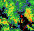
Yep, it's been raining off and on for a good part of the day, but I'm not even at .2" yet. I guess it's just bad luck with the setup:

Red dot my location
1747071760343.png

At this point, I'll consider an inch total for the two-day event as a big win.
 
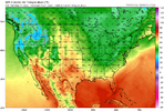
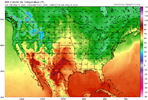
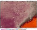
The euro modeled cape late week is pretty crazy. Imagine we whiff it with no convection

Decided to spend the 9.99$ a month for WeatherFront (iOS) and looked at the cape for Friday on ecmwf (assume it’s ok to post ?)
b709ac839d9559e9610943d223f57ce0.jpg


Sent from my iPhone using Tapatalk
 
Back
Top