Downeastnc
Member
Count yourself lucky. It was awful here. Those late night severe setups are a no for me.I had two rumbles of thunder overnight and that was it.
You were definitely lucky then. It sounded it like a war zone here from just after 2 to almost 4. I hardly ever get woken up by storms but definitely got woken up by that line. Also, I’ve ended up with another 1.7” rain the last two days which puts me right about 4.5” for May… that’s nearly 4x what I had all of AprilI had two rumbles of thunder overnight and that was it.

How is thatMetro Atlanta doing Metro Atlanta things....the line is weakening as it approaches.
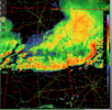
 ? We want nothing to do with what North Alabama and parts of Tennessee had.
I don't want that either. But, as a weather enthusiast, I do enjoy action besides rain. Lately it has been hard to just get a good storm where it actually thunders (and lightning).How is that
Agreed, been like that for awhile. The state line seems to suck all a storms energy for whatever readonI don't want that either. But, as a weather enthusiast, I do enjoy action besides rain. Lately it has been hard to just get a good storm where it actually thunders (and lightning).
Same here. And people here are going to start thinking the local TV mets are crying wolf whenever they mention the chance for severe storms. Maybe I am just lucky, or unlucky depending on how you look it, but the past few years I end up not having a storm at all a lot more than I do when the forecast calls for a chance of severe storms.I don't want that either. But, as a weather enthusiast, I do enjoy action besides rain. Lately it has been hard to just get a good storm where it actually thunders (and lightning).
I watched on RadarScope.. hail core dissipated as it moved into Troup County.. nothing more than a thunderstorm now.. went right over my houseIf I was in northern Troup County, I'd be taking shelter.
damn the nwsI had two rumbles of thunder overnight and that was it.
So thoughts on round 2 tonight for Alabama into GA?

Last scan seems to be around 10:44 am today.Did Hytop get hit last night?


Fro I was up til 3am wondering if I was gonna have to get my family somewhere safe. I haven’t been that shook in a long time. How was it up your way?We are back. Got dime size hail yesterday with the bookend that passed over CLT, then these beauties last night View attachment 147659View attachment 147660View attachment 147661


Storm I chased yesterday dropped 2 tors. Saw the circulation as I was outrunning the cell was scraping the ground behind the treesFro I was up til 3am wondering if I was gonna have to get my family somewhere safe. I haven’t been that shook in a long time. How was it up your way?