• Hello, please take a minute to check out our awesome content, contributed by the wonderful members of our community. We hope you'll add your own thoughts and opinions by making a free account!

Severe May 25-27 2022 Severe

SD

Administrator
Moderator
Joined
Jan 4, 2017
Messages
28,877
Reaction score
76,094
Location
Chalybeate Springs, NC
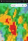
Multi day severe threat covering much of the region. Wind/hail are the primary threats with a non zero tornado threat. Flash flooding concerns exist as well with mean storm motion from S to N with not much eastward movement so a lot of training potential the next 3 days
day1otlk_1630.gifday2otlk_0600 (1).gif
day3otlk_0730 (2).gif
94ewbg.gif98ewbg.gif
99ewbg.gif
 
Well, let's see if the SPC can get it right for tomorrow. Even though it really doesn't matter since their descriptions for the levels don't make sense.

day2otlk_0600.gif
 
Sounds like a tornado hit Iredell county NC, with additional rotation spotted. Per scanner.
 
Tornado watch already posted .. two separate lines one initial will have some potential but second line around 2 pm could be the bigger severe threat .. still a very active day overall .. fun times1653648009069.png
 
Not sure if he posts here, but there's a met student at NC State that has a page on Facebook called the NC Weather Authority, and he said there should be two lines, with the worse coming through my area around 2:00.
 
Not sure if the tornado threat will be as high later once this initial band gets throug. Models arent as enthusiastic about backing the ll wind field and things get a little more unidirectional so hail/wind threat seems to be the main concern especially as you go south through nc
 
Last edited:
Back
Top