BufordWX
Member
Wouldn’t some cold air be nice to have with this?
I mean for this far out .... ILL TAKE THAT LOOKWouldn’t some cold air go well with this?View attachment 17734
ICON goes bombogenesis with a 970 low off of NC/VA coast at hour 180.I mean for this far out .... ILL TAKE THAT LOOK

Rain showing on the models 180 our means 70 and thunderstorms come verification. That is not what you want lolI mean for this far out .... ILL TAKE THAT LOOK
 heres that energy on a z500 map which helps break out precip, also looking at soundings this is at least a little convective, not suprised but BL temps is a real struggle


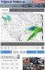
 this is the 6z
Warm ground temps, sun angle..... don't call 911 nothing to see here. Next *sarcasm*Gfs still shows some areas in NC may get R/S, altho light it’s something, gfs has a light setup with a positively tilted trough and NC with a w/sw flow at 500mb allowing for a little precip breaking out with decent energy based off the Z500 map, again tho BL temps are a real struggle View attachment 17744 this is the 6z
The 0Z Euro is a rainstorm (no, I'm not talking about the famous poster from VA) for FL and the NC coast.


 ?
?
Why don't they just admit it, FV3-GFS sucks just as bad if not worse than the original GFS. That's why they keep delaying it's transition. lol j/k kinda
 ️
️
This will have the azaleas ready in Augusta for the Masters a couple weeks later
6 inches of snow on March 30th.... Heck it would all be gone before lunchtime the next day. I have only seen 5 late March and early April events in my 54 years here. So, that puts the odds of a repeat at less than 10%. Of course we are reminded of that May 1992 event.Who would have known we would get one more fantasy storm look in the long range ... I mean I’ll take it lol


12z continues this, with a nasty look at H5, probably under doing wind shear View attachment 17813View attachment 17814View attachment 17815
With 988 Mb slp... no doubt it’s under doing shear values ... this pattern coming looks nast end month12z continues this, with a nasty look at H5, probably under doing wind shear View attachment 17813View attachment 17814View attachment 17815
Not looking like a big event for the south ATM, but the look at H5 and after makes me think it could be primer system for the next.
.png")

You will wish, as will many, in July ...Some upper 20s Monday or Tuesday night here! That’s indeed Marvelous!
Some upper 20s Monday or Tuesday night here! That’s indeed Marvelous!

The Multivariate ENSO Index has been temporarily discontinued on NOAA ESRL:
https://www.esrl.noaa.gov/psd/enso/mei/
View attachment 17820
Thus, I've spent the better part of the last week or so recreating the MEI using NCEP-NCAR Reanalysis (once again).
I've also significantly improved the navigability of my website and I've extended my analyses of individual winter storms and seasons in NC thru the winter of 1944-45. I'm really gonna try to get this winter storm archive finished by next winter but we'll see, I still have about 1,200 ish storms left to analyze.
https://www.webberweather.com/multivariate-enso-index.html
View attachment 17819