• Hello, please take a minute to check out our awesome content, contributed by the wonderful members of our community. We hope you'll add your own thoughts and opinions by making a free account!

Severe March 14-18 severe potential.

Z

Zander98al

Guest
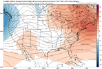
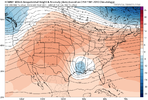
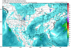
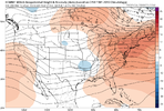
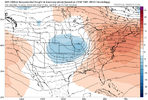
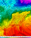
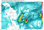
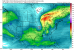
Thought I would have a thread made potential for two waves to come through and produce severe weather. 1st wave is a bit confined to the gulf coast states. While the 2nd looks a bit more broad. Instability looks a bit questionable. But we are in tornado season. It is mid March after all.
 
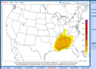
Oh yeah there is a day 4 risk area for south Alabama Georgia and Florida as well.
 
Oh yeah there is a day 4 risk area for south Alabama Georgia and Florida as well.
I’ve been watching this one. Not sure about how severe it will be but that’s a potent LP for southern gulf coast.
 
Thought I would have a thread made potential for two waves to come through and produce severe weather. 1st wave is a bit confined to the gulf coast states. While the 2nd looks a bit more broad. Instability looks a bit questionable. But we are in tornado season. It is mid March after all.
Thought mods had to start the thread! ? I can’t see it because you started it
 
Latest SPC has all of the eastern half of the DFW under a 5% tornado risk, 15% wind risk and hatched 15% hail risk for today.

FWD also added a severe wording to their grids.

We'll see...

EDIT: Best potential for widespread severe weather looks to be just east of here, out towards Paris and Tyler.
 
Last edited:
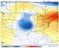
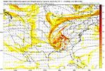
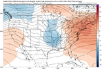
Normally this is a very impressive event with this look at H5, but the previous cutoff really reduces moisture return/scours moisture out and really messes up the moisture return process in general. Really avoiding any big stuff this year so far 27E8B463-409E-45D8-8302-F52C5977A945.png
 
1647287299621.png

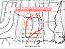
Mesoscale Discussion 0253
NWS Storm Prediction Center Norman OK
0237 PM CDT Mon Mar 14 2022

Areas affected...Parts of north-central/northeast Texas and
southeastern Oklahoma

Concerning...Severe potential...Watch likely

Valid 141937Z - 142100Z

Probability of Watch Issuance...80 percent

SUMMARY...The risk for large hail, damaging wind gusts, and a
tornado or two should develop between 21Z-23Z. Watch issuance is
likely in the next couple hours.

DISCUSSION...Latest water vapor imagery depicts an upper-level
trough moving eastward across the southern Plains, with an
accompanying midlevel speed maximum moving through the base of the
trough. Over the next couple hours, increasing forcing for ascent
preceding the trough will overspread a destabilizing air mass across
parts of north-central/northeast Texas and southeastern Oklahoma.
Here, latest surface observations show southerly surface winds and
dewpoints in the lower/middle 50s ahead of a surface trough/dryline
feature. Visible satellite imagery shows increasingly agitated
cumulus fields developing across the warm sector, where surface
pressure falls are evident. Convection should initiate between
21Z-23Z along/ahead of the surface trough/dryline, and move eastward
into the destabilizing air mass characterized by MLCAPE of 1000-1500
J/kg. As the trough continues eastward, deep-layer shear will
gradually increase to 40-50 knots, with effective SRH of 150-200
m2/s2. Initial convection may remain somewhat discrete, and
steepening midlevel lapse rates combined with the favorable
deep-layer shear should support large hail and perhaps a tornado or
two. With time, forcing for ascent will increase as a cold front
approaches from the west, favoring upscale growth and a greater risk
of wind damage and embedded tornadoes with eastward extent.

..Weinman/Mosier.. 03/14/2022

...Please see www.spc.noaa.gov for graphic product...

ATTN...WFO...SHV...TSA...HGX...FWD...OUN...EWX...

LAT...LON 31489514 31209567 30319702 30569749 31659741 32469734
33309725 33939664 34309574 34209466 33799443 33429424
32989416 32149414 31839425 31619463 31489514
 
Other than a few raindrops and an occasional distant rumble of thunder, we've had zilch here.

Something could still happen, but I suspect the storms in every which direction but here have worked over the atmosphere too much.

2022 starting off just like 2021! :)
 
I'd watch the coastal Carolinas late tomorrow into Thursday for a severe storm or 2 with the lead wave. Looks though like the potential is there for qlcs to get going in the northern gulf that slides across FL and S GA that may interrupt inflow to the Carolinas and bias the sfc low east really limiting severe potential. Still wouldn't be terribly terribly shocked to see a low end hail/wind/tor threat as the upper low approaches and lapse rates increase

To add to this a bit I think there is some potential for a localized heavy rain low end flood threat for parts of Ga/NC/SC where 850mb fgen may be maximized to the E/NE of the upper low with a decent amount of divergence aloft. This could easily bust down to near 0.00 if we get a dominant line of convection riding south then offshore however
 
Last edited:
Back
Top