-
Hello, please take a minute to check out our awesome content, contributed by the wonderful members of our community. We hope you'll add your own thoughts and opinions by making a free account!
You are using an out of date browser. It may not display this or other websites correctly.
You should upgrade or use an alternative browser.
You should upgrade or use an alternative browser.
Tropical Major Hurricane Milton
- Thread starter SD
- Start date
Henry2326
Member
50/80
1. Gulf of Mexico (AL92):
Recent satellite-derived wind data indicate that an area of low
pressure located over the southwestern Gulf of Mexico is broad and
ill defined, but it is producing winds just below gale force.
Development of this system is expected, and a tropical or
subtropical depression or storm is likely to form this weekend or
early next week while moving eastward or northeastward across the
Gulf of Mexico. Interests on the Yucatan peninsula of Mexico, the
Florida Peninsula, the Florida Keys, and the northwestern Bahamas
should monitor the progress of this system. Regardless of tropical
or subtropical development, locally heavy rains could occur over
portions of Mexico during the next day or two, and over much of
Florida late this weekend through the middle of next week.
* Formation chance through 48 hours...medium...50 percent.
* Formation chance through 7 days...high...80 percent.
Henry2326
Member
Henry2326
Member
Henry2326
Member
Brent
Member
Henry2326
Member
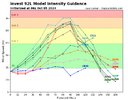
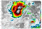
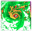
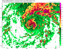
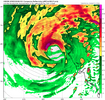
Yep, watching short term Hurricane models. So far hmon, hafs a and B have it a Hurricane on Sunday night. Waiting on hwrf.This is clearly way ahead of schedule View attachment 152583
Hmon has it at 963 at 9z Monday. Good lord....
Henry2326
Member
Henry2326
Member
Henry2326
Member
Henry2326
Member
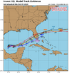
I don't like those northern members at all. Note that all of them are intense hurricanes, and the way models are stepping up the forecast intensity of this system is concerning.00z and 06z are very similar.....
Even lower pressure to 949.
Hurricane on Monday morning.
Looks like about half the ensemble agrees with operational.
View attachment 152581
View attachment 152582
AJ1013
Member
Jesus christ the hurricane models are going apeshit with this thing. Not good.
Henry2326
Member
70/90
Apparently they see what we are seeing.
Possible hurricane tomorrow.
1. Gulf of Mexico (AL92):
Showers and thunderstorms associated with a broad area of low
pressure located over the southwestern Gulf of Mexico are gradually
becoming better organized. Development of this system is expected,
and a tropical depression or storm is likely to form later today or
on Sunday while it moves slowly eastward over the southwestern Gulf
of Mexico. By early next week, the system is forecast to move
faster eastward or northeastward across the central and eastern Gulf
of Mexico where additional strengthening is likely. Interests on
the Yucatan peninsula of Mexico, the Florida Peninsula, the Florida
Keys, and the northwestern Bahamas should monitor the progress of
this system. Regardless of development, locally heavy rains could
occur over portions of Mexico during the next day or two, and over
much of Florida late this weekend through the middle of next week.
* Formation chance through 48 hours...high...70 percent.
* Formation chance through 7 days...high...90 percent.
Brent
Member
Henry2326
Member
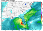
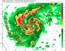
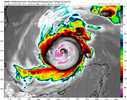
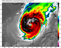
939 pressure.....Hmon is 946 and Hafs-A has 950 at that point. Hafs-b is on an island with 985.Monday nightView attachment 152588
AJ1013
Member
Wtf. Less than 48 hours ago globals had this thing unable to organize at all.Monday nightView attachment 152588
Henry2326
Member
Henry2326
Member
Henry2326
Member
Brent
Member
Henry2326
Member
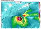
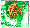
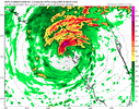
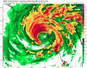
925....HMON 936 at same point.....We saw this same thing with the first run of hurricane models for Helene. And so much agreement with GFS.....good griefNo words View attachment 152592
kennedybb6
Member
925....HMON 936 at same point.....We saw this same thing with the first run of hurricane models for Helene. And so much agreement with GFS.....good gr
After Florida is it coming back inland or ots925....HMON 936 at same point.....We saw this same thing with the first run of hurricane models for Helene. And so much agreement with GFS.....good grief
BHS1975
Member
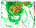
HAFS-A.....Wednesday morning it's 926, but by Wednesday afternoon at landfall it's 957.....I'm assuming shear.....
View attachment 152590
Didn't they do best with Helene?
Sent from my iPhone using Tapatalk
Henry2326
Member
The short term Hurricane models don't go out that far. But GFS says ots. We should have a high over the southeastern that blocks it. But we are 5 days out so have to continue to watch.
Henry2326
Member
My opinion......Hwrf and Hmon were fantastic. The Hafs not so much.Didn't they do best with Helene?
Sent from my iPhone using Tapatalk
kennedybb6
Member
Is this just a Florida hit or back up east coast ? Hopefully for nothing ……
Florida hit.Is this just a Florida hit or back up east coast ? Hopefully for nothing ……
BHS1975
Member
My opinion......Hwrf and Hmon were fantastic. The Hafs not so much.
Looks like they are all showing dry air getting into the core just before landfall. Even a weak storm into Tampa Bay would be bad though.
Sent from my iPhone using Tapatalk
Henry2326
Member
Brent
Member
Henry2326
Member
We know how that hold ups.....notLooks like they are all showing dry air getting into the core just before landfall.
Sent from my iPhone using Tapatalk
Henry2326
Member
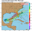
All the short terms and GFS are north of this bundle by alot...if I'm reading th FL map correctly.
Last edited:
lexxnchloe
Member
No words View attachment 152592
Honestly, I can’t believe I agree with JB, but I do. Quick hurricane moving ENE into FL is a nasty scenario.
Looks like they are all showing dry air getting into the core just before landfall. Even a weak storm into Tampa Bay would be bad though.
Sent from my iPhone using Tapatalk
Dry air will probably not be a problem with this track and movement.
The system is currently drifting northward.
 www.ndbc.noaa.gov
NDBC - Station 42055 Recent Data
National Data Buoy Center - Recent observations from buoy 42055 (22.140N 94.112W) - BAY OF CAMPECHE - 214 NM NE of Veracruz, MX.
Brent
Member
Dry air will probably not be a problem with this track and movement.
Yes and we've seen many times this year storms were supposed to weaken and they failed
Webberweather53
Meteorologist
Is this going to be the storm that finally takes out Tampa? Been over a century since they've taken a direct hit.
Has Tampa ever taken a direct hit from the West? A hurricane moving ENE across the width of the GOM is rare.Is this going to be the storm that finally takes out Tampa? Been over a century since they've taken a direct hit.


