
Downeastnc
Member
Dunno what they should expect this was the drop in the NW eyewall on the last pass...
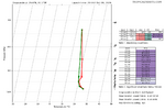


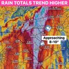


Radar sure looks more east of due north, heading for Destin looks like to me

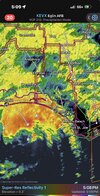

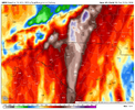

Cut totals by 1/3Sump pump about to be busy View attachment 198708


If you get a slow moving band those amounts can easily be reached. These can produce 2-4 inch per hour rain rates. The area from Spartanburg to Gaffney and Union got pounded like this back in 1990. 6+ in 2 hours with that band.Cut totals by 1/3
Getting into winter form….
I’m watching James Spann’s news network stream live and they say the air is super dry and it could evaporate the storm. It makes sense because it is very cool outside which is the opposite of what I figured it would be. They also named several other hurricanes that evaporated due to dry air so hopefully that’s the case with this one too!It seems the storm is going to maintain an east of north movement right up until landfall.
The northern eyewall shows no signs of imminent weakening. It's going to be a heck of a blow.


I don't know what area of Alabama he's referring to, but that northern eyewall is no joke, and it isn't falling apart anytime soon.I’m watching James Spann’s news network stream live and they say the air is super dry and it could evaporate the storm. It makes sense because it is very cool outside which is the opposite of what I figured it would be. They also named several other hurricanes that evaporated due to dry air so hopefully that’s the case with this one too!

I don't know what area of Alabama he's referring to, but that northern eyewall is no joke, and it isn't falling apart anytime soon.
If that big band sets up just right, you can easily get much than 6. There is a lot of dry air to overcome, but that one big band could still be big trouble.I fully expect around 6” around my house. Right up the road in Tryon could get 8”. Saluda could get a foot. I’m really worried about the wind now. I’m at the Gaffney and Greer football game and the wind is already picking up quite a bit
