iGRXY
Member
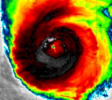
Eye is clearing. It’ll have a few hours here to intensify. My guess is it has a real shot af peaking around 120 mph



gonna be close....looks good for now, this is going to be a pretty small intense core, hurricane winds are only forecast to be 40 miles or so across but on the east side there could be hurricane force gust along the coast out a good 75 miles or so.


| ...ISAIAS ON THE CUSP OF MAJOR HURRICANE STRENGTH... ...PREPARATIONS WITHIN THE STORM SURGE AND HURRICANE WARNING AREAS SHOULD BE COMPLETED WITHIN THE NEXT FEW HOURS... |
| 7:00 AM CDT Fri Oct 09 Location: 27.0°N 87.7°W Moving: NNE at 15 mph Min pressure: 958 mb Max sustained: 110 mph |

A potential race to Cat 4 status?
East on tropical systems, NW on winter systems. Easy moneyStill running east of the track too... Always bet on east
It's gonna have to turn left to hit Pensacola


I swear, this newfangled GDM AI trash almost takes the fun out of being a weather weenie. No need to track every recon flight and satellite image. Just peek at the model a few days out and plan accordingly.
A potential race to Cat 4 status?


A potential race to Cat 4 status?

Land likes to help tighten these things up, so maybe just enough to offset the shear until just after LF. Gonna be close for sureLooking at the hurricane models, there is a very legitimate chance this makes landfall as a MH. Even if it technically doesn't, for instance the HWRF has Cat 3 winds almost on the coast.