WeatherWatch
Member
Here we go, Irma is on the WNW bound

Sent from my SM-J327T1 using Tapatalk

Sent from my SM-J327T1 using Tapatalk

Old map?Here we go, Irma is on the WNW bound

Sent from my SM-J327T1 using Tapatalk
Maybe starting to finally take off?New VDM has surface winds of 113 kts, 130 mph
What was the pressure?New VDM has surface winds of 113 kts, 130 mph
That's the latestOld map?
Funny update on the blog but no mention of TS Watch issued 30 minutes ago
East AL red head step child I guess
What was the pressure?
That is a fantastic idea - UGA hasn't had a decent non-conference rivalry since Clemson in the 1980s (I purposely omit Ga Tech).It was a great game. First time they've played each other since the 1981 Sugar Bowl ! I would love to see it be a yearly game.
Hmmmm I think soCat 4 surface winds on the VDM
D. Estimated (by SFMR or visually) Maximum Surface Wind Inbound: 113kts (~ 130.0mph)
NHC gonna need a special advisory
Ya I’m not bashing either. Just was puzzled. Eye is warming and clouds are coolingI knew their 11pm was trash the moment I saw it, made no sense with the satellite trends


Link that site in here if you don’t mind pleaseLove the Goes 16, hot tower poping in east eyewall.

Link that site in here if you don’t mind please

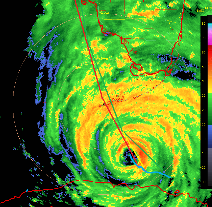
ThinkingThe Keys are getting in those heavier bands and you can make out the WNW movement.

Sent from my SM-J327T1 using Tapatalk
Hate to see how the Keys are going to end up.The Keys are getting in those heavier bands and you can make out the WNW movement.

Sent from my SM-J327T1 using Tapatalk
She isn't moving WNW.....The Keys are getting in those heavier bands and you can make out the WNW movement.

Sent from my SM-J327T1 using Tapatalk
LOL they ignored recon I see...hahahahahand the NHC still says its 120
ty!Its the GHCC site.
LOL they ignored recon I see...hahahahah
BTW, here comes recon and they are going to punch through that side. The NE eye-wall looks nastyor at least giving it another pass? I dunno but I'm getting annoyed lol
or at least giving it another pass? I dunno but I'm getting annoyed lol
I wonder if they didn't believe that value? I thought it was a little strange that the max flight level winds were less than the surface winds. But usually you can trust the values reported in the VDM.
ya at least for now, she is gaining strength926 mb xtrap, 5 mb lower than last pass
