GeorgiaGirl
Member
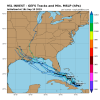
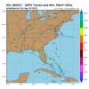
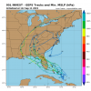
They just declared an invest on the one north of Hispaniola. Post away...
Shower and thunderstorm activity associated with a surface trough near the southeastern Bahamas and adjacent Atlantic waters has increased since yesterday. Limited development of this disturbance is expected during the next couple of days while it moves west-northwestward across the Bahamas. However, environmental conditions could become a little more conducive for development when the system moves over the Florida Straits and the Gulf of Mexico late this week and this weekend. Regardless of development, this disturbance will produce periods of locally heavy rainfall across the Bahamas through Thursday, and across Florida on Friday and continuing into the weekend. * Formation chance through 48 hours...low...10 percent. * Formation chance through 5 days...low...30 percent.
Shower and thunderstorm activity associated with a surface trough near the southeastern Bahamas and adjacent Atlantic waters has increased since yesterday. Limited development of this disturbance is expected during the next couple of days while it moves west-northwestward across the Bahamas. However, environmental conditions could become a little more conducive for development when the system moves over the Florida Straits and the Gulf of Mexico late this week and this weekend. Regardless of development, this disturbance will produce periods of locally heavy rainfall across the Bahamas through Thursday, and across Florida on Friday and continuing into the weekend. * Formation chance through 48 hours...low...10 percent. * Formation chance through 5 days...low...30 percent.


