• Hello, please take a minute to check out our awesome content, contributed by the wonderful members of our community. We hope you'll add your own thoughts and opinions by making a free account!

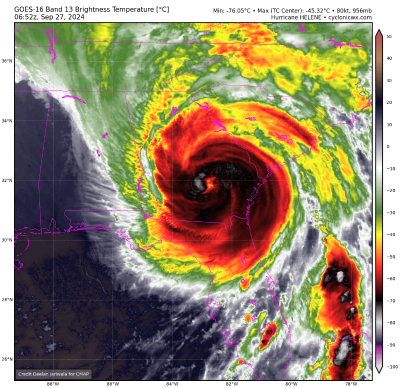
Tropical Major Hurricane Helene

I still think the worst of the winds will be east of a dawsonville to Lawrenceville to Forsyth line.(gusts at or over 60). I'm having a real difficult time understanding the nhcs reasoning being so far west when just about every model is to the east...some well to the east of their track. It's rather frustrating they still wont address their reasoning. My neck of the woods/Athens area seems poised to be slammed regardless...but it seems obvious very strong winds are going to be extended well into the Carolinas. One just hopes people there aren't caught off guard because they see the nhc track so far to the west.
To your last point, part of the problem is in the same way we fixate over where the track of the center leans left (west) or right (east) we also get caught up over where the cone is. We seem to be having a hard time communicating that the main concern is Helene is going to have significant impacts over a swath of 400 miles. That’s what the emphasis should be about, that’s why NHC amended their forecast cone products to display weather bulletins because they want to stress that it doesn’t only matter who’s inside the cone what matters is if you’re going to be impacted in any capacity that information is properly communicated to the general public. It’s also like this weird discourse going on in this thread about impacts on Atlanta. Impacts to some degree to power outages, tree damage, and flooding will be felt across the city regardless of Helene’s center going west, east, or on top of us. Will it be as bad as Athens or further east based on the current forecast? No, probably not, but you go back 12-24hrs ago it was a different scenario. Forecasts EVOLVE and change, they don’t stay stagnant.

Just to make this clear, I quoted you, but this response is not directed specifically to you. I’m speaking in general about the situation.
 
A little off topic but with all of the overbuilding we’ve seen here in the last 3 years I’m curious to see how the rivers and new home sites look after tomorrow. I have a feeling there’s going to be a lot of issues in that department
One can only hope it deters further development...
Gonna be a lot of new home sites washed out onto others properties...silt fences don't stand a chance and neither do building material prices..watch em sky rocket!
 
Perhaps the current SE radar loop can offer some clues. The rain shield associated with the trough over the SE is moving north rather than NE even as the rain shield is retrograding NW. Offering some ground truth to the expected northward or even NNW turn post-landfall?
This was always depicted in the tropical models, coming straight North out of the Gulf, where she ends up, who knows. The last loop is a northward speed, even some NNW?
 
Guys, here's a good site to follow the rain totals. You can set for past 12, 24, 36, 72, hours etc. It's not exact for all locations of course but gives a good overall picture to see where the heaviest rainfall has occurred. My area is in the 6-8 in band (already fallen past 72 hours) but MBY is already at 9 in since Tuesday evening. You can zoom and click on certain areas. Check it out.

 
Back
Top