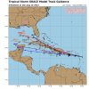
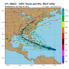
Grace is looking rather frisky this AM. Would a much stronger than anticipated storm taking advantage of this 24-36 hour window of favorable conditions lead to a track just north of Shederolla to where if not weakened by the landmasses it's able to fight off the predicted shear on the approach to the US? Hmm.
-
Hello, please take a minute to check out our awesome content, contributed by the wonderful members of our community. We hope you'll add your own thoughts and opinions by making a free account!
You are using an out of date browser. It may not display this or other websites correctly.
You should upgrade or use an alternative browser.
You should upgrade or use an alternative browser.
Tropical Major Hurricane Grace
- Thread starter SD
- Start date
Henry2326
Member
BHS1975
Member
HWRF went way north.
Sent from my iPhone using Tapatalk
Sent from my iPhone using Tapatalk
Shaggy
Member
Grace sustaining a small but strong cluster over the center now. If she would slow down 5kts she might really have a chance to strengthen more before the islands. That fast forward speed though!!
Brent
Member
This looks better than Fred ever did
Grace up to 45 MPH.BULLETIN
Tropical Storm Grace Advisory Number 5
NWS National Hurricane Center Miami FL AL072021
1100 AM AST Sat Aug 14 2021
...GRACE A LITTLE STRONGER...
...CONDITIONS EXPECTED TO DETERIORATE IN THE LEEWARD ISLANDS LATER
TODAY AND TONIGHT...
SUMMARY OF 1100 AM AST...1500 UTC...INFORMATION
-----------------------------------------------
LOCATION...16.2N 57.9W
ABOUT 265 MI...425 KM ESE OF THE LEEWARD ISLANDS
MAXIMUM SUSTAINED WINDS...45 MPH...75 KM/H
PRESENT MOVEMENT...W OR 280 DEGREES AT 23 MPH...37 KM/H
MINIMUM CENTRAL PRESSURE...1005 MB...29.68 INCHES
?


Shaggy
Member
Southwest turn into southern Texas. Wow.
Shaggy
Member
Seems the gefs favors a north central gulf strike
Henry2326
Member
Henry2326
Member
Brent
Member
It's definitely got a shot to be a significant threat if it can just avoid Hispaniola
Henry2326
Member
Euro shredded it.It's definitely got a shot to be a significant threat if it can just avoid Hispaniola
Henry2326
Member
Brent
Member
Meanwhile recon did 2 passes and really didn't find a center so there's that ?
One impressive looking wave lol
One impressive looking wave lol
NCSNOW
Member
Massive quake just hit Haiti. They say way many more dead 29 so far. And here comes this storm.
7.2 magnitude earthquake hits Haiti; at least 29 killed
7.2 magnitude earthquake hits Haiti; at least 29 killed
Brent
Member
Brent
Member
Storm a bit weaker and going a bit faster.BULLETIN
Tropical Storm Grace Advisory Number 6
NWS National Hurricane Center Miami FL AL072021
500 PM AST Sat Aug 14 2021
...SQUALLY WEATHER FROM GRACE SPREADING ACROSS THE LESSER
ANTILLES...
...HEAVY RAINFALL ACROSS THE LESSER AND GREATER ANTILLES WILL BE A
CONCERN IN THE COMING DAYS...
SUMMARY OF 500 PM AST...2100 UTC...INFORMATION
----------------------------------------------
LOCATION...15.9N 60.7W
ABOUT 55 MI...85 KM ESE OF GUADELOUPE
MAXIMUM SUSTAINED WINDS...40 MPH...65 KM/H
PRESENT MOVEMENT...W OR 275 DEGREES AT 26 MPH...43 KM/H
MINIMUM CENTRAL PRESSURE...1010 MB...29.83 INCHES
Brent
Member
If Grace slows down as forecast--which is obviously not a sure
thing--environmental conditions should be conducive to allow for
some strengthening before the system reaches the Greater Antilles.
The southward adjustment in the official forecast now takes Grace
over the Greater Antilles for a longer period of time, and the
official intensity forecast is therefore lowered beyond 48 hours.
This is a middle-of-the-road solution, and actually lower than most
of the intensity guidance. If the forecast track shifts north or
south, the system could strengthen further over water.
Alternatively, Grace could go the way of Fred and dissipate before
the end of the 5-day period.
18z GFS fell back to earth. It's not very excited about it.
Shaggy
Member
18z GFS fell back to earth. It's not very excited about it.
Well initializing the poorly defined system as mentioned in the 5pm disco is probably leading to much weaker solutions
I think it’s easy to see the what to look for here .. The stronger the storm is the more north it will go so a benchmark is if it scrapes the northern part of Puerto Rico it probably means it’s going to take that northern track and then if it’s weaker it’ll go and just run through Puerto Rico and then Hispaniola and get shredded by those mountains and possibly return into the golf but I think we’re looking at a scenario that is either like the HMON or the HWRF
Also, watch Invest 96L for the possibility that it does something not well modeled that then disrupts the steering flow enough to cause a significant deviation in Grace’s track vs modeling since 96L isn’t in a vacuum.
Shaggy
Member
Also, watch Invest 96L for the possibility that it does something not well modeled that then disrupts the steering flow enough to cause a significant deviation in Grace’s track vs modeling since 96L isn’t in a vacuum.
I was thinking maybe 96L buckles the ridge a bit
Brent
Member
accu35
Member
- Joined
- Jan 5, 2017
- Messages
- 8,717
- Reaction score
- 10,961
Yup and that black line is directly on me ?This really narrows it downView attachment 88226
Brent
Member
Yup and that black line is directly on me ?
Yeah that's the mean congrats ?
Grace starting to slow down.BULLETIN
Tropical Storm Grace Advisory Number 7
NWS National Hurricane Center Miami FL AL072021
1100 PM AST Sat Aug 14 2021
...POORLY ORGANIZED GRACE NOW MOVING A BIT SLOWER...
...HEAVY RAINFALL ACROSS THE LESSER AND GREATER ANTILLES REMAINS A
PRIMARY THREAT OVER THE NEXT FEW DAYS...
SUMMARY OF 1100 PM AST...0300 UTC...INFORMATION
-----------------------------------------------
LOCATION...16.8N 62.4W
ABOUT 170 MI...275 KM ESE OF ST. CROIX
ABOUT 265 MI...430 KM ESE OF SAN JUAN PUERTO RICO
MAXIMUM SUSTAINED WINDS...40 MPH...65 KM/H
PRESENT MOVEMENT...WNW OR 285 DEGREES AT 20 MPH...31 KM/H
MINIMUM CENTRAL PRESSURE...1010 MB...29.83 INCHES
Graphic:

Well, at least it took Belize off the table...for now.This really narrows it downView attachment 88226
Brent
Member
HWRF smashes Puerto Rico but then is able to make it north of Hispaniola .. that’s the key difference … if it can make it north of that island of shredders then we have a problem on our hands for Florida .. if it goes through the ringer then this thing is getting torn up and spit out into the Gulf which it will need a long time to recover
Brent
Member
Henry2326
Member


