Here fishy fishy but something to watch I guess

That east turn in August sets the stage for how the mid Atlantic ridge is toast with all the tutts. Need the adores and bermuda highs to merge and strengthen to keep the systems from turning north right away.

I haven't really been paying attention, but when troughs leave systems behind all kinds of wonka stuff can happen
Yeah the icon was a little concerning with Franklin missing the trough then starting to limp west. That said the general troughing in the east should eventually push it ots even if it went west for a while unless we got a deep trough to its which has been hinted at on some models but isn't a lock.I haven't really been paying attention, but when troughs leave systems behind all kinds of wonka stuff can happen
Yeah the icon was a little concerning with Franklin missing the trough then starting to limp west. That said the general troughing in the east should eventually push it ots even if it went west for a while unless we got a deep trough to its which has been hinted at on some models but isn't a lock.
This is why you never live model run to model run.Yeah the icon was a little concerning with Franklin missing the trough then starting to limp west. That said the general troughing in the east should eventually push it ots even if it went west for a while unless we got a deep trough to its which has been hinted at on some models but isn't a lock.
Got to have the ball on our court before we play the game. 12z runs get the ball closer to the court but it's just one run and 18z could easily revert back to east runs.Euro misses but is a lot closer. Long shot but hey we've seen stranger things
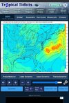
Fwiw the ICON would at least make this slightly interesting
Ukie maybeI can't remember but which model forst shifted Ian as a crossover storm for Florida and up the east coast?

This is definitely true. If you remember, Florence looked like it was destined to be a fish storm before the trough missed it.I haven't really been paying attention, but when troughs leave systems behind all kinds of wonka stuff can happen
Fairly typical for an El NiñoBunch of trashy sheared storms in this burst of activity
There will be, like every other year.There has to be 1 storm that will form that will do something
Should be some nice waves next week at the beach from Franklin. Hopefully it stays far enough east it doesn't help pull the front through this weekend


Imagine this one in the Bahamas threatening the SE coast!! Would have made for a nailbiterCat 4, still drifting NW
View attachment 136541
That's a lot of energy exhausting from the sea to the sky! A couple of more of these and we should be ready to cool the northern hemisphere nicely going in to Autumn. Guidance has it going around Bermuda, which is good for them!145 mph... Setting the bar high for the season