Snownut
Member
Here as of 2pmanyone got updated rain totals then?


Sent from my SM-G955U using Tapatalk
Here as of 2pmanyone got updated rain totals then?
I'll have to check for surge. The Trent and NeuseIs this also the worst flooding ever for New Bern?

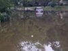
I thought that was getting close to your houseStarting to get close to home...
Tornado Warning
Tornado Warning
NCC065-083-127-171215-
/O.NEW.KRAH.TO.W.0026.180917T1140Z-180917T1215Z/
BULLETIN - EAS ACTIVATION REQUESTED
Tornado Warning
National Weather Service Raleigh NC
740 AM EDT MON SEP 17 2018
The National Weather Service in Raleigh has issued a
* Tornado Warning for...
Northeastern Nash County in central North Carolina...
Northwestern Edgecombe County in central North Carolina...
West central Halifax County in central North Carolina...
* Until 815 AM EDT
* At 740 AM EDT, a severe thunderstorm capable of producing a tornado
was located near Dortches, or near Rocky Mount, moving north at 25
mph.
HAZARD...Tornado.
SOURCE...Radar indicated rotation.
I thought that was getting close to your house
Sent from my SM-G955U using Tapatalk
I thought that was getting close to your house
Sent from my SM-G955U using Tapatalk
Yes they did. Watching videos of Durham County buses driving through moving water and barely seeing the tops of the tires is not a good sight. Hopefully students, drivers, and all faculty got to the schools safely in spite of the terrible decision.
I could see the towering cumulonimbus clouds off to my northeast. You could tell someone was getting a nice storm.At least the tornado warnings are over with this morning.
And now it's pouring down rain here after the sun came out after it poured down rain the first time.