• Hello, please take a minute to check out our awesome content, contributed by the wonderful members of our community. We hope you'll add your own thoughts and opinions by making a free account!

Tropical Major Hurricane Erin

Brad P made a post on X, twitter, whatever you prefer of 50 rescues today due to rip currents at Wrightsville beach!
This is absolutely ridiculous and unnecessary. I know you can't "force" people to stay out of the water, but 50 rescues?!? Fifty??? Something needs to be done. I just don't know what.
 
This is absolutely ridiculous and unnecessary. I know you can't "force" people to stay out of the water, but 50 rescues?!? Fifty??? Something needs to be done. I just don't know what.

I get it but people don't care that's the problem

Or don't think it will happen to them because last time didn't do anything(this was a big problem in the Texas flood and why it was so bad that whole area has flooded many times)

It basically goes back to the overall issue of the government telling them what to do if you push it too much
 
Last edited:
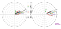
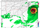
Also worth noting, every single model tracked on this chart has been too far east/northeast even inside 48-72 hours.

View attachment 174417

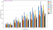
Inside 72 hours, the UK has been king and Euro a close second. Unfortunately icon isn’t tracked on here.
View attachment 174418

Icon placed it and held position way ahead of any others. UK caught up first. The rest (just shaking my head).
 
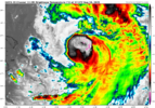
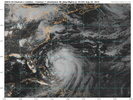
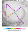
Really falling apart on satellite. Recon obs are downright pathetic too

I'm still hearing a lot of talk about another peak once it starts moving faster though

I see why. The Euro restrengthens her a lot.

Also, I just noticed this on the 0Z UKMET: it initialized it at 943 as of 8PM EDT last evening, then weakened it all the way down to 963 as of 12Z/8AM EDT this morning, and then restrengthens her starting today all the way down to 928 mb Thursday at 8PM EDT:

HURRICANE ERIN ANALYSED POSITION : 23.9N 71.5W

ATCF IDENTIFIER : AL052025

LEAD CENTRAL MAXIMUM WIND
VERIFYING TIME TIME POSITION PRESSURE (MB) SPEED (KNOTS)
-------------- ---- -------- ------------- -------------
0000UTC 19.08.2025 0 23.9N 71.5W 943 84
1200UTC 19.08.2025 12 25.2N 72.6W 963 75
0000UTC 20.08.2025 24 26.9N 73.1W 953 79
1200UTC 20.08.2025 36 28.9N 74.3W 942 89
0000UTC 21.08.2025 48 31.6N 74.3W 936 100
1200UTC 21.08.2025 60 34.0N 73.3W 935 96
0000UTC 22.08.2025 72 36.2N 70.8W 928 94
 
Last edited:
It may restrengthen like the models show but right now it's ingested some dry air and they usually have a hard time fully recovering from that, this late in the game. Should eventually lead to that large eye though, we shall see
 
Gonna set the over/under at .5 beach houses washed into the ocean in Rodanthe
Tbf you can do that with any nor'easter down there. Most of those houses that we will hear about "washed away by powerful extreme hurricane Erin", are vacant, condemned and already sitting in the edge of the ocean
 
TCPAT5

BULLETIN
Hurricane Erin Advisory Number 33
NWS National Hurricane Center Miami FL AL052025
1100 AM EDT Tue Aug 19 2025

...STORM SURGE AND TROPICAL STORM WARNINGS ISSUED FOR THE NORTH
CAROLINA OUTER BANKS...
...LIFE-THREATENING RIP CURRENTS EXPECTED ALONG U.S. EAST COAST
BEACHES...


SUMMARY OF 1100 AM EDT...1500 UTC...INFORMATION
-----------------------------------------------
LOCATION...25.6N 72.4W
ABOUT 650 MI...1050 KM SW OF BERMUDA
ABOUT 690 MI...1105 KM SSE OF CAPE HATTERAS NORTH CAROLINA
MAXIMUM SUSTAINED WINDS...105 MPH...165 KM/H
PRESENT MOVEMENT...NW OR 325 DEGREES AT 9 MPH...15 KM/H
MINIMUM CENTRAL PRESSURE...961 MB...28.38 INCHES


WATCHES AND WARNINGS
--------------------
CHANGES WITH THIS ADVISORY:

A Storm Surge Warning has been issued for the North Carolina Outer
Banks from Cape Lookout to Duck.

A Tropical Storm Warning has been issued for the North Carolina
Outer Banks from Beaufort Inlet to Duck.

A Tropical Storm Watch has been issued north of Duck to Cape Charles
Light Virginia.
Down to 105/961. Also NC Outer Banks TS watches upgraded to a warning and the southern Virginia coast is now under a TS watch.
 
This is absolutely ridiculous and unnecessary. I know you can't "force" people to stay out of the water, but 50 rescues?!? Fifty??? Something needs to be done. I just don't know what.
This is solely the choice of local leadership. Public safety closures of beaches happened every year a decade ago. Now local leaders are so afraid of offending businesses they fail at the very first part of their job which is “public safety.” A social contract is just that, a contract. The government is bound by statute to rescue you from drowning or locate your body if they can’t and they’re entitled to tell you it’s too dangerous for your own good to be out there.
 
This is solely the choice of local leadership. Public safety closures of beaches happened every year a decade ago. Now local leaders are so afraid of offending businesses they fail at the very first part of their job which is “public safety.” A social contract is just that, a contract. The government is bound by statute to rescue you from drowning or locate your body if they can’t and they’re entitled to tell you it’s too dangerous for your own good to be out there.
This is Darwin's Law of Natural Selection at work again. I can't believe any rational mind would go into the ocean in conditions like those occurring along the beaches now, especially after so many warnings from public officials and the media not to enter the water. George Carlin was right when he asked us to think about how stupid the average person is and then realize that 50% of the population is more stupid than that.
 
12Z UKMET: like the 0Z this run restrengthens Erin to a peak Thu evening off NC, but by not as much as it gets down to 947 vs 928 on the 0Z:

HURRICANE ERIN ANALYSED POSITION : 25.3N 72.1W

ATCF IDENTIFIER : AL052025

LEAD CENTRAL MAXIMUM WIND
VERIFYING TIME TIME POSITION PRESSURE (MB) SPEED (KNOTS)
-------------- ---- -------- ------------- -------------
1200UTC 19.08.2025 0 25.3N 72.1W 961 79
0000UTC 20.08.2025 12 27.0N 73.1W 960 71
1200UTC 20.08.2025 24 29.0N 73.8W 954 83
0000UTC 21.08.2025 36 31.7N 74.0W 950 84
1200UTC 21.08.2025 48 34.1N 73.1W 949 81
0000UTC 22.08.2025 60 36.1N 70.7W 947 76
 
12Z Euro hour 24 isn’t nearly as strong as the 919 mb of the 6Z as this run gets it down “only” to 945 and is WNW of the 6Z.
 
Which means she will get to cat 4 by tonight lol
Actually she might....lol......

NHC said at 11am

Predicting Erin's intensity is somewhat problematic. Given the
current disorganization of the cloud pattern, one would be reluctant
to call for restrengthening. However,the dynamical guidance shows
increasingly anticyclonic upper-level flow over the system and the
SHIPS model diagnoses a significant decrease in vertical wind shear.
 
Probably going to start putting itself together overnight as the shear continues to lessen, you can already see the CDO expanding back to the NW. By tomorrow afternoon into the evening the northern outflow will likely get connected to some jet help off of the SE Canada coast. With the overall size of the storm and this morning's disruption I'm not sure how rapidly we will see wind respond to a pressure drop.
 
These videos were filmed at Crystal pier and oceanic restaurant. People never listen. The first video doesn't seem too crazy but this video shows how big even the white wash is. These people were knocked off their feet and sent the lifeguards into action

Edited to add the video of when the lifeguards had to get involved


Last edited:
NHC 5pm

Since the shear over Erin appears to have lessened, and the system
will continue to traverse warm waters for the next couple of days,
some re-strengthening could occur. The future intensity is
dependent on whether the inner-core eyewall structure becomes
re-established. The official forecast conservatively shows a
slight increase in intensity similar to the model consensus but the
LGEM guidance shows a little more strengthening than that.
 
Nice beach sounds but yeah, idk about getting in the water at all (even knee deep) if I were there, even without context.

My clumsy self probably gets knocked over in about 5 minutes.
Yeah the white wash was strong and not to be played with. It was running up into the dunes at high tide in places there. Could easily sweep someone off their feet.
 
From the 11pm disco

It should be noted that the 34- and 50-kt wind speed probabilities
beyond 36 hours in the text and graphical products are likely
underestimating the risk of those winds occurring. This is because
the forecast wind field of Erin is considerably larger than average
compared to the wind field used to derive the wind speed probability
product.
 
Back
Top