- Joined
- Jan 23, 2021
- Messages
- 4,604
- Reaction score
- 15,203
- Location
- Lebanon Township, Durham County NC
My sister over near Crowders Mountain State Park says they have 10”
Same but we take solace! Delayed, not denied!a little miffed we missed the afternoon party- friend who's from swansboro sent me some crazy footage. looked like russia


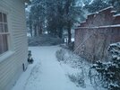
 View attachment IMG_6463.jpeg

 Only a quarter of an inch here in Georgia but the wind was crazy. Still blowing snow everywhere

A few more bands will probably rotate through over next few hoursUnless some of these later bands produce this was an under achievement. If not for that last band would’ve maybe broken an inch. Is what it is. It was a pretty snow to watch fall which is all I care about. That’s why I want more. Beats a cold rain.
I'm encouraged by the radar returns coming in south of here off the ocean, hoping we can still do well down here considering.For central NC, the dry slot slowly closing in. I think Harnett and Cumberland Counties are the last to close and will be the biggest losers of this otherwise historic snow event....amazing really.

Not sure about here.
I can’t tell you how happy I am for you broThis is probably more so around 8.5-10” on legit surfaces but this is a grass measurement here in E/NE CLT. The band won’t stop nuking, about 4 hours of straight nukage and still going strong. Gonna threaten a foot View attachment 192923View attachment 192924

Yeah, the globals and NAM sucked with this one. Can't count on them for specifics at all. Just look at the 3K NAM and HRRR a day out.Valid crashout incoming.
I just drove out to Mebane and back from ~Wegmans area of Raleigh. Picks up as soon as you hit Cary/KRDU. Morrisville and Durham are completely covered. Chapel Hill and points westward have a legit snowstorm-- roads totally covered and plows out. Come back home after 2.5 hours and it's still bone ------- dry. Not a flake. This is the worst bust I've ever experienced in Raleigh-- moved here in 2012. I'm legit done tracking storms after this, what's the point? 2 days ago 3 days ago the most reliable models were showing 6" minimum for MBY every single run. Now its 18:00 and there's not a single flake. The day before the seemingly amazing system hits, the dry slot starts getting progged. I tried to be optimistic but nope. In Raleigh, it's always something. Usually temp/mixing or moisture/QPF. This time neither was a problem. Oh cool you're excited cause of that? ---- you, random dry slot it up all day long. I hate being a weenie and I hate loving snow. This ------- sucks.
Gonna have to deal with some gaps in the band coming up from the south but been great so far....a solid 12ish hrs to go.

My assumption is the best forcing for ascent should occur between about 7pm - 2am, coinciding with the low starting to bomb SE of Lookout. I'd expect a significant uptick in winds during this period too. Thus far the Atlantic tap has been about perfect, Gulf Stream convection is always a concern disrupting moisture transport back inland.
It's been a rough day man. I'll take all the optimism you can give! Also glad to hear so many in the west cashed in (I sincerely mean that). Been trying to let folks enjoy it without interupting with "BUT HEY LOOK AT ME WHERE SNOW?".Trying to give additional optimism for us dry slot folks: I do like the way radar shows the bands tilting northwest, signs the trough is tilting negative now. I think we can enjoy some heavy bands for a few hours. I was just looking forward to watching it snow during the daytime for once!

how much do you have now?Think we get our 12"+ totals? Its gonna be hard to tell I think but its snowing awful hard even when the return on radar get weaker.
3 inches isn’t a snowstorm, unfortunately. That’s a winter weather advisory where I hail fromlook i do think raleigh gets its act together and claws and scratches to 3 inches. it won't be sexy but you will have a traditional snow day tomorrow
And we aren’t getting 3” tonight. Where it’s snowing is it and where it’s not it won’t.3 inches isn’t a snowstorm, unfortunately. That’s a winter weather advisory where I hail from
Yeah we probably don’t see a flake. Glad it’s my last semester of college anyway so I can go somehwere with better climo. Literally anywhere north of I 10 and I probably have better snow climo except for the triangleAnd we aren’t getting 3” tonight. Where it’s snowing is it and where it’s not it won’t.
Actually feeling more optimistic here now that those heavy returns east are quickly moving our way rather than starting with the upper level low. We have now a much better chance for back building and some heavier rates that the models cannot catchYeah, the globals and NAM sucked with this one. Can't count on them for specifics at all. Just look at the 3K NAM and HRRR a day out.

Greensboro….Charlotte…Greenville NC…Richmond. Pretty much anywhereYeah we probably don’t see a flake. Glad it’s my last semester of college anyway so I can go somehwere with better climo. Literally anywhere north of I 10 and I probably have better snow climo except for the triangle