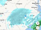
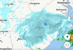
RAH still bullish down my way, thinks global handling better?
A major winter storm is beginning to take shape early this morning
with conditions expected to deteriorate through the morning hours in
the western Piedmont and elsewhere this afternoon into the overnight
hours. Regional
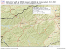
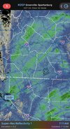
radar mosaic imagery and
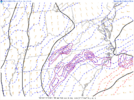
SPC mesoanalysis highlight
two areas of ongoing snowfall, which will be described separately
below.
The first is occurring over southwest VA into the
NC Piedmont and
foothills driven by weak H850
WAA and strengthening FGEN as the
mid/
upper level trough approaches, which is currently pivoting
across the Mid-Mississippi and Ohio Valleys. This area is
expected to remain mostly light but fill in through daybreak as
the H850 band slowly collapses southward and the mid/upper
trough begins to close off and transition to neutrally-tilted
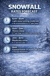
by 18z. This should result in widespread 0.1" to around 0.3" of
liquid equivalent across the western Piedmont, which at roughly
15:1 snow-liquid ratios (SLR), will equate to an area of 1.5 to
roughly 4 inches through the morning hours. Areas in the eastern
Piedmont and western Sandhills may not receive much snowfall
before 18z, but this is
likely to change through the afternoon
and result in widespread 3-7 inches with locally higher amounts
of up to 10 inches. Some areas of the eastern Piedmont may see a
QPF minimum relative to surrounding areas. The general
consensus within 50th percentile
ensemble guidance suggests 0.25
of liquid equivalent is still favored in this area and
translates to around 4 inches.
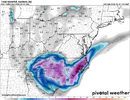
The second is a well developed area on regional
radar across the
eastern Sandhills and southern/central Coastal Plain and is being
driven by a strengthening H925 FGEN band. This area is
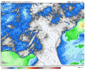
surprisingly not being resolved well within the
hi-res guidance,
but rather the global and regional models; such as the
GFS,
Canadian reg/nh, and
NAM 12km. These models suggest liquid
equivalent of 0.3 to 0.6 will be possible within this area by
18z and would produce 3 to as much as 6 inches (with SLR of
closer to 11:1 at this time) before the afternoon hours. If
observational trends hold and the global models do handle its
evolution well, then as the mid/upper
trough negatively tilts
and brings significant synoptic forcing overtop this band, it is
reasonably possible that 0.75 to 1 inch of liquid equivalent
falls and results in a swath of 10-15 inches of snow. This swath
would
likely fall within a larger area of 4-8 inches in the
Coastal Plain into the eastern Sandhills.

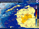

 this is a bit early!