Tokenfreak
Member
Might get more in the Lowcountry then they are forecasting right now


It’s just the fact that it’s actually gonna snow that feels off and not right. I know it’s a strange feeling.Um, something feels off. Are things coming together with this snowstorm? I know it’s snowing in Roxboro and Reidsville etc… nonetheless something doesn’t feel right….
Look at the dry slot near Asheboro (0"). Only 40 miles to the SE there is nearly two feet.
Might get more in the Lowcountry then they are forecasting right now
And it still might not actually happen. Someone posted a video early from a NWS office talking about why the dry slot is probably overdone.That gap is there folks. Almost no denying it. Where "exactly"--and I mean exact location--it sets up is TBD.
I do think it's overdone in the 'too broad' sense but there may indeed still be a corridor somewhereAnd it still might not actually happen. Someone posted a video early from a NWS office talking about why the dry slot is probably overdone.
Ella Dorsey from ANF was talking about the same thing during the evening news, but when I first heard what she was saying, I thought immediately that she had seen the long snow squall that is supposed to form in that region and misinterpreted it as a lake enhanced band due to its vicinity to the lake. I think some minor enhancement is plausible because of just how cold surface temps will be going over the lake, and not to mention the wind direction should be decent relative to the axis of the lake. Alabama seems to get decent lake enhancement off of some of their smaller lakes during extreme cold spells with low cloud cover, although their lakes are generally larger. My thoughts would be that some places downwind of the lake if enhancement occurs could see up to a few tenths of an inch of increased accumulations, but overall I just don't see the lake being large enough for much more than that.As cold as it is both at the surface and aloft, given the wind direction right down Lake Lanier, I would think areas on the east side of Atlanta proper would have some lake-enhanced snow bands. Radar is going to be fascinating in the morning here.
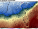
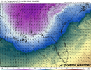
Not something I ever give thought to since the conditions for such are so rare. Thoughts?View attachment 192193View attachment 192194
you have to be close per radar returns I'm seeing.anything we get tonight is a bonus according to basically every model but the GFS
Just got underway hereyou have to be close per radar returns I'm seeing.
I do, but you do too. Go to pivotalweather.com. Try the beta version it works great on mobile.Do you all have the NAM 12 km
Sent from my iPhone using Tapatalk
It's super interesting how even the most meager radar returns are reaching the ground in many places. I suppose it's a combination of sublimation rather than evaporation and a lower DGZ than we're accustomed to down here.That band seems to be intensifying that’s about to slide through
Seeing anything on your side?anything we get tonight is a bonus according to basically every model but the GFS
Yep. If this goes like it did at the airport in Timberlake, it’ll take 30 minutes to moisten up and then it’ll be on
January 2003 vibes! Disturbance coming thru the mountains and exploding on the lee side! Think Gaffney to Gastonia got about 8-10”!??
