-
Hello, please take a minute to check out our awesome content, contributed by the wonderful members of our community. We hope you'll add your own thoughts and opinions by making a free account!
You are using an out of date browser. It may not display this or other websites correctly.
You should upgrade or use an alternative browser.
You should upgrade or use an alternative browser.
Wintry Machine Learning Mauler 1/30-2/1
- Thread starter SD
- Start date
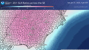
Usually I’m a lurker here, but gotta ask, are the NBM snowfall maps based on these ratios or the standard 10:1?
Tsappfrog20
Member
Allan Huffman just sent out his update saying that he is not going to change his map. He says that he uk and Nam do have a real possibility for the triangle but others still show around the range he is using right now. He said he may update after 18z comes out.
Sent from my iPhone using Tapatalk
Sent from my iPhone using Tapatalk
Model RatiosUsually I’m a lurker here, but gotta ask, are the NBM snowfall maps based on these ratios or the standard 10:1?
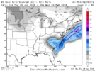
Solid 4-6 should make a lot of people happy.
Blue_Ridge_Escarpment
Member
Probably more than that as it appears that is 10:1 ratio?Solid 4-6 should make a lot of people happy.
foothillscrewzone
Member
at 10-1 ratiosSolid 4-6 should make a lot of people happy.
no real changes looks like from last interval
Bigedd09
Member
Solid 4-6 should make a lot of people happy.
That’s 10:1 too
Sent from my iPhone using Tapatalk
BrickTamland
Member
But isn't that more like 8 to 12 with the ratios we're expecting?Solid 4-6 should make a lot of people happy.
Iceagewhereartthou
Member
I'm shocked they went this high this soon, they are normally very conservative. I assume they are weighting the Euro here. I am going to try to keep myself grounded and cut these at least in half in my mind.Wow. NWS GSP bumped their totals up
Sent from my iPhone using Tapatalk
Still around 7-8 ish in the triangle. I also agree with the earlier poster that QPF tends to juice up in the last ~36-48 hours after a couple day drying trend
Good point.at 10-1 ratios
foothillscrewzone
Member
It has been oscillating like the Euro between 00Z/12Z and 06Z and 18Z with 6z and 18z wetter
I expect we will juice up some too given the strength of the wave dropping in. Just don’t want to lose the strength / tilt of itStill around 7-8 ish in the triangle. I also agree with the earlier poster that QPF tends to juice up in the last ~36-48 hours after a couple day drying trend
Strong wording for the outer banks
WHAT...Blizzard conditions possible. Total snow accumulations
between 10 and 16 inches, with locally higher amounts possible.
Winds could gust as high as 65 mph.
* WHERE...Mainland Dare and Tyrrell Counties, and Northern Outer
Banks.
* WHEN...From Friday evening through Sunday evening.
* IMPACTS...Visibilities may drop below 1/4 mile due to falling and
blowing snow. Travel will become impossible and life threatening.
Strong winds could cause tree damage.
That Bahamas LP needs to disappear.
Definitely a tick drier for the WN2, but it’s pretty good, all things considered.
Downeastnc
Member
Cant say I have seen this maybe ever from MHX
* WHAT...Heavy snow possible. Total snow accumulations between 8 and
14 inches, with locally higher amounts possible. Winds could gust
as high as 50 mph.
IMPACTS...Travel will become impossible and life threatening.
Blowing and drifting snow is likely, particularly in open areas.
Gusty winds could bring down tree branches.
The good news is it won’t take much QPF to juice up snow totals. It’s not like we have half our QPF being burnt on mixing or rain and the snow ratios are like 8:1I expect we will juice up some too given the strength of the wave dropping in. Just don’t want to lose the strength / tilt of it
Dayum
* WHAT...Blizzard conditions possible. Total snow accumulations
between 9 and 12 inches possible. Winds could gust as high as 70 mph.
* WHERE...Hatteras Island and Ocracoke Island.
* WHEN...From Saturday afternoon through Sunday evening.
* IMPACTS...Visibilities may drop below 1/4 mile due to falling and
blowing snow. Travel will become impossible and life threatening.
Strong winds could cause tree damage.
Gusts at 70 mph? Thats plum wild. And will be insanely fun to watch on live cams if it comes to fruition...Strong wording for the outer banks
NBAcentel
Member
Tsappfrog20
Member
Jonathan Wall
Sent from my iPhone using Tapatalk
Sent from my iPhone using Tapatalk
Great snippet on the mesolow from GSP latest disco
Furthermore, guidance has latched onto the development of a mesolow
in the lee of the Southern Appalachians with the mesolow moving
southeast through the Savannah River Valley and into the South
Carolina coastal plain. This would place much of the forecast area
in a very favorable location north of the mesolow and north of the
bowling ball closed upper low. Here, strong forcing for ascent will
be present in conjunction with convergent low-level flow, some
component of which will have a moisture connection to the Atlantic.
This will also foster the development of a notable band of 850mb
frontogenesis across the Upstate and into the North Carolina
Piedmont and portions of the foothills. The result of which has been
a notable southwest trend in QPF with an uptick along the I-85
corridor. Snow will start as early as tomorrow afternoon across the
mountains as upper divergence increases as the TPV encroaches on the
Tennessee Valley.
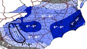
Bro if we get 6” + I will take you out for dinner/supper at your place of choosing.2nd call… View attachment 191315
Jonathan Wall
Sent from my iPhone using Tapatalk
A west shift would certainly not be the most unprecedented thing ever. Get that TPV in slightly slower so the SS gets ahead a little more as Webb points out
That’s got to be a typo on the windsI never in my life thought I’d see this from the nws for charlotte the day before a storm
...WINTER STORM WARNING IN EFFECT FROM 4 PM FRIDAY TO 7 AM EST
SUNDAY...
* WHAT...Heavy snow expected. Total snow accumulations between 4 and
7 inches. Winds gusting as high as 55 mph.
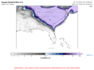
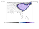
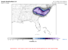
I've been paying attention to that 4" probability; looks like that's trending down for the triangle a bit. Still over 50%, but I could certainly envision a local precip min there similar to what the AI GFS has been showing. Love to see the 1" probability being 100% in such a large area though!WeatherNext2 probabilities
View attachment 191311
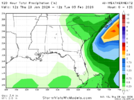
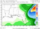
View attachment 191312View attachment 191313View attachment 191314
Mountain warningThat’s got to be a typo on the winds
I said this earlier about the SREF but I’ll say it again. Never trust it in terms of amount, but typically it’s fairly solid on the footprint of moistureKind of wild how different the SREFs are from a lot of other modeling, with the highest totals in E / NE NC / SE VA with comparatively little in SC and the CLT area. You'd think it's wrong and it probably is although I suppose climo would favor it to some extent (but climo is just climo and there are plenty of exceptions to it).
WeatherNext should be out soon, right?
I said this earlier about the SREF but I’ll say it again. Never trust it in terms of amount, but typically it’s fairly solid on the footprint of moisture
Predicting the snows that matter most | NCAR & UCAR News
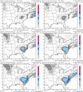
These are 10:1, so Using 20:1 ratios , thanks to post way above, we magically get 8-12.Solid 4-6 should make a lot of people happy.
Bigedd09
Member
Wow that’s not encouraging. Perhaps it may not be as consistent and good as we thought it was. Did a great job last storm though
Sent from my iPhone using Tapatalk

