• Hello, please take a minute to check out our awesome content, contributed by the wonderful members of our community. We hope you'll add your own thoughts and opinions by making a free account!

Wintry Machine Learning Mauler 1/30-2/1

It is SO SO strange how the 18z/6z runs have been so different from the 12z/0z runs. Don't typically see the jumpiness like that.. and it is across the board-- all models that initialize with ECMWF are having this. Even AIFS-ENS and WeatherNext.
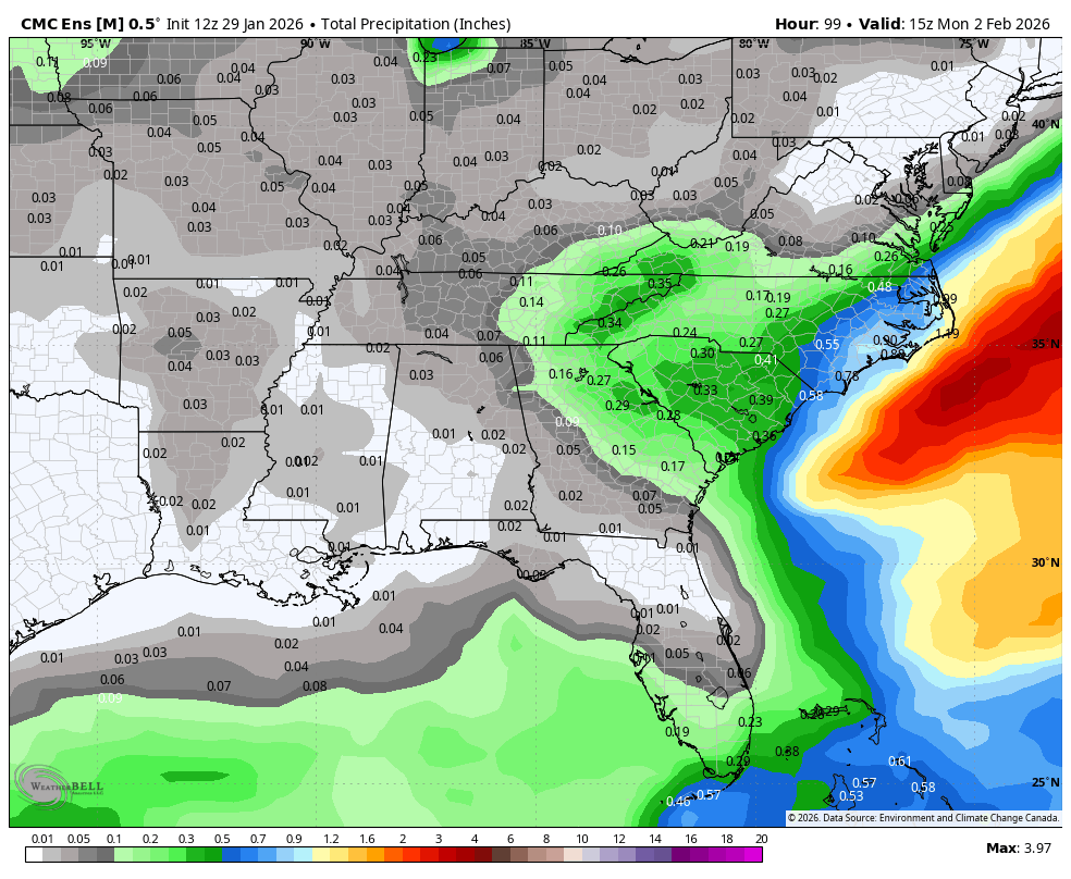
Does the UKMET use the same initialization? It's been jumpy as well.
 
Wow! I know everyone here is super pumped for you guys in the midlands of SC, you have all been so snake bitten. I believe a 5-8” event there in Columbia, SC would be the biggest storm since February 2010?!
And 2010 was the largest since 1973 if I'm not mistaken. These sort of things are pretty rare around here. I'm still preparing for the models to start falling apart tomorrow and then by Saturday seeing everyone around us getting a foot of snow 😂
 
Well, the 12z eps isnt matching up with the op very well. Drier across the board. Lots of nuances with this one.
View attachment 191293
For me, I think it’s close enough and not completely opposite it’s ensembles like the NAM and GFS
 
You know maybe it’s a coincidence but looking that map, it’s got me roughly at 7.33”. The latest Hourly graphs that GSP has at my location is for a storm total of 7.1”
Just east of you and I would be ecstatic over those totals! It’s been a long time. Now I hope Charlotte stays below 12” as I always keep my word!
 
Is there a chance a blizzard warning is issued for upstate or nc?
I tend to doubt it simply because the forecast winds don’t match up with Blizzard criteria. Perhaps a strongly worded mention of wind and blowing/drifting snow will be included once a Winter Storm Warning get issued
 
12z Canadian ensembles sucked for many.
1770044400-jpoBWgKnL2A.png
 
I tend to doubt it simply because the forecast winds don’t match up with Blizzard criteria. Perhaps a strongly worded mention of wind and blowing/drifting snow will be included once a Winter Storm Warning get issued
Last night it showed 35 mph gusts for 3+ hours, based off of the models! Gusts and/or sustained meets the criteria. I just didn’t see the 1/4 mile visibility being met but it could change too I guess!
 
I wonder where the minimum will show up? I bet it will be a surprise. Ha ha!
711ec55a603643e16a5bdfdc1f21da5c.jpg


Sent from my iPhone using Tapatalk
I hate it for you but don’t at the same time! If we could all get 11.9” board wide it would be great! You have more opportunities than us flat landers is the reason for my comment!
 
I wonder where the minimum will show up? I bet it will be a surprise. Ha ha!
711ec55a603643e16a5bdfdc1f21da5c.jpg


Sent from my iPhone using Tapatalk
Your in good shape for at least a moderate event. I wouldn't sweat it. If I had a nickel for every time you out preformed the southern foothills.... Well you get the idea. Stay warm and safe my friend. Enjoy!
 
I never in my life thought I’d see this from the nws for charlotte the day before a storm


...WINTER STORM WARNING IN EFFECT FROM 4 PM FRIDAY TO 7 AM EST
SUNDAY...

* WHAT...Heavy snow expected. Total snow accumulations between 4 and
7 inches. Winds gusting as high as 55 mph.
 
15z SREF - Another model I have zero trust in, but I'll post it anyway.
sn10_acc-mean-imp.us_ma.png
Kind of wild how different the SREFs are from a lot of other modeling, with the highest totals in E / NE NC / SE VA with comparatively little in SC and the CLT area. You'd think it's wrong and it probably is although I suppose climo would favor it to some extent (but climo is just climo and there are plenty of exceptions to it).

WeatherNext should be out soon, right?
 
Someone asked a question about Charleston, SC having any back to back years with accumulating snowfall. I tried to keep criteria of at least an inch and was able to find an abridged most snow in one day (does not state the storm total if it was a multi day event). What I found was yes, it has happened in back to back years a small handful of times. 3 dating back since 1895.

1.5" 1/13/1912 (to compare with 1914/15)
2.2" 2/25/1914
1.7" 12/21/1915

Honorable Mention
1.0" 12/30/1917
0.5" 1/2/1918
Interesting just a few days spread but over two calendar years.

Starting a period from 1957 thru 1971, a trace or better fell every year.
0.5" 3/11/1960
0.2" 2/16/1963
0.8" 1/27/1966

1.3" 2/22/1968
2.0" 3/4/1969

From 1976 thru 1980, 5 years in a row accumulating snow but 1979-1980 had back to back years over an inch of accumulating snow. (The 1979 storm was also on top of a lot of freezing rain/sleet)
0.4" 1/17/1976
0.6" 1/31/1977
0.4" 2/9/1978

1.6" 2/18/1979
3.7" 12/27/1980
 
based on history this is typically when we reach our qpf nadir before models bump things up some. atypical storm sure. but if we're going with history this is our bottom

Agreed. And that’s why I tend to defer to the professional Mets that have deep experience with our climo and these setups around this time. Fishel’s thought that it will hug and bomb right off the coast due to Gulf Stream and ULL influence carries a lot of weight with me. That’s 40+ years of studying these storms and our climo talking. Tricky dynamics that the models can struggle to fully decipher.


Sent from my iPhone using Tapatalk
 
I never in my life thought I’d see this from the nws for charlotte the day before a storm


...WINTER STORM WARNING IN EFFECT FROM 4 PM FRIDAY TO 7 AM EST
SUNDAY...

* WHAT...Heavy snow expected. Total snow accumulations between 4 and
7 inches. Winds gusting as high as 55 mph.
isn't that the warning for the mountains? I don't see a WS Warning issues for CLT yet
 
I wonder where the minimum will show up? I bet it will be a surprise. Ha ha!
711ec55a603643e16a5bdfdc1f21da5c.jpg


Sent from my iPhone using Tapatalk
Just across these latest runs, we've seen the dreaded dry spot hone in on the Triangle, Roanoke Rapids, Wilmington... and I'm sure I'm missing some spots. It is truly a TBD/Find Out In Live Time!
 
Back
Top