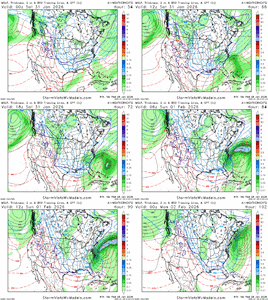
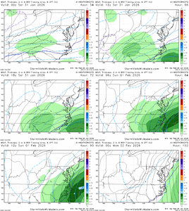
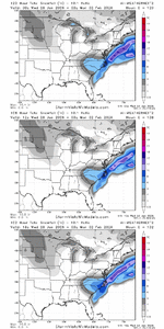
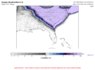
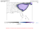
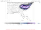
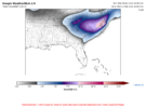
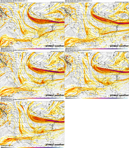
I was looking at that earlier. Pretty amazing.synoptically pleasing, eye candy, ocd pleasing, this buzzes more then any vape or cig, this is more intoxicating then a bottle of don don don julio View attachment 190898View attachment 190899
-
Hello, please take a minute to check out our awesome content, contributed by the wonderful members of our community. We hope you'll add your own thoughts and opinions by making a free account!
You are using an out of date browser. It may not display this or other websites correctly.
You should upgrade or use an alternative browser.
You should upgrade or use an alternative browser.
Wintry Machine Learning Mauler 1/30-2/1
- Thread starter SD
- Start date
I got that error trying to load the SREF plumes earlier. Now I can't load the Probabilistic maps on RAH's page.We crashed the NWS website. Good job team!

Sent from my iPhone using Tapatalk
It’s nice that we don’t have to worry about temps, either. One less thing to worry about. Famous last words, of course, but it’s hard to see how most of us plausibly mix (except maybe at the start for some) unless the setup completely changes.I’ve had some big means before but they usually come in the form of tight contouring over my house which results in disappointment 100% of the time. This is a broad low temp storm with the absence of cutoff zones. So It feels like equal opportunity which is really nice for a change
packfan98
Moderator
Btownheel
Member
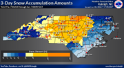
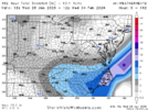
Updated 3 day totals.
View attachment 190905
RAH putting the flag up. WOOF!
Sent from my iPhone using Tapatalk
Tsappfrog20
Member
Rendering in process. I spent some time today optimizing my processing, so it shouldn't take very long
How are they looking so far?
Sent from my iPhone using Tapatalk
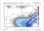
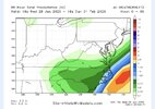
WeatherNext2.. WOW! Not a huge change but wetter! Plots coming in just 2-3 mins
jamesmbryanjr1
Member
Wonder if it’ll trend a tad further west
Sent from my iPhone using Tapatalk
This run will make many happy, from ATL thru the Carolinas...
Of course Roxboro is on that 12-18” zoneUpdated 3 day totals.
View attachment 190905
Looks like they backed off some of the 12-18" totals in Wake but I thought that was overdone myself.Updated 3 day totals.
View attachment 190905
RAH loves that GSO-Henderson corridor for heaviest amountsUpdated 3 day totals.
View attachment 190905
You’re making us feel like a 5 year old waking up on Christmas morning… lol. Seriously though thanks for all you do with that modelThis run will make many happy, from ATL thru the Carolinas...
Has anyone been able to get the RAH area forecast discussion to update? I've been trying and it's still stuck on the morning's 7 AM discussion.I got that error trying to load the SREF plumes earlier. Now I can't load the Probabilistic maps on RAH's page.
Last edited:
darn StormVista is quicker than me again.
My probabilistic maps will be up shortly
Makeitsnow
Member
Well im assuming the .40 amounts are now creaping into ga with that so 4 to 6 is looking pretty good for my neck of the woods at the least.
Crow
Member
I wonder what is making them out the precip maximum at the NC/VA border?Updated 3 day totals.
View attachment 190905
BrickTamland
Member
Me, too, when most of the models have it in the Triangle or east of there.I wonder what is making them out the precip maximum at the NC/VA border?
Xlhunter3
Member
wow
Member
NC special, though would hope this would pull NW to make it a memorable event for more. But Google says otherwise. The Gods have spoken!
bncho
Member
Mitch seems pretty excited!
But rightly so. This setup favors NC/SC. That's just Nina climo!
iGRXY
Member
There’s more separation with the N/S on the NAM already at 27
Mahomeless
Member
This held true other than the AL part….westward trend has stopped, but the QPF fields are still expanding! Congrats to all of you guys in NC/SC/GA….I’ll be heading east soon enough!Expect continued westward trends with the ULL and expanded qpf fields back into AL/GA. This may continue until verification…time will tell.
Tsappfrog20
Member
There’s more separation with the N/S on the NAM already at 27
I was going to say I heard it was already further west just a minute ago
Sent from my iPhone using Tapatalk
NBAcentel
Member
Hmmm, the base looks more loaded this NAM run imo, could be good

The Snowfall Forecast Contest Thread Watch has been upgraded to a Warning! I have thrown in $50 for the winner. DM me if you would like to add to the pot. Link to the thread below.
Site News - Griteater Snowfall Contest 👀
Snowfall Forecast Contest Thread (January 31, 2026) For: The MACHINE LEARNING MAULER STORM I am putting up $50 to the winner. Winner take all. DM me (@griteater) if you would like to donate to increase the pot. Here's how it will work: Post in this thread your total storm snowfall (includes...
southernwx.com
BrickTamland
Member
Man. That pivot looks really good for CLT, especially the east side of the metro area and Cabarrus/Union counties
wow
Member
Nuff said
BrickTamland
Member
BrickTamland
Member


