I think there’s probably some collaboration with other offices on that. GSP mentions that they will hold off on issuing watch until most likely tomorrow morning.I was surprised they said they’re not going to put out a watch until tomorrow.
-
Hello, please take a minute to check out our awesome content, contributed by the wonderful members of our community. We hope you'll add your own thoughts and opinions by making a free account!
You are using an out of date browser. It may not display this or other websites correctly.
You should upgrade or use an alternative browser.
You should upgrade or use an alternative browser.
Wintry Machine Learning Mauler 1/30-2/1
- Thread starter SD
- Start date
Yeah, I know they are slow with the products. They have been like that for as long as I can remember. They will always be the last forecast office in the area to get out an updated forecast package.Without hitting banter territory. RNK is often very conservative and only updates graphics when the forecast period switches (usually 5pm it switches from this afternoon tonight).
Usually when there us big snow it goes from a “Chance” to 7-8” or whatever about 24 hours out.
LukeBarrette
im north of 90% of people on here so yeah
Meteorology Student
Member
2024 Supporter
2017-2023 Supporter
NWS Blacksburg is always very conservative until about day-ish out. Been in the building before for a shadow and it’s a lot of older guys. They are starting to get some younger people in though.RNK doesn't even have a snowfall map for this time period. There's ends at 7am saturday, Why is that??
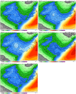
View attachment 190779
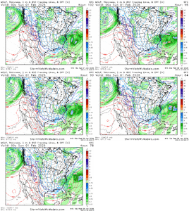
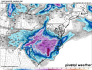
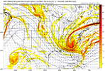
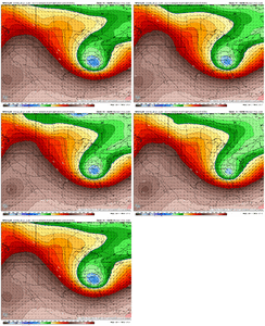
It's interesting that the Canadian models have a history of performing well in storms like this with an upper wave approaching from the NW. For the Jan 2003 storm, GSP NWS wrote up a short paper that talked about how it performed well in that one. I recall it standing out on a few others like this (upper waves from the NW) in recent years....there was one where we hailed it the new king in here, I remember that lolsave this one.. what a bomb! The neg tilt pulling the low in and it'll snow for many more hours after this.
View attachment 190787
View attachment 190788
Last edited:
That's good to hear; they have always been ultra-conservative.NWS Blacksburg is always very conservative until about day-ish out. Been in the building before for a shadow and it’s a lot of older guys. They are starting to get some younger people in though.
JHS
Member
I would not be shocked at all to see subzero temps over a large part of SC and NC for at least 1, if not 2 nights. I think if we get the snow, the coldest night since 1985 is likely for many of us. Someone in NC is going to get 12-18 inches of snow I think, with at least 2-4 in parts of almost every county in both states.Found an interesting note in GSP’s discussion. It says all time record low 500mb heights for the southeast are being modeled. Just another sign of how rare a storm this could be for a lot of us
RGEM gives Mitch 24 hours of snow, lol. Ya boy gonna be eating pizza with pizza for dessert
@Mitch West
@Mitch West

Just a quick question for you guys: why look at those models—the NWS or local mets—but aside from their forecasts, ignore tools like the RGEM, the Navy’s app, and other models you don’t hear mainstream outlets use to make informed decisions?
If we’re trying to imitate other mets and climatologists, why not copy their methods?
Also, wishcasting has been increasing on this thread. I know I’m the new guy and not a daily poster, but there are a lot of lurkers who don’t post, and this is a well-known board in the industry.
If we’re trying to imitate other mets and climatologists, why not copy their methods?
Also, wishcasting has been increasing on this thread. I know I’m the new guy and not a daily poster, but there are a lot of lurkers who don’t post, and this is a well-known board in the industry.
rburrel2
Member
BrickTamland
Member
18z GFS lays down 10"+ for most of the eastern 2/3rds of NC, per Kuchera. Jackpot with 20"+ SW of PGV.
Chase1983
Member
Can you explain this effect?Leeside Cyclonegenisis could possibly play a large role in east GA and the upstate of SC. Too early to talk about specific mesoscale features though, but it is something to watch.
I line in Landrum, SC. I mostly lurk l, but I've been within the upstate weather community since Andy Wood was around for Fox Carolina. This Forum as well as AmericanWx gives me insight to the different model runs and maps that I don't have access to within tropical tidbits. So I mostly observe and keep my co-workers and loved ones up to date on the latest possible outcomes. There's so much click-bait on social media that the majority of people here in the upstate refuse to take things seriously when it's pretty much locked in that some sort of winter weather is going to happen.Just a quick question for you guys: why look at those models—the NWS or local mets—but aside from their forecasts, ignore tools like the RGEM, the Navy’s app, and other models you don’t hear mainstream outlets use to make informed decisions?
If we’re trying to imitate other mets and climatologists, why not copy their methods?
Also, wishcasting has been increasing on this thread. I know I’m the new guy and not a daily poster, but there are a lot of lurkers who don’t post, and this is a well-known board in the industry.
BrickTamland
Member
No one in here should be trying to imitate anyone. It's up to you the poster to do your own research and hopefully be a contributor in here and not a distraction.Just a quick question for you guys: why look at those models—the NWS or local mets—but aside from their forecasts, ignore tools like the RGEM, the Navy’s app, and other models you don’t hear mainstream outlets use to make informed decisions?
If we’re trying to imitate other mets and climatologists, why not copy their methods?
Also, wishcasting has been increasing on this thread. I know I’m the new guy and not a daily poster, but there are a lot of lurkers who don’t post, and this is a well-known board in the industry.
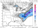
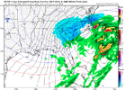
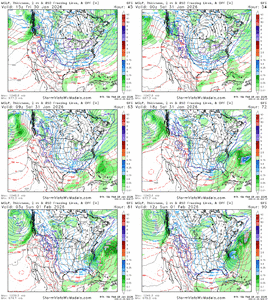
18z GFS follows the going theme regarding trends of the geographic footprint of precipitation
packfan98
Moderator
BrickTamland
Member
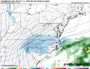
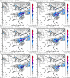
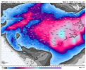
That's not the whole total yet.Gfs totals
View attachment 190801
mydoortotheworld
Member
Good to know because this gives me confidence that ATL will see something. May just book a cabin in Blue Ridge and perhaps see higher totals thereIt's interesting that the Canadian models have a history of performing well in storms like this with an upper wave approaching from the NW. For the Jan 2003 storm, GSP NWS wrote up a short paper that talked about how it performed well in that one. I recall it standing out on a few others like this (upper waves from the NW) in recent years....there was one where we hailed it the new king in here, I remember that lol
BrickTamland
Member
BrickTamland
Member
GFS and NAM are very similar.
Don't have Kuchera maps for the 18z AIGFS, but I would speculate this translates to 8-12" for CLT, 6-8" for GSO, 4-6" for RDU, 6-8" for GSP, etc. Definitely a different look and not in a good way comparatively speaking for those of us in N/E NC, but it remains within the realm of possibilities...
8-12" for CAE? Not sure if ratios are quite as primed down there, though.
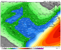
8-12" for CAE? Not sure if ratios are quite as primed down there, though.

LittleMountain
Member
The lee minima is shown too much to ignore. Someone is gonna get a bust in that areaGfs totals
View attachment 190801
Greed index high in here. I’m going to start trimming my position here. Good luck, boys.
Makeitsnow
Member
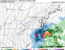
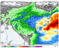
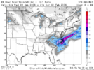
the gfs has finally trended back into somewhat agreement with the other models for ne ga though still likely underdone. But that 0.75 in that band over ne ga really shows the potential for who ever is lucky enough to get under it.Much more reasonable, but I do think we are going to see the hi-res modeling do some cool things back west unless we lose our setup.
View attachment 190808
I want to say that happened with the Christmas / Boxing Day Storm of 2010, but I'm not 100% sure.When was the last time all 100 NC Counties was in a Winter Storm Warning at the same time? 2018? Or has that ever happened?
Sent from my A600DL using Tapatalk
wow
Member
rburrel2
Member
Interesting battle here between GFS AI/Euro AI and GFS/CMC/Euro in regards to Eastern NC precip maxima or minima.
Weathernext is a good happy medium I guess. Just feels like it's one of those things that will either go one way or the other and not in-between.
All i'd say is don't have your hopes so high in the triangle that you get disappointed with 4-6 inches. Take that, be happy, and anything extra is just gravy.
Makeitsnow
Member
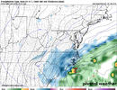
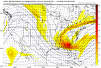
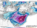
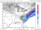
that's a solid 4 to 7 inches along the border counties in ga and 1 to 4 in the metro verbatim. temps will be in the low to mid 20s initially and fall into the teens as the day goes on in west ga so ratios will be very high in west ga for whatever that falls.Don't have Kuchera maps for the 18z AIGFS, but I would speculate this translates to 8-12" for CLT, 6-8" for GSO, 4-6" for RDU, 6-8" for GSP, etc. Definitely a different look and not in a good way comparatively speaking for those of us in N/E NC, but it remains within the realm of possibilities...
8-12" for CAE? Not sure if ratios are quite as primed down there, though.
View attachment 190813
WxBlue
Meteorologist
NWS Raleigh said to expect Winter Storm Watches tomorrow.
Fwiw the UK just jumped on board too
NWG_WX14
Member
UKMET moving closer to the model consensus

