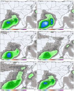
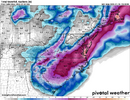
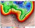
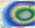
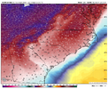
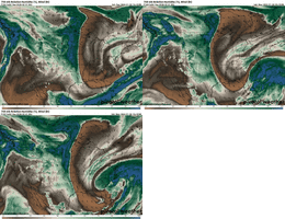
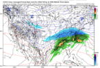
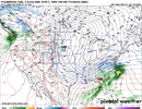
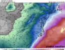
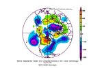
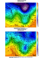
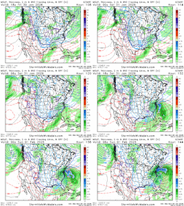
Im curious what his thoughts were during January 2025. I believe it’s just built into his programming. He’s a weenie like the rest of us. Did he think that gulf coast blizzard was coming north last year?Notice he went with the most northerly map looks. Who knows, he's maybe more right than wrong.
-
Hello, please take a minute to check out our awesome content, contributed by the wonderful members of our community. We hope you'll add your own thoughts and opinions by making a free account!
You are using an out of date browser. It may not display this or other websites correctly.
You should upgrade or use an alternative browser.
You should upgrade or use an alternative browser.
Wintry Machine Learning Mauler 1/30-2/1
- Thread starter SD
- Start date
Makeitsnow
Member
That would probably be a 4 to 6 inch snow for ne ga and the upstate when taking ratios into considerationThe latest 06z WeatherNext Ens run was without a doubt the best one I've seen for the eastern / northeastern areas of the forum. The EPS and WNext are quite similar with the storm right now.....but where do we trend??
06z WeatherNext run…
View attachment 189446
View attachment 189447
Crazy high end setup with what is modeled currently. I've got some concerns about the evolution Dec 00 type outcome sticks out or just a general not enough blocking so this gradually leaks north on models. But the high end potential makes chasing this one worth it for years if it hits
EPS SLP trend:
Go NW young man as usual. ATL’s best bet would have been a W trend to well out into the Gulf rather than NW, which favors areas to ATL’s northeast. But W trends aren’t what usually happens. (Thus, at this point, I don’t expect to be making a trip to ATL to be there this weekend). And if this keeps correcting too far NW, more of NC will be left out of anything significant:
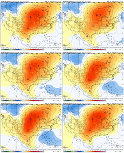
Go NW young man as usual. ATL’s best bet would have been a W trend to well out into the Gulf rather than NW, which favors areas to ATL’s northeast. But W trends aren’t what usually happens. (Thus, at this point, I don’t expect to be making a trip to ATL to be there this weekend). And if this keeps correcting too far NW, more of NC will be left out of anything significant:

Last edited:
The closed off low should really be much, much further east and south. Barring that I'd be okay if this low just drifted west towards TN & KYEuro bomba. I’d say another thing we need to be careful is we don’t trend the closed off H5 vort to far north. But wow View attachment 189361
SnowNiner
Member
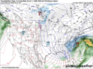
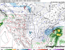
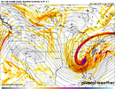
6z WeatherNext snowfall probability thresholds.
WeatherNext is clearly a little under dispersed, but considering the run-to-run consistency and the track record, this is very high confidence from the model.
View attachment 189439View attachment 189440View attachment 189441
That footprint is absolutely classic, and you love to see it. This setup though seems to favor the Raleigh area however as the storm is still so far off the coast on the Google IMO. I have my doubts we get that much with it so far east. I know west trending eventually gets you in trouble, but for 77 and west I'd love to see a couple more ticks west.
Since this is a Miller A, it's likely not going to run west to east along the gulf which are my favorite storms, but hopefully we can get the qpf starting at least in GA and run NE.
Bigedd09
Member
That footprint is absolutely classic, and you love to see it. This setup though seems to favor the Raleigh area however as the storm is still so far off the coast on the Google IMO. I have my doubts we get that much with it so far east. I know west trending eventually gets you in trouble, but for 77 and west I'd love to see a couple more ticks west.
Since this is a Miller A, it's likely not going to run west to east along the gulf which are my favorite storms, but hopefully we can get the qpf starting at least in GA and run NE.
Someone said even if the low is further east we’d still do fairly well in the western Carolina’s with the northern energy
Sent from my iPhone using Tapatalk
NEGaweather
Member

Sent from my iPhone using Tapatalk
WolfpackHomer91
Member
Raleigh - Richmond HammerThat footprint is absolutely classic, and you love to see it. This setup though seems to favor the Raleigh area however as the storm is still so far off the coast on the Google IMO. I have my doubts we get that much with it so far east. I know west trending eventually gets you in trouble, but for 77 and west I'd love to see a couple more ticks west.
Since this is a Miller A, it's likely not going to run west to east along the gulf which are my favorite storms, but hopefully we can get the qpf starting at least in GA and run NE.
Tsappfrog20
Member
Wral is alright talking about this weekend and has a 30% chance of Snow Saturday and Sunday
Sent from my iPhone using Tapatalk
Sent from my iPhone using Tapatalk
Brandon10
Member
Now we begin with 12z....Its the NAM but it shows a stout piece of NS Energy on Friday diving down and it is veryyyy cold.
Icon next.
Icon next.
packfan98
Moderator
Quick reminder to put your wishes and complaints to the banter thread.
And as always, may the models ever be in your favor!
And as always, may the models ever be in your favor!
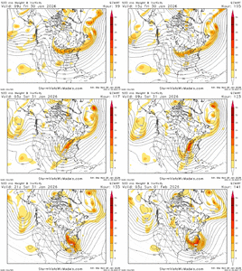
The regular Euro is dropping the closed upper low, slowing it down in the base of the trough, and working it toward negative tilt quicker than any of the op / ensemble runs I believe. The Euro is probably on the western side of the EPS solutions in terms of it riding up the coast as a noreaster. The WNext and EPS show more of the snow footprint there for typical storms that have a more focused hit in parts of the SE and Southern Mid-Atlantic. Either is possible hereGrit, question--the orientation of this coastal NE->SW on its snow print looks kind of odd to me for storms that tend to form and move up the coast. What do you think is going on there?
bncho
Member
Brandon10
Member
12Z ICON is more organized, stays offshore enough to keep warm nose at bay. Decent Snow much of SC and NC as it heads NE. THis is up to hour 132
Bigedd09
Member
Icon off to a good start at 12z!
Sent from my iPhone using Tapatalk
Sent from my iPhone using Tapatalk
NCWeatherNow
Member
LovingGulfLows
Member
- Joined
- Jan 5, 2017
- Messages
- 1,499
- Reaction score
- 4,100
ICON continues the good trend. Ga., as usual, is marginal at the surface while the LP was still in the GOMView attachment 189463
Yeah it pops a legit gulf low at hour 102, but it's too warm in GA until it gets cranking off the Carolina coast.
packfan98
Moderator
ABC11 as well they have for Saturday "Snow Showers?" when I saw the 7 day earlierWral is alright talking about this weekend and has a 30% chance of Snow Saturday and Sunday
Sent from my iPhone using Tapatalk
Sent from my SM-S156V using Tapatalk
wow
Member
Hopefully keeps trending better where we can get 1-3 inchesICON continues the good trend. Ga., as usual, is marginal at the surface while the LP was still in the GOMView attachment 189463
Can you post that 12z frame at 114hrsICON continues the good trend. Ga., as usual, is marginal at the surface while the LP was still in the GOMView attachment 189463
NCWeatherhound
Member
Can the mods make a rule that, in order to post, a person must be able to at least identify their home county on a map? It would save a lot of aggravation.I encourage you to read closely the maps @bouncycorn just posted literally 3 posts before yours, 20 mins ago, and see if you can answer your own question. If you’re not sure where Atlanta is without labels, can pull up a county map on Google. Really helpful when reading weather maps to find your own county.
Is this a good or bad thingCannot deny the trend. Seeing the trough keeping digging deeper south and more negative tilt is just as big as the westward move for us in AL.
View attachment 189470
Makeitsnow
Member
Look at the surface temps and 850s...ratios would be very high...snows in the teens hereAcceptable
View attachment 189467
NEGaweather
Member
Is this a good or bad thing
Very good
Sent from my iPhone using Tapatalk
CNCsnwfan1210
Member
That will do it.
View attachment 189469

990mb surface low ESE of Hatteras at hr 132 12z icon
Sent from my iPhone using Tapatalk
BHS1975
Member
This would get those insane totals further south.Is this a good or bad thing
NBAcentel
Member
rburrel2
Member
One good thing... if this lobe keeps trending West... we get the gulf much more involved for Friday night. So even if the 5h low cuts off much further north... we are potentially still getting hit hard on the front end from this.
Just saying it's a way we score, even if we ultimately lose the cut off to our north.

Just saying it's a way we score, even if we ultimately lose the cut off to our north.
