-
Hello, please take a minute to check out our awesome content, contributed by the wonderful members of our community. We hope you'll add your own thoughts and opinions by making a free account!
You are using an out of date browser. It may not display this or other websites correctly.
You should upgrade or use an alternative browser.
You should upgrade or use an alternative browser.
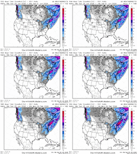
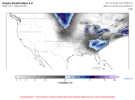
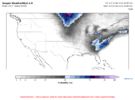
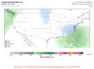
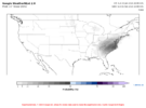
Wintry Machine Learning Mauler 1/30-2/1
- Thread starter SD
- Start date
AJ1013
Member
Record cold coming my way if this verifies (Plus you guys get a nice snowstorm. Win-win!). 12z was much weaker and still dropped Miami to 34F


If we get a big dog from this southernwx needs to make WeatherNext merch and we will hit our donation goals thru 2030Our new king?
Sent from my Pixel 10 Pro XL using Tapatalk
Codariah
Member
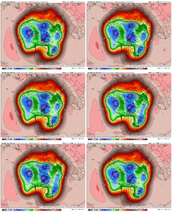
Weathernext is remarkably consistent. Only minor adjustments here and there.
Sent from my iPhone using Tapatalk
Sent from my iPhone using Tapatalk
Woahhhh woah woah shhhhhhA cutter seems unlikely. I f anything it would be suppressed SE
JP152
Member
Snow on snow.
Tokenfreak
Member
Weathernext is remarkably consistent. Only minor adjustments here and there.
Sent from my iPhone using Tapatalk
It does seem to keep decreasing totals slightly each run for the Carolinas but I guess that is to be expected this far out.
Yup and all that snow on the ground up north will help those arctic air masses stay as cold as possible.A couple of general things I will state about the potential event next weekend:
1) Our areas are all expected to have well below average temps this week and into this weekend. The ground will be cold!
2) The airmass after next weekend looks to remain cold.
So, this could be an event with long-lasting effects vs warm -> cold/snow -> warm (rapid melting)
This is the one.
The next person to say the word overrunning is banned for 9 days!Let's just do an overrunning and call it a day!
wow
Member
Beep beep boo boop the Euro dropped 12" of.snow for this human. I'm genuinely intrigued to see how this shakes out. I'm a little scared tbh.
Xlhunter3
Member
NBAcentel
Member
I’d say honestly the biggest concern would be pinching off early/slowing to early and the 50/50 low escaping to quickly, allowing another mixed event, but the swath would probably be further SE vs today. Tons of cold with that look already
iGRXY
Member
I’ve been iffy on this potential but the EPS latching on with this kind of movement at this lead time is about as good as you will ever get it for southern snow
SnowNiner
Member
Beep beep boo boop the Euro dropped 12" of.snow for this human. I'm genuinely intrigued to see how this shakes out. I'm a little scared tbh.
Why scared? Potential for actual suppression this time?
So close. Back that trough up another 300 miles and we good.
I may totally jinx it. If the upper air pattern stays as modeled.... this has a maxima of how far northwest it can come. I think suppression is a bigger issue.
What limits how far NW it can come?
Actually I didn’t ask but what are the odds of SE AL/S GA and N FL getting snow because it looks really low from what I seen
Sent from my iPhone using Tapatalk
Climo/history says odds are low for these areas, especially for anything measurable.
wow
Member
AI figures it all outWhy scared? Potential for actual suppression this time?
So close. Back that trough up another 300 miles and we good.
Hopefully not the Randolph County line.What limits how far NW it can come?
I need a footer. Been over 20 years and I aint getting any younger.
If Jim Gandy is in, Im In!!
Lol don't worry he will chime in at some point If he thinks he needs toHopefully not the Randolph County line.
I need a footer. Been over 20 years and I aint getting any younger.
If Jim Gandy is in, Im In!!
BradGPT says watch the NW trend
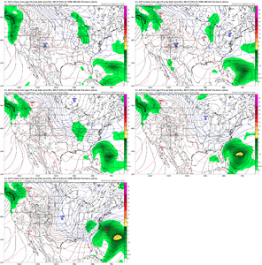
Wow, look how much it trended NW within just 18 hours of EPS runs. The storm, the Arctic high to its NW, and other features on the map. It better slow down soon!
We just need to get that system to trend WNW about 200 miles so us fine folks in central/north GA can dip in on this snow action this time.
BHS1975
Member
Yeap, already in the bullseye. Not good.Wow, look how much it trended NW within just 18 hours of EPS runs. The storm, the Arctic high to its NW, and other features on the map. It better slow down soon!
bncho
Member
I doubt if this materializes it will be an inland runner. Being warm nosed by a sub 1000mb riding rapidly up the coast is in the cards possiblyYeap, already in the bullseye. Not good.
Bigedd09
Member
I doubt if this materializes it will be an inland runner. Being warm nosed by a sub 1000mb riding rapidly up the coast is in the cards possibly
No it won’t . We got weather next on our side
Sent from my iPhone using Tapatalk
Yes this is banter, but seeing this, we need a pimp my ride version of how all the indicies line up going into the weekend! Been way tooo long! Thanks
Major snow pack now in the Ohio Valley and northeast, very cold press all week, my pool has 1/2" and growing frozen top layer.... we're good for next weekend, guys. I'd be more worried about super suppression than a cutter. Last banter comment from me until we are on the other side of fab February
I think that's a bit too far east.
NBAcentel
Member
rusrius
Member
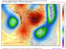
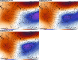
I remember this one. Monumental snow. I couldn't walk in it there was so much. My dad took me outside and threw a snowball at me and hit me plum in the eyes. Cried like a baby which I kinda was.Well if were going to throw around some of our favorite analogs..
Upcoming time frame looks better than this honestly
View attachment 189257
View attachment 189263
SnowNiner
Member
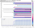
Hopefully tomorrow we wake up to pretty pink and purple AIFS meteograms lighting up the thread like the last one.

