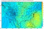
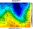
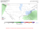
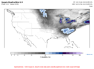
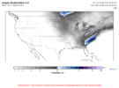
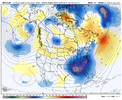
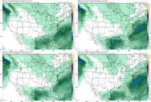
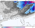
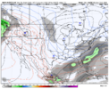
These models are going to save us a lot of pain and suffering in the future. Already are to some extent.Wish the AI models weren't already pretty locked in on the H5 pattern.....
-
Hello, please take a minute to check out our awesome content, contributed by the wonderful members of our community. We hope you'll add your own thoughts and opinions by making a free account!
You are using an out of date browser. It may not display this or other websites correctly.
You should upgrade or use an alternative browser.
You should upgrade or use an alternative browser.
Wintry Machine Learning Mauler 1/30-2/1
- Thread starter SD
- Start date
SegTindo
Member

Looks like there’s more members on here
Sent from my iPhone using Tapatalk
That Euro AI ensemble that fro posted is an absolute thing of beauty for the majority of the board and the weathernext is holding steady. I’m not sure why some are upset having those two on our side. The GFS is dead to me anyways. It’s Sunday and we have 6 days to go. I believe I’ll take my chances after being in the sweet spot at this lead point for the last two events and whiffing terribly.
NEGaweather
Member
February 2010 would like to have a word with Chris.
Exactly
Sent from my iPhone using Tapatalk
packfan98
Moderator
Alright folks. This is a storm thread and not one for mindless banter. Don’t lose your ability to post in this thread. If you get banned from multiple threads in one week, common sense tell us that you are not adding value to our forum and it would be better without your presence.
Not the mama
Member
Serious question. Does weathernext2 also have a tendency to trend NW or is that just a typical standard model trend. Also does anyone know why they end up ticking NW so frequently?
wow
Member
I am on full faith on climatology and AI with this one.
accu35
Member
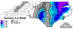
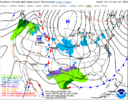
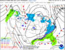
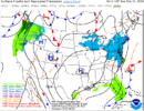
May I ask where WPC get there graft run from? Which model or a blend?One of the best things about this potential setup is the cold is already in place, ground frozen, etc. Anything that falls, sticks.
View attachment 189178
View attachment 189179
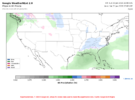
View attachment 189181
Serious question. Does weathernext2 also have a tendency to trend NW or is that just a typical standard model trend. Also does anyone know why they end up ticking NW so frequently?
According to conversations I had with pro met. Brad Harvey going back a number of years, it appears to largely be related to the models not handing the warm pool in the WPAC well causing them to be biased too far SE. I can recall this going back to the late 2010s and it has been pretty relentless since, almost like clockwork. So, as the models get closer to the event, they “trend” NW to catch up with reality.
And I honestly cannot ever think of an event that models had missing us to the nw come trend se as we got closer.According to conversations I had with pro met. Brad Harvey going back a number of years, it appears to largely be related to the models not handing the warm pool in the WPAC well causing them to be biased too far SE. I can recall this going back to the late 2010s and it has been pretty relentless since, almost like clockwork. So, as the models get closer to the event, they “trend” NW to catch up with reality.
February 2010 would like to have a word with Chris.
I think the way KCHS worded this in an earlier discussion is perfect:
THERE REMAINS A LOW CHANCE THAT A SOUTHERN STREAM LOW COULD
BRING WINTRY PRECIPITATION NEXT WEEKEND.
That was earlier and they have since removed that in later discussions.
Starting with the early afternoon forecast, they introduced a 20% chance of rain along the coast for Saturday. Then the next forecast, which goes out through Sun, extended that into Sunday. This looks like a good way to handle this low chance possibility though not to be ignored although I suppose they could have said mix or generic “precip”, but this is fine. The odds this far out, despite models suggesting to watch this period, favor this ending up as little or nothing per climo as well as the typical NW trend which could easily bring this much too far NW for the coast to get wintry. How many times have we seen this occur? A whole lot of times. So, low odds as of now for coastal wintry.
SATURDAY
PARTLY SUNNY WITH A 20 PERCENT CHANCE OF RAIN
SHOWERS. HIGHS AROUND 40. WIND CHILL VALUES AS LOW AS 15 IN THE
MORNING.
SATURDAY NIGHT
PARTLY CLOUDY WITH A 20 PERCENT CHANCE OF RAIN
SHOWERS. LOWS IN THE LOWER 20S. WIND CHILL VALUES AS LOW AS 15.
SUNDAY
SUNNY WITH A 20 PERCENT CHANCE OF RAIN SHOWERS. HIGHS
IN THE LOWER 40S. WIND CHILL VALUES AS LOW AS 15 IN THE MORNING.
accu35
Member
Little change on the 18th gfs
Edward Nygma
Member
I’m expecting this to trend well NW like usual. Combining that with climo of the coast being only infrequently hit with anything significant wintrywise, gives me extra confidence. Not a guarantee but easily the best bet since it usually happens. It just happened with the last two, for example. The models don’t “know better”.
MichaelJ
Member
A lot of it depends on the location and movement of the high pressure, if it is too far east and booking it, the storm escapes to the east, if it is too far west, it becomes an Apps runner and causes a Miller B that transfers to the low forming off the coast. Where it reforms off the coast is critical for those who want snow, too far East the Western areas get squat, if it hugs or only 50-75 miles off the coast line the eastern half of the States (NC,SC, Va) mix or miss and the Western areas have a field day. As Webber has mentioned many times, the best way to get a board wide storm is overrunning from a low just north of the Gulf coast
They all trend NWI’m expecting this to trend well NW like usual. Not a guarantee but easily the best bet since it usually happens. The models don’t “know better”.
GeorgiaGirl
Member
Yeah, while suppression does still worry me here with this pattern, I do have my suspicions that this is the same ole' game here.
Wonder if the ensembles here can pop more this time as that was a heck of a jump.
Wonder if the ensembles here can pop more this time as that was a heck of a jump.
This just come out ?
It is the latest run(12z) , but the 00z, 06z, and 12z looked VERY similar to each other.This just come out ?
Tokenfreak
Member
It is the latest run(12z) , but the 00z, 06z, and 12z looked VERY similar to each other.
Is/will there be an 18z run or no?
A lot of it depends on the location and movement of the high pressure, if it is too far east and booking it, the storm escapes to the east, if it is too far west, it becomes an Apps runner and causes a Miller B that transfers to the low forming off the coast. Where it reforms off the coast is critical for those who want snow, too far East the Western areas get squat, if it hugs or only 50-75 miles off the coast line the eastern half of the States (NC,SC, Va) mix or miss and the Western areas have a field day. As Webber has mentioned many times, the best way to get a board wide storm is overrunning from a low just north of the Gulf coast
The best bet for a SE boardwide storm is for the low being further south than you said. A low N of the Gulf coast will usually eliminate the deep SE and often even up to Atlanta, for example. It needs to be well down into the Gulf and cross the FL peninsula along with a very expansive precip shield to its north. Examples include Feb of 1899 and Feb of 1914.
SegTindo
Member
Hey as long as SE AL And S GA gets snow SC/NC y’all get as much as y’all want!
Sent from my iPhone using Tapatalk
Sent from my iPhone using Tapatalk
WeatherNext2 schedule (roughly)Is/will there be an 18z run or no?
12z becomes available around 2pm ET
18z becomes available around 8pm ET
00z becomes available around 2am ET
06z becomes available around 8am ET
They all trend NW
Hoping this doesn’t trend too far NW to take the snow line NW of ATL, which could easily happen with it being 6-7 days out. I might consider a weekend trip there to my ATL peeps next weekend if a major snow really looks to be hitting them.
How did the WeatherNext do with the Penscola Blizzard last year?
Branch
Member
If the Weathernext nails two complicated winter systems back to back can we just start ignoring all the other junk models?It is the latest run(12z) , but the 00z, 06z, and 12z looked VERY similar to each other.
It wasn't publicly available yet, but I can run the model for leading up to that event and will share results! Good experiment!How did the WeatherNext do with the Penscola Blizzard last year?
iwantsouthernsnow123
Member
Insane, because if this does happen, areas of the carolinas and northeast GA may not fully recover from the ice storm prior to it.
If it gets this one, it’ll be 3.If the Weathernext nails two complicated winter systems back to back can we just start ignoring all the other junk models?
Bigedd09
Member
GEFS

Sent from my iPhone using Tapatalk

Sent from my iPhone using Tapatalk
Bigedd09
Member
Should’ve went to the next couple frames lol. I like it.

Sent from my iPhone using Tapatalk

Sent from my iPhone using Tapatalk
GeorgiaGirl
Member
The GEFS footprint doesn't look too far off from what the AIFS-ens and EPS has.
Late bloomer potential at the very least is there.
Late bloomer potential at the very least is there.
Bigedd09
Member

AIGFS ensembles with a northwesterly shift as well. May be happening too early lol
Sent from my iPhone using Tapatalk
Brandon10
Member
I may totally jinx it. If the upper air pattern stays as modeled.... this has a maxima of how far northwest it can come. I think suppression is a bigger issue.

