-
Hello, please take a minute to check out our awesome content, contributed by the wonderful members of our community. We hope you'll add your own thoughts and opinions by making a free account!
You are using an out of date browser. It may not display this or other websites correctly.
You should upgrade or use an alternative browser.
You should upgrade or use an alternative browser.
Wintry Machine Learning Mauler 1/30-2/1
- Thread starter SD
- Start date
SegTindo
Member
Actually I didn’t ask but what are the odds of SE AL/S GA and N FL getting snow because it looks really low from what I seen
Sent from my iPhone using Tapatalk
?
Sent from my iPhone using Tapatalk
iwantsouthernsnow123
Member
Wayy too far out to tell. The pattern for a southern snowstorm is there. Question is, how does it look dynamically, that will not be answered for at least a few days.?
Sent from my iPhone using Tapatalk
There is a chance. Keep your eyes on the trends over the next few days. We will have a better idea by Wednesday when all of the players are lining up on the field.?
Sent from my iPhone using Tapatalk
NBAcentel
Member
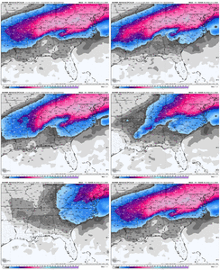
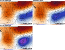
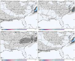
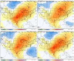
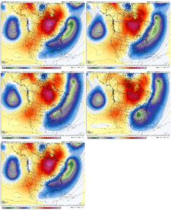
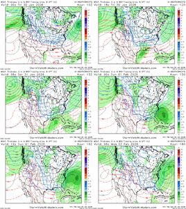
this gif is a little misleading since each run removes part of the current eventView attachment 189237
Since the air masses in question aren't yet deciphered, I'm hoping it won't be just the Carolinas cashing in on this. We'll have to see though, if isn't just a phase'y-cutter through the Apps, or if it'll be a traditional Miller A.
View attachment 189237
Since the air masses in question aren't yet deciphered, I'm hoping it won't be just the Carolinas cashing in on this. We'll have to see though, if isn't just a phase'y-cutter through the Apps, or if it'll be a traditional Miller A.
I would say the chance of this cutting the apps is about 2%.
this gif is a little misleading since each run removes part of the current event
Very aware; unfortunately the 24hr/etc. maps were not available at the time of posting.
As the others have said it is still to far out to tell, hell this system is just now starting to exit. At this point we want to see a NW trend but hopefully not running up the App"s. Wednesday and Thursday will tell the tale for Miss/Alabama. Let's hope the trend is our friend.?
Sent from my iPhone using Tapatalk
Really? 37 minutes later you had to do that??
Sent from my iPhone using Tapatalk
SegTindo
Member
As the others have said it is still to far out to tell, hell this system is just now starting to exit. At this point we want to see a NW trend but hopefully not running up the App"s. Wednesday and Thursday will tell the tale for Miss/Alabama. Let's hope the trend is our friend.
Yea maybe things will look up
Sent from my iPhone using Tapatalk
Xlhunter3
Member
A couple of general things I will state about the potential event next weekend:
1) Our areas are all expected to have well below average temps this week and into this weekend. The ground will be cold!
2) The airmass after next weekend looks to remain cold.
So, this could be an event with long-lasting effects vs warm -> cold/snow -> warm (rapid melting)
1) Our areas are all expected to have well below average temps this week and into this weekend. The ground will be cold!
2) The airmass after next weekend looks to remain cold.
So, this could be an event with long-lasting effects vs warm -> cold/snow -> warm (rapid melting)
LovingGulfLows
Member
- Joined
- Jan 5, 2017
- Messages
- 1,499
- Reaction score
- 4,100
To me this looks like a positive trend for the entire SE including North GA.
SegTindo
Member
Sent from my iPhone using Tapatalk
rburrel2
Member
The ratios on the euro run would be insane, lawd.
mydoortotheworld
Member
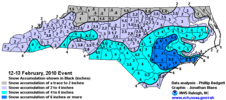
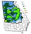
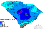
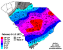
Anyone with access to archives find any analogues for this? (And if so how can I access?) just from surface it looks a little like 2/12/10?
trackersacker
Member
Kind of feels like it could do a December 25th26th 2010 type deal but maybe not crawl up the coast.
The northern energy wrapping into the coastal energy kept us snowing in East TN for a long time, similar to what the euro shows
The northern energy wrapping into the coastal energy kept us snowing in East TN for a long time, similar to what the euro shows
Looks synoptically like Feb 12, 2010 to me.
SnowNiner
Member
Late bloomer..I aint feeling it! Let's see what 0z bring for Atlanta
I don’t like late bloomers either, but it’s too early to call it that. With all the blocking up top, everything is likely to back up in the flow. Signal I take away from is that a coastal right off the coast is more and more likely. Where it starts is unknown. Hopefully it’d backs up to TX.
I mean if we keep digging it farther west with northern wave who knows where this ends up. That was a sizeable jump by euro/aifs with northern stream.
This is the way
GeorgiaGirl
Member
That's sure to generate a tingle up the leg for much of the board!Looks synoptically like Feb 12, 2010 to me.
rburrel2
Member
Euro, euro ai, google weathernext, ukmet all on board for a high ratio powder snow in the upstate on Saturday.
That’s gonna be tough to beat.
That’s gonna be tough to beat.
2010 was a good one but it melted quickly the next day with temps in the 40s. It was a drought breaker for my area. We had gone years without anything more than an inch or two.
SnowNiner
Member
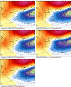
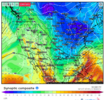
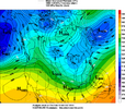
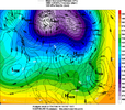
I looked at reanalysis out of boredom after the first comment on this, and the low pressure positioning that the Euro ensembles are keying in on is similar...
View attachment 189247
I swear, don't play games with my heart now please...
That’ll work, maybe shift the low a little closer to Savannah this time though.
wow
Member
No this is not 2010 it's way colder.. something coming here
2/12/10 looked like it was going to be completely squashed until just a couple days out. I remember tracking that one - trended NW at last minute.
lexxnchloe
Member
A cutter seems unlikely. I f anything it would be suppressed SE
wow
Member
My first time driving in snow! So excited and nerves at the same time!!! Beautiful snowfall!

