I am curious how much melting is going to happen today. On the one hand, we may not top 30 degrees, but on the other we are going to have wall-to-wall sunshine. It would be amazing to make it through the day with full grass coverage, but given how powerful the sun is and how with the wind some areas of grass have as little as ~4" of snow there, I am not holding my breath.
-
Hello, please take a minute to check out our awesome content, contributed by the wonderful members of our community. We hope you'll add your own thoughts and opinions by making a free account!
You are using an out of date browser. It may not display this or other websites correctly.
You should upgrade or use an alternative browser.
You should upgrade or use an alternative browser.
Wintry Machine Learning Mauler 1/30-2/1
- Thread starter SD
- Start date


Shaggy
Member
Winds ripping since the sun came out. Gusting upper 30s causing a lot of blowing snow. Even seen a snow devil in between the houses
I am curious how much melting is going to happen today. On the one hand, we may not top 30 degrees, but on the other we are going to have wall-to-wall sunshine. It would be amazing to make it through the day with full grass coverage, but given how powerful the sun is and how with the wind some areas of grass have as little as ~4" of snow there, I am not holding my breath.
A ton is simply going to evaporate. February sun should help the roads a lot.
Webberweather53
Meteorologist
Working towards making the snow map for this event. Here's the one for last weekend.
Unfortunately, lots of data gaps here as a lot of people said "ehh I'm not measuring this nonsense on the ground"

Unfortunately, lots of data gaps here as a lot of people said "ehh I'm not measuring this nonsense on the ground"
CAMs found it beforehand as well. Cool stuff. My 6" was 5.5" before the sun came up and who knows what it is now. I think I'll see blacktop before the day endsthat streamer was the difference maker there at the end @jackendrickwx View attachment 193201View attachment 193202
chase223322
Member
We are still at 27 but we have lost a significant amount of the snow already. Someone posted yeaterday that the high ratio snow goes away alot faster abd that seems to be accurateI am curious how much melting is going to happen today. On the one hand, we may not top 30 degrees, but on the other we are going to have wall-to-wall sunshine. It would be amazing to make it through the day with full grass coverage, but given how powerful the sun is and how with the wind some areas of grass have as little as ~4" of snow there, I am not holding my breath.
11.0 at Charlotte is 9th highest storm total of all-time, back to 1878. 3rd highest in my lifetime. 1st highest for this style of storm per re-analysis maps of upper wave dropping SE out of Canada (those types are highlighted in yellow)

The benefit we have is that the ground itself is cold, so at least we shouldn’t see much, if any, melting from underneath, like we sometimes do.We are still at 27 but we have lost a significant amount of the snow already. Someone posted yeaterday that the high ratio snow goes away alot faster abd that seems to be accurate
Interesting that Charlotte has more one-footers than Greensboro, although not particularly surprising with how each place gets their storms. Just not what you would expect on a quick glance at the snowfall averages.11.0 at Charlotte is 9th highest storm total of all-time, back to 1878. 3rd highest in my lifetime. 1st highest for this style of storm per re-analysis maps of upper wave dropping SE out of Canada (those types are highlighted in yellow)
View attachment 193208
I just told my family to expect the snow in the sun to rapidly disappear. Probably more from evaporation than melting. Which will not help our drought conditions.I am curious how much melting is going to happen today. On the one hand, we may not top 30 degrees, but on the other we are going to have wall-to-wall sunshine. It would be amazing to make it through the day with full grass coverage, but given how powerful the sun is and how with the wind some areas of grass have as little as ~4" of snow there, I am not holding my breath.
- Joined
- Jan 23, 2021
- Messages
- 4,604
- Reaction score
- 15,203
- Location
- Lebanon Township, Durham County NC
Just like I said, generational event.

Congrats all that got snow!!! Sorry, photo dump and then I'm taking a break for a while. Getting water to all my animals in this stretch of winter weather has worn me out lol


Weatherheels
Member
Gso over the years will inevitably get those 2-3”Interesting that Charlotte has more one-footers than Greensboro, although not particularly surprising with how each place gets their storms. Just not what you would expect on a quick glance at the snowfall averages.
Storms that Raleigh and Charlotte will be too warm for, and it throws the avg. CLT and RDU are honestly both in better spots to get big dog storms; at least during my lifetime based on patterns of storms.
Great storm for most of us. Glad Raleigh got in on some action. Had radars been reversed and I had to sit 10 hours and watch guys 50-75 miles away get dumped on, would’ve felt like home honestly. I used to get so mad as a kid when that happened, now I’m just glad people around here are getting snow.
Derekrsmith87
Member
The heavier radar returns near Goldsboro and north west are moving northwest. I have been under the band for roughly 2 hours. Measured 1" over last hour with a total of 4" having started here ~ 1800. Any one else live under these training returns? I believe I recall seeing someone from Lucama on this thread. Going to end with more than I anticipated after being in the dry area most of the day.View attachment 193016View attachment 193017View attachment 193020
Ended up totaling 6" here in Selma, NC( 25 miles ESE of Raleigh)based on 10 measurements ranging from 5.5-6.5(roughly).
Teach Lesley
Member
Lots of mid to late Februarys on that list.11.0 at Charlotte is 9th highest storm total of all-time, back to 1878. 3rd highest in my lifetime. 1st highest for this style of storm per re-analysis maps of upper wave dropping SE out of Canada (those types are highlighted in yellow)
View attachment 193208
Weatherheels
Member
PTI official report 10.6” on .4 liquid. 26.5:1 snowfall rate, yeah, can we get that again in the near future? Never seen .4 liquid do so much! I Woudlve guessed nearly an inch of liquid had fallen if I didn’t know any better.
disassociated_vort
Member
gorgeous stunning beautiful

Stormsfury
Member
Charleston WFO officially. 0.7" but I think you might be right.This may be true for South Carolina too.
Definitely the one that us in the to the southeast of CLT have waited a while for after the frustration of 2/2015, 1/2017, 12/2018Just in awe of this storm, to hit double digits is unreal. My new GOAT
Totals still rolling in on the NWS snow reports map. Some big numbers towards the coast, the type of stuff you tell your grandkids about one day lol.
https://www.weather.gov/source/crh/snowmap.html

https://www.weather.gov/source/crh/snowmap.html
Yep. All timer footprint. Hope y’all soaked it in 
Zbrown59091
Member
Ended with about an inch in Alpharetta. We got lucky with a decent band in the afternoon yesterday.
Still have some snow on the ground and on shaded, untreated roads. No snow at all just a few exits south of me.
Still have some snow on the ground and on shaded, untreated roads. No snow at all just a few exits south of me.
Downeastnc
Member
Definitely top 3 in my lifetime in Pitt Co

Myrtle beach snow drifts last night 
Downeastnc
Member
Brandon Copic spent the last 4 or 5 hrs of his live stream last night riding around my town lol....
We shut the main road down in front of my house twice in a week.  ’d January

’d January Edward Nygma
Member
This is how a clear satellite image would have looked over Raleigh yesterday.I’m tired boss.View attachment 193187
12.5 was total mby . Just to west of Farmer 14. 4 in Randolph county.
I have shoveled all morning, blown. Still had sleet accums , espeacilly north side house. Caught a drift up bottom of my pants pocket.
Amazing storm.
I have shoveled all morning, blown. Still had sleet accums , espeacilly north side house. Caught a drift up bottom of my pants pocket.
Amazing storm.
Makeitsnow
Member
It also settles a lot..I saw dry snow can settle up to 3 inches per foot just at night. Sure enough I think I lost about 2 inches overnight from that. I went out this morning and i was like wtf..it looked less and I measured and it was mostly 4 to 5.We are still at 27 but we have lost a significant amount of the snow already. Someone posted yeaterday that the high ratio snow goes away alot faster abd that seems to be accurate
Last edited:
Here's another version of the snowfall map with a wider view. Like most storms involving a closed upper low, this one for sure had a funky looking footprint. Surprises for some and a disappointment for others.

GeorgiaGirl
Member
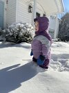
Took a fairly long walk outside and did a lot of shooting, this is only part of it.
Starting to melt fast now, but I'm happy. My only thing is that I wish this event was Sunday instead of Saturday for this weekend round...lol. Second week of February looks pretty tasty to me now tbh...
Webberweather53
Meteorologist
Working towards making the snow map for this event. Here's the one for last weekend.
Unfortunately, lots of data gaps here as a lot of people said "ehh I'm not measuring this nonsense on the ground"
View attachment 193203
South Carolina

Mr Freeze
Member
This is the 24 hour snowfall map from the NWS. It’d be interesting to see how some of the late week modeling matched up with this.

so long 

Webberweather53
Meteorologist
Lol there were snow flurries all the way down in south Florida from this system 
Idk if this AI but I don’t believe it is 
Isnt Duck where Cantore was at??Idk if this AI but I don’t believe it is View attachment 193245
Makeitsnow
Member
I can tell you at least here the heaviest band of snow in ne ga ended up being a bit east of most of the models..by about 20 to 30 miles or so but the overall feature was shown well. A few new 6 and 7 inch reports have come in east of athens. An 8 inch report up in Stephen's County too.This is the 24 hour snowfall map from the NWS. It’d be interesting to see how some of the late week modeling matched up with this.
View attachment 193243

