It indeed was one of the first accuracies and we kind of dismissed it at that range vs what others were showing. At least I did.
But unlike then, the CMC has been strongly trending N and NW as per the loops I just posted.
It indeed was one of the first accuracies and we kind of dismissed it at that range vs what others were showing. At least I did.
Gotta think sometimes, the ridiculously cold temp anomalies also adjust as we get closer to that time, especially given the GEMs well known cold bias in the MR/LR. Two things working for us is the 500 mb low and the insanely cold 850mb. Lot more wiggle room than most setups.CMC: looks good now for many (thus I wish that were for today) but we need to be wary of N/NW trend of the low and the Arctic high: how much more will it trend? There’s still 5 days to go, plenty of time for further NW trends.
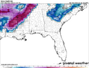
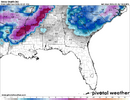
This is over only a 36 hour period of runs:
View attachment 189541
Temps warming up as Arctic air backs NW:
View attachment 189542
Tuesday at 18z was the turning point. So about 96 hours from the start in NCHow far out were we from this Sat/Sun when the models turned NW? I know I seem negative but it’s hard to trust anything at this point!
Chrystal ball here but we tend to see a convergence from the models on a more consistent corridor and then moves the whole thing NW a bit with minor wobbles back SE. Just my guess though on past views.How far out were we from this Sat/Sun when the models turned NW? I know I seem negative but it’s hard to trust anything at this point!

But it's showing something. Most important thing at this point.well looks like the ukmet wants to be the party pooper. too progressive and mostly dry.
while there were some warning shots, the 18z euro on tuesday was the inflection point. obviously we have more model cycles of holding our breath to goHow far out were we from this Sat/Sun when the models turned NW? I know I seem negative but it’s hard to trust anything at this point!
i thought h5 looked improved to 00z in backing up west a little more, just too much leftover vorticity through the northeast for this to really "pinch" into a cutoffwell looks like the ukmet wants to be the party pooper. too progressive and mostly dry.
yeah it ended up ok for eastern nc. regardless, if the euro/aifs comes in west, i think it's safe to dismiss it as a clear outlier.But it's showing something. Most important thing at this point.
We're getting close to the 120-hour mark. It seems that's when the models jump/trend to their preferred track. At least that's what has happened the last few events.
And if we are getting technical about the Canadian looking back 5 days out on the storm that just went through yesterday. It had the track absolutely nailed 5 days out and even had this storm showing up. Not saying the Canadian is a great model but you have to tip your hat when it is due
CMC: looks good now for many (thus I wish that were for today) but we need to be wary of N/NW trend of the low and the Arctic high: how much more will it trend? There’s still 5 days to go, plenty of time for further NW trends.
This is over only a 36 hour period of runs:
View attachment 189541
Temps warming up as Arctic air backs NW:
View attachment 189542
WeatherNext had the track before that:while there were some warning shots, the 18z euro on tuesday was the inflection point. obviously we have more model cycles of holding our breath to go
i thought h5 looked improved to 00z in backing up west a little more, just too much leftover vorticity through the northeast for this to really "pinch" into a cutoff
The 850s were plenty cold enough. With higher rates and a bit more expansive precip shield while GOM is near the north central GOM, we could get the boundary levels cold enough for some sloppy accumulations to start. This sounding is for MBY east of Atlanta.Yeah it pops a legit gulf low at hour 102, but it's too warm in GA until it gets cranking off the Carolina coast.
![soundings-[33.75,-83.75]-icon-prateptype_cat_icon-imp-us_se-2026012612-108.png soundings-[33.75,-83.75]-icon-prateptype_cat_icon-imp-us_se-2026012612-108.png](https://southernwx.nyc3.digitaloceanspaces.com/data/attachments/189/189564-c7d5d3deefb5f81d6c2d98c9f1a6e75f.jpg)
Yeah we are what we would considered fully in mid-range view parts out West are basically just under 5 days out and Carolinas at 5 days window. It seems all models are moving aways from the super-suppressed look which they usually do and dynamics improving for SE overall just how much will be determined over next few days.
Gotta think sometimes, the ridiculously cold temp anomalies also adjust as we get closer to that time, especially given the GEMs well known cold bias in the MR/LR. Two things working for us is the 500 mb low and the insanely cold 850mb. Lot more wiggle room than most setups.

Last time this was saidWe are under /at 96-100 hour mark from this thing starting
I remember that the January 2002 storm had a good amount of upper level driven snow in northern GA with the surface low offshore of the CarolinasFor GA: The 12Z Icon purely upper level driven (based on sfc low then in unfavorable location offshore of the Carolinas moving away) snow of this magnitude in the NE half of GA would be very highly anomalous, especially down this way. If I get the time, I’ll search for an analog.
View attachment 189478
View attachment 189479
View attachment 189480
View attachment 189481
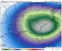
When a model shows an extreme solution out a few days or more, I don’t bet on it verifying closely. This has a 522 H5 over SAV, which would tie with the historic 1/19/77 522 H5 that brought snow to Miami for the lowest H5 at SAV since at least 1948: so, very likely overdone
Icon for 10PM Sat. night 1/31:
View attachment 189495
H5 for 12Z 1/19/1977: see upper right
View attachment 189496
Regardless of what it shows now, look for NW trends away from this.
Interestingly CMC/ICON/Euro shows a Gulf Low while the GFS tries to get going in AR/LA but gets crushed
Interestingly CMC/ICON/Euro shows a Gulf Low while the GFS tries to get going in AR/LA but gets crushed
The 1980 storm was insane with thunder snow at the NC coast and this looks even more amped and colder which makes sense being in January vs March.
2008?When was the last time we had this big a snow in the teens....in the middle of the day.
View attachment 189556

The Mississippi temps are definitely contaminated with the spurious "snow depth" cover from this past weekend's icestorm thereC'mon, fellas, no CMC run is complete without a day after low temp map. It's raining iguanas in Miami.
View attachment 189557
HaHa looks like the hand of God about to pick up North and South CarolinaEuro AI, definitely further southeast with the snowfall opposed to last run
Sent from my iPhone using Tapatalk
