Brent
Member
Sure why not
And on the weekend again heat index near 100 til then
And on the weekend again
heat index near 100 til then heat index near 100 til thenIts outright impossible. The question is why do they allow this to continue?my backyard davis fluctuates but i would say that even on the most turbulent days temps remain in a tight 3-5 degree window. i know nws has been out there and has said "everything is calibrated fine" but... something isn't adding up. rdu has racked up a streak of these high temp outperformances that are statistically highly unlilkely


Just typical summer weather in Atlanta. But next week, Atlanta is forecast to only be 78 on Tuesday !The extremely dry soils in parts of NC are favoring that highs there will be a little hotter and threaten records vs most other areas of the SE. It will be interesting to see what actually happens. Much will depend on the pattern of mid afternoon pop-up thunderstorm activity and how far reaching are the associated outflow boundaries.
OTOH, the ATL area, where it has been raining a good bit more, isn’t favored to threaten record highs. Their forecasts have mainly lower 90s. But ATL dewpoints may thus be a bit higher meaning heat indices being closer together. This all areas will be miserable.
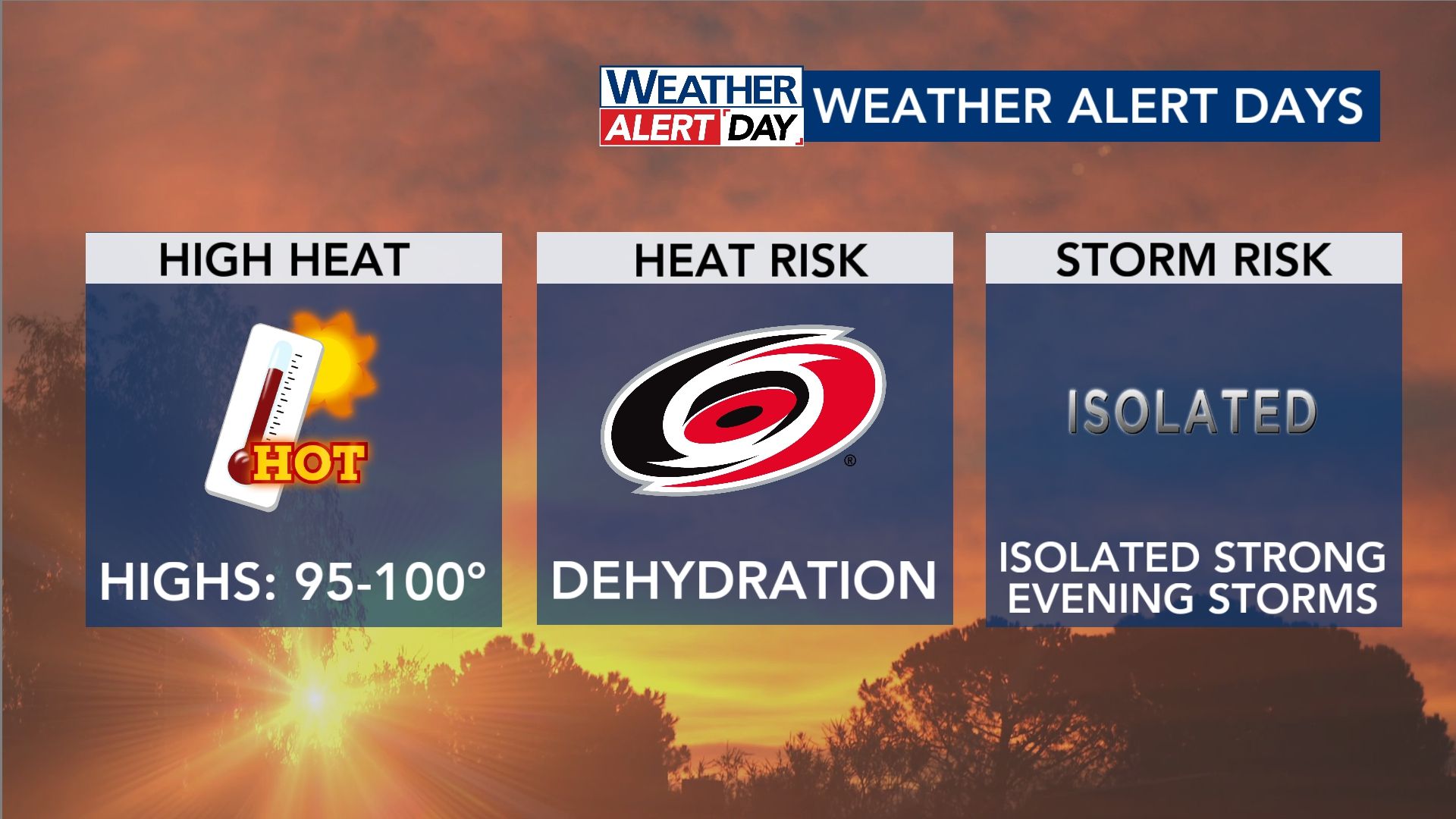


Nah, but check in with us Friday. Balmy 92 here so far.RDU up to 103 yet?
Are you sure?? Don’t get my hopes up.View attachment 196316
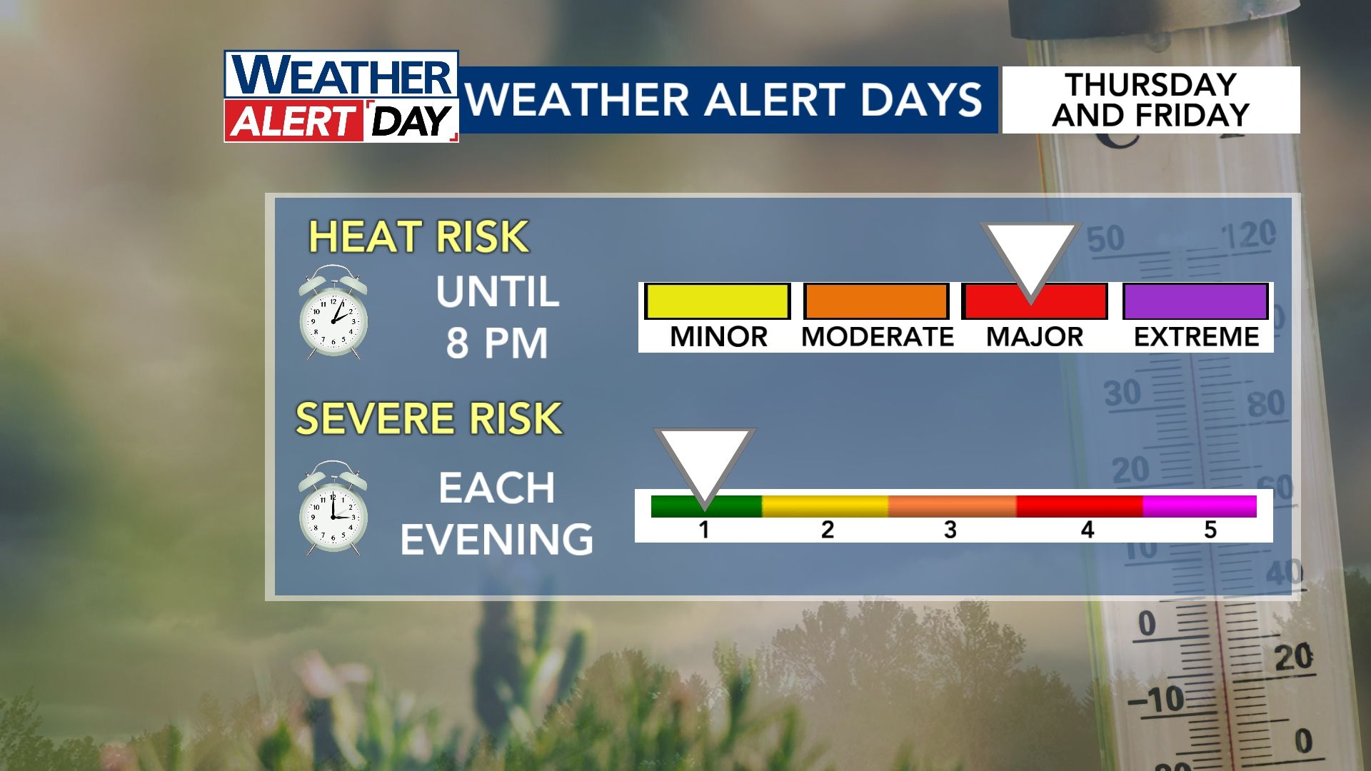
areas in blue will have highest risk of severe weather, as stated in the areas in green below.
View attachment 196317

You call that summer ? That's October weather in the south.The way summer should be! View attachment 196319
I don't like what the AI models are showing. Below is the total two-week QPF from the 6z GFS AI. The 6z euro AI is similar but has the minimum shifted NE some. I have a feeling the minimum will just expand more to cover all the (worse) drought areas. This has been the rule for many months now.2 weeks without any rain IMBY....the 40% this afternoon is now a 20% overnight but radar says naw.

I don't like what the AI models are showing. Below is the total two-week QPF from the 6z GFS AI. The 6z euro AI is similar but has the minimum shifted NE some. I have a feeling the minimum will just expand more to cover all the (worse) drought areas. This has been the rule for many months now.
View attachment 196320


92 here at KNCERWIN28As of noon, RDU (and Rocky Mt, NC also) was at 94F, not surprisingly THE hottest in the entire SE. I’m including all SE states including FL. With 94 at noon, RDU has a good shot at 101-2 despite the NWS forecast having “only” upper 90s for the Raleigh area. This, of course, is assuming that clouds and convection don’t start to increase there or even in the general vicinity:
“TODAY MOSTLY SUNNY. ISOLATED SHOWERS AND THUNDERSTORMS THIS AFTERNOON. HOT WITH HIGHS IN THE UPPER 90S. SOUTHWEST WINDS 5 TO 10 MPH. CHANCE OF RAIN 20 PERCENT. HEAT INDEX VALUES UP TO 102.”


View attachment 196339
old record in june 2024/25

