Me waiting for the drought monitor 
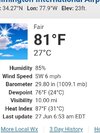
That is some impressive heat! For quite a while the temperature reading at RDU has consistently run anywhere from three to five degrees above the NWS other reporting stations so I take their measurements with a grain of salt. 103 degrees might be a little high but I believe the temperature hit the century mark in spots today. The thermometer at my residence about ten miles SSW of the airport recorded a high of 99 degrees todayLooks like RDU hit 102 today.
Somehow, we are 5+ degrees warmer than Fayetteville and Greensboro.


Me waiting for mid Sept.Me waiting for the drought monitor View attachment 148148
Me waiting for mid Sept.
Still hot and dry? Why wait when it’s what you have now! Some of the hottest I remember is after Fran.Me waiting for mid Sept.
Even with the known bias of the HRRR to mix out dewpoints too much at that range, it really was a very large miss for it… off by 15 degrees in both Richmond and CharlotteThe NWS, which wasn’t quite as hot and wasn’t nearly as dry vs HRRR, did better than the HRRR:
Verification of yesterday’s 6Z HRRR prog for temperature/dewpoint at 19Z/3PM EDT today:
Richmond, VA: HRRR 103/52 vs actual 99/68
Raleigh, NC: HRRR 100/61 vs actual 96/66
Charlotte, NC: HRRR 102/48 vs actual 98/63
Columbia, SC: HRRR 103/58 vs actual 100/60
Florence, SC: HRRR 99/64 vs actual 94/73
Atlanta, GA: HRRR 101/45 vs actual 95/55
Augusta, GA: HRRR 103/46 vs actual 99/52
Brunswick, GA: HRRR 96/66 vs actual 91/78
Summary for 8 cities:
-HRRR was too hot for all 8 with avg miss of +4.4 with range of +3 (Columbia) to +6 (Atlanta)
-HRRR was too dry for all 8 with avg dewpoint miss of -9.4 with range -2 (Columbia) to -16 (Richmond)
3PM data sources:
GA https://kamala.cod.edu/ga/latest.asus42.FFC.KFFC.html
SC https://kamala.cod.edu/sc/latest.asus42.CAE.KCAE.html
NC
VA
Went down even further. Aiken hit 101, it's dewpoint actually dropped to 49. Humidity was 18% at one point. Shortwave high/subsidence pocket. Those areas that blasted the century mark today also saw max mix out. Charleston today never got above 95, dewpoints never mixed below 75. Ridiculous heat index readings across the Lowcountry. Witherbee maxed at 116, Summerville Airport hit 114 (technically Jedburg 5 miles N of Summerville, usually a more sheltered spot), and many 110 readings across the board. Charleston Airport (NWS) hit 107 today.Check this out for something fascinating at Augusta, GA (Bush):
-noon was 93 with a dewpoint of 76 on a SE wind at 9
-1PM was 99 with a dewpoint way down at 58 on a SW wind at 13 gusting to 22!!
That’s a heck of a boundary, a dry line of sorts that went through Augusta last hour! And it came in on SW winds!
@Stormsfury

Same back this way (Wet back porch). Hoping the early morning rain out west can hold together as it heads eastward. Looks promising right now but we've seen similar setups dissipate.A few sprinkles first thing this morning barely wet the road but an encouraging sign...