-
Hello, please take a minute to check out our awesome content, contributed by the wonderful members of our community. We hope you'll add your own thoughts and opinions by making a free account!
You are using an out of date browser. It may not display this or other websites correctly.
You should upgrade or use an alternative browser.
You should upgrade or use an alternative browser.
Pattern June’s Drought Dialogues
- Thread starter SD
- Start date
I got the garbage covered. Checked the JMA and the Spire and the NAVGEM. NAVGEM was thiiiiiiiis close, but no dice on the 600.
Its not a heatwave until you hit 600I got the garbage covered. Checked the JMA and the Spire and the NAVGEM. NAVGEM was thiiiiiiiis close, but no dice on the 600.
Picked up a very welcome .28" this afternoon. That'll help us out next week.
Kinda surprised to see the coastal plains running so hot in the models with an easterly fetch in NC/SC. Our hottest weather usually comes with a stiff west wind that pins the seabreeze from coming inland. Unless I'm missing something this pattern looks like it'll send the seabreeze in ~100 miles every afternoon.
Kinda surprised to see the coastal plains running so hot in the models with an easterly fetch in NC/SC. Our hottest weather usually comes with a stiff west wind that pins the seabreeze from coming inland. Unless I'm missing something this pattern looks like it'll send the seabreeze in ~100 miles every afternoon.
We seem to be 0.6 short. We got about 60 hours or so to find it.Its not a heatwave until you hit 600
Based on the last few winters that shouldn't be an issueWe seem to be 0.6 short. We got about 60 hours or so to find it.
Shaggy
Member
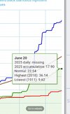
We have been taking one step forward and get a couple inches but then take 2 steps back and go 10.days without a drop. Wilmington area approaching a 5 inch deficit and with the next week's heat we are gonna bake the ground hard.Picked up a very welcome .28" this afternoon. That'll help us out next week.
Kinda surprised to see the coastal plains running so hot in the models with an easterly fetch in NC/SC. Our hottest weather usually comes with a stiff west wind that pins the seabreeze from coming inland. Unless I'm missing something this pattern looks like it'll send the seabreeze in ~100 miles every afternoon.
Brent
Member
Heat index of 85 at 7am  low was only 80 that I can find
And this isn't even a big heat wave here really. The humidity is what is killing us
And this isn't even a big heat wave here really. The humidity is what is killing us
Heat index of 85 at 7amlow was only 80 that I can find
And this isn't even a big heat wave here really. The humidity is what is killing us
Heat index of 85 at 7amlow was only 80 that I can find
And this isn't even a big heat wave here really. The humidity is what is killing us
No big heatwave expected down here either but RH has been and will continue to be awful.
At least you have good winds to make the RH more tolerable vs light winds here.
Brent
Member
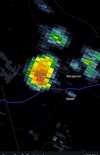
Meanwhile on the ring of fire around the heat
The NWS says a private weather station near Luverne, North Dakota clocked a gust of 111 mph around 12:45 a.m. Saturday and gusts reached 80-90 mph for more than an hour in Jamestown.
Sounds like there was a derecho into Minnesota easily over 100 mph winds in multiple locations
The NWS says a private weather station near Luverne, North Dakota clocked a gust of 111 mph around 12:45 a.m. Saturday and gusts reached 80-90 mph for more than an hour in Jamestown.
Sounds like there was a derecho into Minnesota easily over 100 mph winds in multiple locations
0z euro would be an all time heat wave
GeorgiaGirl
Member
0z euro would be an all time heat wave
You just made me look and I really wish I didn't as that has multiple 100's in a row...
BHS1975
Member
Doesn't the euro tend to over do it?0z euro would be an all time heat wave
Doesn't the euro tend to over do it?
Yes (at least that’s the tendency/bias). The 6Z has highs of 105 on 6/25-6 at RDU.
Iceagewhereartthou
Member
GFS is slightly less intense than the euro, and the EPS definitely knocks it down a category or two. Still looks miserable but not historic. Looks to go back to more seasonable look as we head into early July; who knows, maybe that will feel "pleasant." Gonna be a tough 7-10 days not matter how we slice it.
BHS1975
Member
Looks like the dews will mix out into the low 60s which would keep the index lower.GFS is slightly less intense than the euro, and the EPS definitely knocks it down a category or two. Still looks miserable but not historic. Looks to go back to more seasonable look as we head into early July; who knows, maybe that will feel "pleasant." Gonna be a tough 7-10 days not matter how we slice it.
Euro hates the lee of the apps it's typically too hot and dry for us past day 5 in the summerDoesn't the euro tend to over do it?
Shaggy
Member
Here are the GFS highs for the peak of the coming heat wave at RDU:
6/24 102
6/25 103
6/26 104
6/27 101
6/28 101
6/29 101
If this were to come to fruition this would probably be the longest streak of 100 degree and above
weather in RDU history.
6/24 102
6/25 103
6/26 104
6/27 101
6/28 101
6/29 101
If this were to come to fruition this would probably be the longest streak of 100 degree and above
weather in RDU history.
Here are the GFS highs for the peak of the coming heat wave at RDU:
6/24 102
6/25 103
6/26 104
6/27 101
6/28 101
6/29 101
If this were to come to fruition this would probably be the longest streak of 100 degree and above
weather in RDU history.
Six in a row would break the June record of 4 in a row set in 2008 and tie the alltime record of 6 set in July of 2012!
A 104 would tie with 6/27/1954 and be just behind 105 on 6/29-30/2012 for the hottest for June!

Factoring in the RDU daytime warm bias over the past month of 4.2 F (https://weather.gladstonefamily.net/site/KRDU), these are probably underdone by several degrees just like today as you mentioned.12Z Euro RDU highs:
6/21: 90 (already hit 91 though)
6/22: 95
6/23: 101
6/24: 102
6/25: 104
6/26: 102
6/27: 100
6/28: 98
6/29: 97
6/30: 97
View attachment 173163

Euro 850 mb temps of 17C would approx. yield a surface temp of 90F today, but it is already likely going to be 93 or even 94 today. Tuesday is going to be comical.
BHS1975
Member
Yeah I think we'll get some pulse storms later next week to cool it off in the afternoon.I will never be this lucky when it comes to snow.
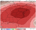
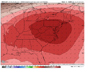
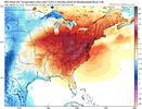
View attachment 173166View attachment 173167View attachment 173168
CHA hit 91 today for hottest temp since September 24th.
That is an interesting feature and it would break the heatwave for eastern sections of GA, SC and NC. After a scorching week of record and near record temperatures it would be nice if this pushes close enough to the southeast coast to give inland areas a break from the heat for the coming weekend.Heatwave killer View attachment 173170
Brent
Member
6Z GFS/Euro at RDU: not as horrible as yesterday’s 12Z lengthwise but still bad enough
6/23: 101/101
6/24: 104/102
6/25: 96/101
6/26: 94/98
6/27: 96/98
6/28: 95/(0Z Euro 94)
6/29: 95/(0Z Euro 96)
The Euro was too hot here during the first heat wave in May i remember. People were posting temps of 105 in Texas and it didn't even hit 100 in most areas
Going to be the mid summer i didn't have a watch but got a severe storm pattern this week. High dcapes, tall storms, high microburst potential, probably prolific lightning producers too
Last edited:
Factoring in the RDU daytime warm bias over the past month of 4.2 F (https://weather.gladstonefamily.net/site/KRDU), these are probably underdone by several degrees just like today as you mentioned.
View attachment 173165
Euro 850 mb temps of 17C would approx. yield a surface temp of 90F today, but it is already likely going to be 93 or even 94 today. Tuesday is going to be comical.
Indeed, RDU ended up with a high of 93 yesterday vs yesterday’s 12Z Euro forecast of only 90! OTOH, Greensboro’s high of only 88 was actually two lower than the 12Z’s Euro’s 90. Fayetteville’s high of 92 was 1F higher than the Euro’s 91.
So, based on this and the analysis you posted about the sensor often being several degrees too warm, the RDU sensor actually has a decent chance to get within 1-2 of their alltime high of 106!! Hopefully not though.
KATL is also looking brutal on the 6Zs this week with these highs: (GFS/Euro)
6/22: 96/91
6/23: 99/95
6/24: 103/102
6/25: 101/104
6/26: 94/96
6/27: 96/87
Currently FFC has ATL’s hottest on 6/25 with upper 90s, but they’re watching closely.
6/22: 96/91
6/23: 99/95
6/24: 103/102
6/25: 101/104
6/26: 94/96
6/27: 96/87
Currently FFC has ATL’s hottest on 6/25 with upper 90s, but they’re watching closely.
Last edited:
Bannerdude2
Member
The 12z GFS is definitely reflecting this possibility in central and western NC. Showing big heat but also storm complexes moving through overnight Monday and Tuesday. The rest of the week also looks hot but chance of pop up storms contines and high temps don't look to exceed any recordsGong to be the mid summer i didn't have a watch but got a severe storm pattern this week. High dcapes, tall storms, high microburst potential, probably prolific lightning producers too
The NWS in Raleigh is downplaying this saying the the heat dome that will be over the area is too strong and will supress thunderstorm development. Anyone who does see a pop up thunderstorm is liable to see a strong or even severe thunderstorm with the parameters that the GFS is showing.The 12z GFS is definitely reflecting this possibility in central and western NC. Showing big heat but also storm complexes moving through overnight Monday and Tuesday. The rest of the week also looks hot but chance of pop up storms contines and high temps don't look to exceed any records
Gong to be the mid summer i didn't have a watch but got a severe storm pattern this week. High dcapes, tall storms, high microburst potential, probably prolific lightning producers too
ILM seems to think the cap will be pretty hard to overcome in our area through Wednesday or so.
https://www.wral.com/story/ask-the-...-could-this-week-s-heat-wave-become/22060069/
Here's an article about how this weeks potential heat wave might compare with historical climate data at RDU.
Here's an article about how this weeks potential heat wave might compare with historical climate data at RDU.

