BufordWX
Member
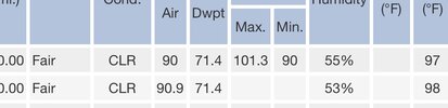
Topped off at 97 for the second day in a row here.


Good thing we're not out west.


Yep. Got to 101 on the Tempest today. Much hate.And just to pile onto the West is best regarding heat, it’s 100 in Morganton.
Edit: actually 101.
Haha no chance man. I will be here in the cool 101 mountain air.I push mowed the backyard first thing this morning and had to change clothes before going to work
Headed to Kill Devil Hills at 5am sharp tmrw morning. @Rain Cold can you meet me in East Raleigh with a 6 pack of Gatorade, bag of ice and a large order of Bo-rounds?
Good thing we're not out west.
Better yet, I'm hoping it's completely wrong. If we get a ridge that strong, it'll hit the east coast eventually.Stay there for the next 3 months please
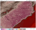
Oh boy, the 6z GFS has the ridge farther east with 597 dm heights over us at least for a while. Hopefully it'll back off. The 600 dm ridge is still there too and coming farther east on that model.

I swear their climate changed once you moved out thereHaha no chance man. I will be here in the cool 101 mountain air.

Its crazy he managed to kill 2 placesI swear their climate changed once you moved out there

I swear their climate changed once you moved out there
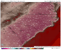
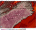
Idk it does pull in some 27-29c 850s that's pretty toasty and there are some eps members around 110 then. I'm not sold on it but that big heat ridge does put us in a position to gobble a big heat releaseOnce again the GFS (6Z) is way too hot in the extended. Even if H5 reaches the near record high upper 590s as it has, highs on July 14-15th will not reach anywhere near as hot as this shows even with the drought:
6Z GFS July 14th highs: for example 112 at SAV is loltastic as that’s compared to the 105 all-time hottest on record there back 155 years!
View attachment 196658
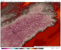
6Z GFS July 15th highs:
View attachment 196659
Wow 27-29 at 850. That's scary. I only looked at 500 MB so am just now seeing those maps. They may very well verify with those 850 temps. I'm not sure they have been that high here before, even in 2012.Idk it does pull in some 27-29c 850s that's pretty toasty and there are some eps members around 110 then. I'm not sold on it but that big heat ridge does put us in a position to gobble a big heat release





It's hellhot. Like it's really miserable to walk around outside. At least we got a strong historic Biblical Nino to save us from cold and snow this winter.I swear their climate changed once you moved out there

This heatwave is not behaving like they usually do for some reason. Augusta and Columbia usually lead the way, but not with this one. This heatwave seems to be favoring the Carolina foothills and western piedmont. Raleigh and Fayetteville in NC are doing their usual thing it seems though.It's hellhot. Like it's really miserable to walk around outside. At least we got a strong historic Biblical Nino to save us from cold and snow this winter.


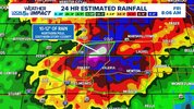
MN and IA been hammered thoThe ring of fire was a ring of lies. Hasn’t produced a lick of rain here.
And Michigan today. The southern 3rd of the state hit hard, including Detroit. Also, parts of Penn and NJ.MN and IA been hammered tho
It's hard to get the ring of fire when the ridge is over you. There are signs we may get into a ring of fire pattern later in the month though.The ring of fire was a ring of lies. Hasn’t produced a lick of rain here.
It's hard to get the ring of fire when the ridge is over you. There are signs we may get into a ring of fire pattern later in the month though.
RDU recorded a high of 101 today. We'll see how high the temperature gets tomorrow during what might be the peak of this heatwave. The rainfall forecast from now until the middle of the month doesn't look too promising which is what concerns me. A friend of mine who restores and repairs boats as a side gig has had plenty of business lately due to the low lake levels at Jordan Lake and people hitting stumps and objects that are normally covered by higher water levels.