• Hello, please take a minute to check out our awesome content, contributed by the wonderful members of our community. We hope you'll add your own thoughts and opinions by making a free account!

Pattern July Fry and Dry

It looks 100+ is certainly coming. We have 100 degrees forecast here now from Sunday through Wednesday with GSP saying heat index values could hit 110+ in some areas. Most areas outside of the mountains will probably get extreme heat warnings from Sunday onwards. They also mention dry weather becoming a concern too with little to no rain outside of the mountains over the next 7 days. Hopefully by next Friday things change but that is long way out.
 
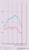
Just some light rain, mainly this morning, so far today. Only about 1/10” today so far. Showers were moving in a somewhat unusual WSW direction from offshore.
 
This is summers last run at Heat wave temps here. Breaks down as we roll into the 1st weekend of August/ Saturday week. Dare I say it, but the Euro and CFS are advertising Below Normal temps week of August 3 onward.
Sign me up and lets get this upcoming week over with and be done with the AN summer wx for 2025
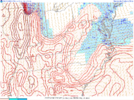
Th 6z GFS brings the heat back at the end. Back to 100 in parts of NC and SC. We will be far from done with summer on August 3. It may be early to mid October before summer lets go.
 
Correct. We haven’t got to the hottest average high temps yet of the season
Most areas have reached their hottest average temperature. We are at the hottest average temps right now. In Jackson, TN where you are located, the avg right now is 90.2 for a high and 69.1 for a low. In one week your avg will be slightly lower with 90.2 for a high and 68.8 for a low.
 
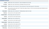
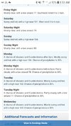
Absolute brutality will be coming early next week from Mother Nature if this forecast for my area verifies well:

SUNDAY
SUNNY, HOT WITH HIGHS AROUND 100. HEAT INDEX VALUES UP
TO 110.

SUNDAY NIGHT
MOSTLY CLEAR. LOWS AROUND 80. HEAT INDEX VALUES
UP TO 110 EARLY IN THE EVENING.

MONDAY
SUNNY WITH A CHANCE OF SHOWERS AND THUNDERSTORMS. HOT
WITH HIGHS AROUND 100. CHANCE OF RAIN 30 PERCENT. HEAT INDEX
VALUES UP TO 115.

MONDAY NIGHT
PARTLY CLOUDY WITH A SLIGHT CHANCE OF SHOWERS AND
THUNDERSTORMS. LOWS IN THE UPPER 70S. CHANCE OF RAIN 20 PERCENT.
HEAT INDEX VALUES UP TO 110 EARLY IN THE EVENING.

TUESDAY
SUNNY WITH A CHANCE OF SHOWERS AND THUNDERSTORMS.
HIGHS IN THE UPPER 90S. CHANCE OF RAIN 40 PERCENT. HEAT INDEX
VALUES UP TO 115.
A heat index of 115 would basically be the equivalent of an actual temp in the desert southwest of 130, because with the low humidity there 130 would feel about 115.
 

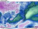
This is also going to ramp up. Some of us will probably see this get worse by 2 categories by this time next week.

I honestly find this map kinda hard to believe locally. Maybe I haven't watched closely enough but considering that the northern half of Richmond County gets pounded with all the rain, I don't think Columbia County is "abnormally dry."

I will say though that in spite of July totals likely not being high, I don't see any plant issues right now. There's been just enough rain that things look good.
 
Most areas have reached their hottest average temperature. We are at the hottest average temps right now. In Jackson, TN where you are located, the avg right now is 90.2 for a high and 69.1 for a low. In one week your avg will be slightly lower with 90.2 for a high and 68.8 for a low.

On average that’s not the case in most locations. An exception is parts of Texas where i think August is usually hotter. I’m not sure why so many people have this perception that August is hotter than July. Sure there are some August’s that are hotter, but that’s not usually the case.

I think the reason many think August is hotter than July is that we are ready for the hot and humid conditions from June and July to go away and as I have learned, the longer you wait for something, the more impatient and miserable you become. Therefore, August seems even hotter than it really is. It looks like the first week of August this year will bring us a welcome break from the miserably uncomfortable conditions that will be felt next week.

These are the correct answers; July is statistically the hottest month for most of us. GSP has already started a slow drop in average high temps [ditto for AVL and CLT]; was 90.5 as of 7/19; now stands at 90.3. By the end of July is will be down to 89.9. Certainly not a big or fast drop; but over the hump nonetheless.

I agree that heat fatigue, and maybe higher humidities the first half of August, contribute to the perception that August is hotter but perception doesn't make is true. Give me the last 10 days of August over the last 10 days of July [or any 10 days of July] every time.
 

This is also going to ramp up. Some of us will probably see this get worse by 2 categories by this time next week.
That thing is never accurate. It has me touching the abnormally dry and I'm at 5.44" for July, 10" for June, and 13.44" for May. 56.83 YTD. My creek is running like springtime.

It is hot as hell though. Y'all can keep this crap. I can always add clothes in winter but I can only take so many off and not get arrested.
 
Th 6z GFS brings the heat back at the end. Back to 100 in parts of NC and SC. We will be far from done with summer on August 3. It may be early to mid October before summer lets go.
You ride the GFS at your own peril.
I stand by my forecast.
The hottest part of summer is over here in my neck of the woods by the end of next week. It's a Downhill slope after that. Maybe not as steep an fast as I'd like, but we will have peaked.
 
You ride the GFS at your own peril.
I stand by my forecast.
The hottest part of summer is over here in my neck of the woods by the end of next week. It's a Downhill slope after that. Maybe not as steep an fast as I'd like, but we will have peaked.
The Euro also now brings the heat back by august 7. Not as hot as next week, but hot enough.
 
Some heat facts for next week
GSO hasn't hit 100F since 7/8/2012, and is currently forecast by NWS for mid-upper 90s.
GSP hasn't hit 100F since 7/1/2012, currently forecast by NWS to be 98-102 5 days straight
AVL hasn't hit 95F since 7/1/2012, currently forecast by NWS to be at 94 Tue & Wed
FAY has already hit 100F once this year, but hasn't hit 102F since 6/30/2012, and the forecast calls for 5 straight days of 100-102.
CAE would need to hit 103F for it to reach a threshold that hasn't been reached in multiple years (6/13/2022)
 
GSP just did not see enough clouds to keep it below 90 so the streak now stands at 34. The all-time streak of 38 will fall and extend to at least 41 days. That is a pretty significant record IMO and hard to believe there wasn't a single day in there with enough clouds or well timed storm to break it. Hopefully this relaxation late next week pans out. GSP did manage to go below 70 with a 68 this am for the first sub 70 since July 12th. CAE only made it down to 77 this am. If it does not fall below 75 tomorrow morning that streak of 75 or higher will be extended out close to 3 weeks at least.
 
Some heat facts for next week
GSO hasn't hit 100F since 7/8/2012, and is currently forecast by NWS for mid-upper 90s.
GSP hasn't hit 100F since 7/1/2012, currently forecast by NWS to be 98-102 5 days straight
AVL hasn't hit 95F since 7/1/2012, currently forecast by NWS to be at 94 Tue & Wed
FAY has already hit 100F once this year, but hasn't hit 102F since 6/30/2012, and the forecast calls for 5 straight days of 100-102.
CAE would need to hit 103F for it to reach a threshold that hasn't been reached in multiple years (6/13/2022)
Somewhat unbelievably to me, KAGS (Augusta GA) will gun for its first 102F since 7/21/2015 and 101F since 8/14/2019
 
Somewhat unbelievably to me, KAGS (Augusta GA) will gun for its first 102F since 7/21/2015 and 101F since 8/14/2019

I tell folks this all the time and they don't seem to believe it. We hit 100F in my backyard in June for the first time since 2022. This is all the more improbable because we've been locked in a drought since 2021 until this year with brown yards most of the summer in years past.
 
Back
Top