• Hello, please take a minute to check out our awesome content, contributed by the wonderful members of our community. We hope you'll add your own thoughts and opinions by making a free account!

Pattern July Fry and Dry

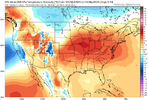
Folks, I'm no fan of the heat myself. Late July does look to be hot though which is fitting being that it is the warmest time of year climatologically speaking. Hopefully things will not be as hot as that model screenshot I posted.
It’s ok. Eventually the heat will be defeated as the nights continue to grow longer. Average temps start slowly going down in the next 2 weeks or so.
 
Thanks, Shane. But keep in mind that as JB has been emphasizing, the models have been too hot and dry in the S Plains, where this EPS has the upper high.

Edit: And then there’s the added uncertainty of Dexter forming and possibly moving into TX, which the EPS has almost no signal for. That could easily increase uncertainty even further.
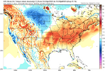
It looks like mjo phases 5/6 flip anomalies in July with a trough moving from the PNW to the NE and a ridge retrograding from the E/SE to the intermountain west or WC. This pattern reminds me a little of the heat wave last month with how it sets up and potentially progresses
 
Last edited:
Any of you outdoor fans of the F.A.T.S. Trail system in the Sumter Forrest. (Augusta etc) been there since Helene? We hiked 7 miles two days ago and just rode the MTB for 15 and it's totally changed. Very little shade. Blazing hot. Microclimate change has got to be real in situations like this.

Plus, I'm sure there have been studies of all the fuel laying on the ground in the form of 1000's of pine trees. The trails have shifted. Run off is much higher....fascinating study I would assume.
 
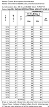
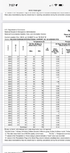
So GSPs all time consecutive 90 degree day streak is 38 from 1993. It is currently at 25 (which ties the 5th longest streak ever). The point and click for tomorrow showed 89 so we'll see, but if it hits 90 tomorrow GSP may well break that record just looking ahead. Shoot, even CAE had an 88 thrown in there earlier this month. These are not the kinds of records I like to be gunning for.
 
Last edited:
So GSPs all time consecutive 90 degree day streak is 38 from 1993. It is currently at 25 (which ties the 5th longest streak ever). The point and click for tomorrow showed 89 so we'll see, but if it hits 90 tomorrow GSP may well break that record just looking ahead. Shoot, even CAE had an 88 thrown in there earlier this month. These are not the kinds of records I like to be gunning for.
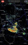
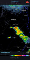
That record is going to fall. The rest of summer and into November is going to be just like 2016 I'm afraid. Hot and dry. When you get 10+ storms within 10 miles of you and still miss you know it'll take a HUGE event for us to get rain again. Yes, we had that many storms that close today and not 1 drop. It did not even cool off here.
 
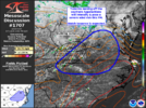
Today had a very tropical feel and look here thanks to the deep onshore flow to the north of Invest 93L coming in from several hundreds of miles offshore. How deep? It was at least to way up at 200 mb, which is near 40,000 feet! And this is expected to continue for much of the rest of this week. It is fairly rare that this far north experiences that deep of a tropical flow for that long of an uninterrupted period.

This deep tropical flow:
-gave us a constant pleasant ESE 10-15 mph breeze with gusts to over 20
-wind coming off the ocean kept the highs in the BN upper 80s but also kept dewpoints in the mid 70s
-the skies much of the day had a tropical paradise look of towering cumulus coming off of the ocean mixed with deep blue
-isolated showers came off of the ocean moving at a brisk pace and tended to diminish as they went more inland (I had no rainfall today)

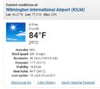
Yeah, I just said in the banter thread that it honestly wasn't that bad today even where I am a couple hours from the ocean. Especially in the evening with the sun lower.

I felt that breeze myself, but no thunderstorms too.

Taking a closer look at my forecast, there's going to be southeast winds again tomorrow and then south winds for the rest of the week.
 
A pretty fast moving small shower has moved NW from offshore to here on the NE side of Invest 93L. There may be more to come within the next couple of hours.
 
Back
Top