Z
-
Hello, please take a minute to check out our awesome content, contributed by the wonderful members of our community. We hope you'll add your own thoughts and opinions by making a free account!
You are using an out of date browser. It may not display this or other websites correctly.
You should upgrade or use an alternative browser.
You should upgrade or use an alternative browser.
Pattern Januworry
- Thread starter SD
- Start date
Brent
Member
Virga storm here so far yay
Maybe February will actually have moisture
Maybe February will actually have moisture
Brent
Member
Flizzard here starting to dust the cars
Brent
Member
Z
Zander98al
Guest
Did tropical tidbits make changes to the EURO model on there website? It only shows 00z and 06z and only goes out to like 90 hours
GFS has shown a massive storm in the day 8 range for two runs in a row.
Yes a lot more parameters now. 500 vort on the high res.. precip.. it's good.. snowfall and ptype maps still not there.. but can't help what the euro is giving out for free. Better than what we had.Did tropical tidbits make changes to the EURO model on there website? It only shows 00z and 06z and only goes out to like 90 hours
The 18 & 06z runs only go to 90. The 00 and 12 will do 240
21F this morning. Somebody check me on this but I think we are still AN for January even after all this
15F this morning
CLT is running about 2.5 below for January, but still almost +4 since 12/121F this morning. Somebody check me on this but I think we are still AN for January even after all this
That must be what I was thinking of. My badCLT is running about 2.5 below for January, but still almost +4 since 12/1
Z
Zander98al
Guest
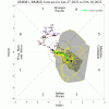
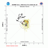
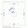
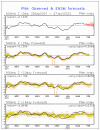
The MJO has been inside the circle (mainly left half) since January 15th along with a +PNA. Since then, the SE US has had BN most days (coldest period of winter) along with a bonus of two significant winter storms in portions of the SE (mainly NE GA to Carolinas). This MJO/PNA pattern looks to continue through an upcoming third wintry event (good portion of Carolinas):


I remember when we were suppose to “loop back into phase 6” like a month ago .. thought the models were over doing that a bit and look at us now .. stuck in winters graspThe MJO has been inside the circle (mainly left half) since January 15th along with a +PNA. Since then, the SE US has had BN most days (coldest period of winter) along with a bonus of two significant winter storms in portions of the SE (mainly NE GA to Carolinas). This MJO/PNA pattern looks to continue through an upcoming third wintry event (good portion of Carolinas):
View attachment 110952
View attachment 110953
I remember when we were suppose to “loop back into phase 6” like a month ago .. thought the models were over doing that a bit and look at us now .. stuck in winters grasp
Nice observation although that (going into phase 6) was only the Euro’s prediction. The Euro has been doing poorly overall with the GEFS doing way better as it has largely kept it inside the circle.
What are we looking at for the next couple weeks projection?Nice observation although that (going into phase 6) was only the Euro’s prediction. The Euro has been doing poorly overall with the GEFS doing way better as it has largely kept it inside the circle.
I don’t know if I like this at all for FebruaryHere are the latest model predictions:
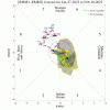
GEFS:
View attachment 110955
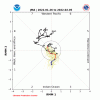
Euro:
View attachment 110956
CFS:
View attachment 110958
JMA:
View attachment 110959
CMC:
View attachment 110960
smast16
Member
14 This morning, and i don't know how many other teens. Lowest so far this month was 10, and to think i was wearing shorts in the beginning.


