-
Hello, please take a minute to check out our awesome content, contributed by the wonderful members of our community. We hope you'll add your own thoughts and opinions by making a free account!
You are using an out of date browser. It may not display this or other websites correctly.
You should upgrade or use an alternative browser.
You should upgrade or use an alternative browser.
Pattern Januworry
- Thread starter SD
- Start date
iGRXY
Member
Honestly I don’t think it’s if we can get a winter storm within the next 2-3 weeks but how many we can get in that timeframe IF we can continue these looks.
griteater
Member
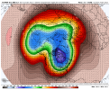
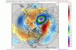
West based -NAO, beautiful 50/50 low, and continued troughing in the Aleutians pushing a +PNA/-EPO = cold and winter storms in the south.
Yeah that control run was stunning, but was it a mirage??That pacific ridge is monstrous, that’s some February 2015 type pacific pattern type ish
Imo the most likely thing to be a mirage here is probably the -NAO like that, I could certainly see there being one but more the the thumb ridge type variety, which is weird to say that because typically it’s the pacific that’s the issueYeah that control run was stunning, but was it a mirage??
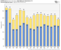
Once again where the snow is needed in SC midlands we are left out again lol wowEPS mean looks fantastic at the endView attachment 102996
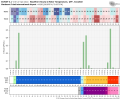
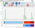
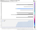
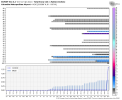
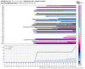
And here’s the individual members for storm number 1 View attachment 102997View attachment 102998
whatalife
Moderator
Clem282340
Member
NEGaweather
Member
Nice to see some members showing big totals in North Georgia.
Sent from my iPhone using Tapatalk
Sent from my iPhone using Tapatalk
Jessy89
Member
Can someone pull the euro essambles for Pickens sc. please and thank you
Sent from my iPhone using Tapatalk
Sent from my iPhone using Tapatalk
It will. But exactly when and how long? Can we still get that transient jet dip into the east heading into February and beyond? Those are questions that will be answered as we progress into the second half of mid winter.What I worry about is that trof wanting to go back into the west by the end of the month.
Keep the faith man. Our time is coming. I’m over being negative about our snow drought. Let us miss a storm or two to our North, then it’ll set the tone for a big one late month with an established favorable pattern. We aren’t going to hit while the pattern is changing. Anyways, pulling for everyone.Once again where the snow is needed in SC midlands we are left out again lol wow
Crazy how the time period we have all been talking about for week or so now (15-25 ) is finally popping off in the models with snow outputs and an amazing pattern … that’s why you can’t freak out about anything past 240 be patient and most of the time in this pattern you’re rewarded
Have mercy. That looks close to ideal in all the right places.
HurricaneSolomon
Member
- Joined
- Dec 6, 2021
- Messages
- 132
- Reaction score
- 237
Crazy how the time period we have all been talking about for week or so now (15-25 ) is finally popping off in the models with snow outputs and an amazing pattern … that’s why you can’t freak out about anything past 240 be patient and most of the time in this pattern you’re rewarded
This is true. Plus I’ve seen the squirrels a little more active in their nest building. Those treehouses need to be stronger.
Sent from my iPad using Tapatalk
iGRXY
Member
Personally I think the midlands, pee dee, and I20 corridor especially will likely see an Ice Storm at some point before the end of the month. The pattern is too ripe for a good portion of the southeast to score here. I’m not sold on snow that far south but definitely think we are going to get some deep CADS going that will get everyone at least along and north of I20 an ice storm.Keep the faith man. Our time is coming. I’m over being negative about our snow drought. Let us miss a storm or two to our North, then it’ll set the tone for a big one late month with an established favorable pattern. We aren’t going to hit while the pattern is changing. Anyways, pulling for everyone.
Personally I think the midlands, pee dee, and I20 corridor especially will likely see an Ice Storm at some point before the end of the month. The pattern is too ripe for a good portion of the southeast to score here. I’m not sold on snow that far south but definitely think we are going to get some deep CADS going that will get everyone at least along and north of I20 an ice storm.
I was thinking the same. There is a decent snow pack to the north. I don’t feel like any of the global are picking that up.
Sent from my iPhone using Tapatalk

