-
Hello, please take a minute to check out our awesome content, contributed by the wonderful members of our community. We hope you'll add your own thoughts and opinions by making a free account!
You are using an out of date browser. It may not display this or other websites correctly.
You should upgrade or use an alternative browser.
You should upgrade or use an alternative browser.
Pattern Januworry
- Thread starter SD
- Start date
Broken024
Member
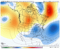
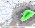
The individual maps out yet?What a satisfying trendView attachment 102970
NopeThe individual maps out yet?
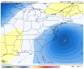
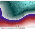
Euro shows lots of subtropical jet stream activity with these storms as well, gonna need to trend even better because given the STJ influence, storms are more likely to come in amped/over perform/NW trend in the short term
I did, but apparently the Lord didn't honor my request to keep the red Ls from tracking through the coastal plain.3 waves and ridging punching up into Greenland. Did everybody go to church today or something?

Blue_Ridge_Escarpment
Member
Euro control looks really good as well!
Blue_Ridge_Escarpment
Member
griteater
Member
ATLwxfan
Member
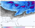
Gonna be one of those situations where far north ATL suburbs look to score but I-20 and I-85 will enjoy chilly rain. I mean it’s climo I suppose.
Sent from my iPhone using Tapatalk
Sent from my iPhone using Tapatalk
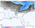
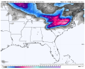
What is nice is that this has lots of time to trend better. If that energy just goes another 50-100 miles south and/or the CAD is a little stronger, there will be a lot of happy posters here. I assume from the EPS mean there are a number of those solutions on the table
This is very true. One thing though that I like is that we see this coming together at a time when there is a healthy snow pack from the Ohio Valley into the mid-Atlantic and Northeast. This set up almost reminds me of the 1/29-30/2010 stormEuro shows lots of subtropical jet stream activity with these storms as well, gonna need to trend even better because given the STJ influence, storms are more likely to come in amped/over perform/NW trend in the short term
Clem282340
Member
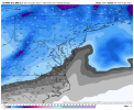
Do you have a closer view where we can see the county’s
Blue_Ridge_Escarpment
Member
Unfortunately it only shows that for mid AtlanticDo you have a closer view where we can see the county’s
Actually as modeled, the E and NE burbs and N&E from there are in the game. Wudge. Gainsville, Tacoa, etc. I'm on the fringe.Gonna be one of those situations where far north ATL suburbs look to score but I-20 and I-85 will enjoy chilly rain. I mean it’s climo I suppose.
Sent from my iPhone using Tapatalk
What did we do to deserve such trends!? My heavens! Give me Miller B or give me DEATH! That eps run should ultimately help out the system coming behind it
If we continue to see this type of stuff on the rest of the days models.. dare I say a thread to be made?

