RollTide18
Member
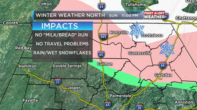
I know theres like a .5% chance of seeing a flake but I would like to see something lol
I bought my sled at that hardware store on the corner across from the old Varsity on CheshireBridge, probably in 70. They used to hang them on the outside wall whenever Guy Sharpe said it might snow, lol. It has brought me as much pleasure as most anything in my life, but only on the rare occasion. The conditions have to be right. It's a FlexiFlyer design and a long body. You can steer it with the handles, and your feet. Your legs are on the platform, with your shins and feet off the side if you need to steer, so it's easy to make sharp turns dragging your foot, because your torso, and most of your leg is supported. You can go places only the most intrepid go, because you have control. Down Amsterdam at 25 mph, or so, with cars on both sides whipping by at light speed, and your eyes streaming tears so you can't see a thing. You rattle and bounce, right at the edge of madness, and it exhilarates you to a manic state. Face first into the worm hole with your chin bouncing 6 inches off the ice. It's like grunge luge. It's big enough for two, and sturdy enough. Makes you go infinitely faster, but right at the edge of out of control. It has tiny steel runners, so snow is worthless. YOu just sink in and hit soil, unless there has been some zrain, or sleet too. But sleet is best....the next night, after the hard freeze has made it a sheet, and the cars trying to go up the hill haven't fazed it. Those runners are made for ice, and sleet makes it fly. And the city, or county roads are the track. We went down Amsterdam, in midtown, from the top, in view of the post office, all the way down past devils dive. It was in the late 70's, around 4 inches of sleet. I could drive at LeMans, leap off the Eiger in a wing suit, but I can't see how it could beat that night. That sled became legend, and icon for the oppressed sleet lovers in the deep south. It earned it's purchase price a thousand times over on that fabled night, and subsequent, though very sparse nights. Oh, people laughed, they asked "when will you use it? It's the south, it never snows". Snickering. But it's not snow the lonely rider wants...it's to once again hear the spattering in the leaves announcing, perhaps, another chance to soar with the polar bears, and enter sleet nirvana on wings of speed!!! A phantom on the midnight winds....the Sleet Dancer.My sled is like my 401k. It ain't about the immediate returns. We are talking LONG term investment here!
Sent from my iPhone using Tapatalk
") I should have been that all along...hmm...maybe Dsaur Sleet Dancer.....
I should have been that all along...hmm...maybe Dsaur Sleet Dancer..... So now I know where tony' s love of sleet comes from. It's all about the sled !
It sounds like that's the case, but I think he still would love it otherwise. To him there seems to be something wonderfully magical and perfectly wintry about it. From it not at all being shy by announcing its presence via loud sounds to it bouncing when it hits to knowing it has staying power and will likely be around for awhile, to him sleet is the King of precip. I'm confident that would still be the case if he didn't have a sled.
The great ATL winter storm of 2/17-8/1979 was quite a turning point in my life. After seeing the beautiful flakes change to little pellets within an hour of the start, I became depressed. It was supposed to snow for a longer period. Also, I figured the sleet would hardly accumulate. Boy was I to be proven wrong.
As time went along and the sleet continued to fall the rest of the evening, it started accumulating noticeably. There was actually a white sleetcover! It kind of looked like snowcover. Also, I was starting to really enjoy the sounds of sleet. I was actually starting to take a liking to the sleet. Whereas I earlier was hoping for a change back to snow, I now was content and rooting for the sleet to continue. I was not the same person I was just a few hours earlier. I had trouble going to sleep during all of this excitement. I wanted to keep watching it accumulate and hear it hit the ground. Up to 1". Up to 1.5". Atlanta was being taken over by the sleet monster and it gave me butterflies. I finally went to sleep but then woke up to a peasant surprise: it was still sleeting and with much more of it potentially falling. Up to 2.5". 3". 3.5". And yes, a whopping 4" of beautiful sleet!!!! Moreover, the sleet had staying power unlike any snow I had ever seen. After this great experience, I never again rooted against sleet and became an official sleetlover though I was and still am also a snowlover.
Well, that's my sleet story and I'm sticking to it. I'm sure many folks have a good sleet story or two.

Winter cancel. Winter (marginally) back on, Tennessee smiles when the King favors and all of a sudden I am rooting for a massive southern sleet storm.So what have I missed over the last 24 hours
Sent from my SM-G928V using Tapatalk
Sounds like a normal January on the boardWinter cancel. Winter (marginally) back on, Tennessee smiles when the King favors and all of a sudden I am rooting for a massive southern sleet storm.

Gotta love Accuweather's 100km blob maps. lolsunday/sun night snow
Chasing clipper flurries! Shows how bad this winter has been and will continue to be! Look to torch or be atleast above normal for most of Feb. just not our year! Look for most to average +6 to + 8! Hard to believe this winter will end up +15 to +20 for DJF, for a few cities in the South! Backloaded and Frontloaded , with warmth!
It sounds like that's the case, but I think he still would love it otherwise. To him there seems to be something wonderfully magical and perfectly wintry about it. From it not at all being shy by announcing its presence via loud sounds to it bouncing when it hits to knowing it has staying power and will likely be around for awhile, to him sleet is the King of precip. I'm confident that would still be the case if he didn't have a sled.
The great ATL winter storm of 2/17-8/1979 was quite a turning point in my life. After seeing the beautiful flakes change to little pellets within an hour of the start, I became depressed. It was supposed to snow for a longer period. Also, I figured the sleet would hardly accumulate. Boy was I to be proven wrong.
As time went along and the sleet continued to fall the rest of the evening, it started accumulating noticeably. There was actually a white sleetcover! It kind of looked like snowcover. Also, I was starting to really enjoy the sounds of sleet. I was actually starting to take a liking to the sleet. Whereas I earlier was hoping for a change back to snow, I now was content and rooting for the sleet to continue. I was not the same person I was just a few hours earlier. I had trouble going to sleep during all of this excitement. I wanted to keep watching it accumulate and hear it hit the ground. Up to 1". Up to 1.5". Atlanta was being taken over by the sleet monster and it gave me butterflies. I finally went to sleep but then woke up to a peasant surprise: it was still sleeting and with much more of it potentially falling. Up to 2.5". 3". 3.5". And yes, a whopping 4" of beautiful sleet!!!! Moreover, the sleet had staying power unlike any snow I had ever seen. After this great experience, I never again rooted against sleet and became an official sleetlover though I was and still am also a snowlover.
Well, that's my sleet story and I'm sticking to it. I'm sure many folks have a good sleet story or two.
The one in the late 50's was the one that spawned my sleet love (I've narrowed it down to 58 or 59 because I was doing the school patrol thing when I was out in it), but that night you describe so wonderfully was the best one of them all for it's power. Sleet is the Led Zeppelin of winter weather. It's a Beautiful Day is the snow. They are both great, saw them both, and waking up to It's a Beautiful Day at the Festival of Light is still one of the high lights of my life, but sometimes you just need to cook. Saw Led Zep at the Atlanta Pop festival in 69, and they still make a great sound track for ear buds and a steep road....Dazed and Confused and loving it, lol....all these years later. And when I can't get down on the sled anymore, I'll still love sleet because of that magical 50's storm, when the clouds came down to the ground and dropped inches of sleet all at once with a loud whoosh. Have never seen the like, or heard that sound since, but I was convinced, and still am, that I saw Old Man winter up close....and he's way cooler than we can know!I've got one of those!! Boy, oh boy....it was then next big one in Atl. 82 wasn't it Larry? Poured rain, inches of rain all night from a Gom low, then the sleet started late in the night, inches of it. That's the clean version, lol. But it was another great sleet storm. Sleet storms are bringers of happiness...if you let them. TGood stuff Larry. I choose not to air my dirty sleet story on here
Sent from my iPhone using Tapatalk
That was beautiful, Larry. I was crying for my lost youth
Atlanta finished +8.7 for JAN. Anyone know where that ranks among the warmest JAN's ?
Thanks Larry. It surprises me that most of the warm January's were so long ago. I figured there would be at least 2 or 3 years in the last 20 years to make the list.