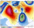
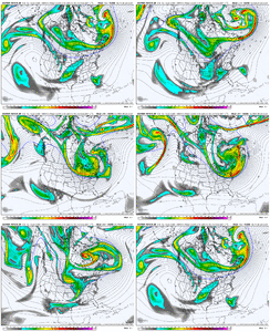
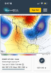
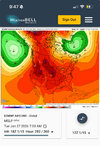
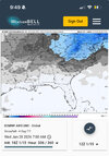
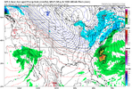
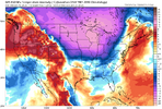
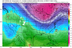
Some semblance of a STJ would help so much.Yeah...it needs to be massaged some more...why I thought maybe once we get into Feb.
-
Hello, please take a minute to check out our awesome content, contributed by the wonderful members of our community. We hope you'll add your own thoughts and opinions by making a free account!
You are using an out of date browser. It may not display this or other websites correctly.
You should upgrade or use an alternative browser.
You should upgrade or use an alternative browser.
Pattern January Joke
- Thread starter SD
- Start date
Cad Wedge NC
Member
You know that will trend west... has all season.
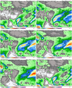
Somewhat has the look of January 2011.My life is going to be so much simpler now that I can just ride the Euro AI and watch it lock in
View attachment 183812
My life is going to be so much simpler now that I can just ride the Euro AI and watch it lock in
View attachment 183812
The Euro AI ENS loves to spew snow in the extended but dang...that looks meaty...
- Joined
- Jan 5, 2017
- Messages
- 3,770
- Reaction score
- 5,969
Bairly above freezing at 2pm this afternoon. 34 degrees under full sun. Very cold!
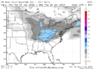
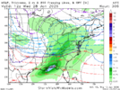
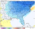
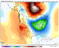
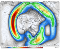
Yeah maybe the East Pac Low can send some waviness thru the weaker western ridging here near month end and get some systems running a bit more west to east instead of NNW to SSE over a tall western ridge. Jet is nice and extended here, albeit a touch poleward. No tropical forcing issues seen. Just gotta ride with what we got and hope we get episodic high pressure to our N / NW and try to time it out with a wave / stormEPS AI looks more wet/active week 2 in a workable pattern....
View attachment 183837View attachment 183838
rburrel2
Member
One of the best extended snow means of the year that it's showed, I believeThe Euro AI ENS loves to spew snow in the extended but dang...that looks meaty...
View attachment 183813
That looks clipperish grit. Not really a southern storm but heck what do I know.My life is going to be so much simpler now that I can just ride the Euro AI and watch it lock in
View attachment 183812
0.1 beats 0! I thinkThat looks clipperish grit. Not really a southern storm but heck what do I know.
Big storm signal from GFS Op and Euro Op Day 9-10 Jan 25th. Looks like a front pushes down and as it's sinking south, several LPs ride along as we get a big Artic push. Probably trend to big Ice Cad areas, with snow on backside. Buries state of VA in snow right now.
SnowNiner
Member
Yeah maybe the East Pac Low can send some waviness thru the weaker western ridging here near month end and get some systems running a bit more west to east instead of NNW to SSE over a tall western ridge. Jet is nice and extended here, albeit a touch poleward. No tropical forcing issues seen. Just gotta ride with what we got and hope we get episodic high pressure to our N / NW and try to time it out with a wave / storm
View attachment 183852
View attachment 183854
View attachment 183856
That split flow really looks good to me, with with the flow south of us. The snow mean is crazy good this far out as well. With high pressure constantly to our north in this set up perhaps our goalposts are a little wider than usual to close the month. Completely different than this weekend's sadness.
The AK sea low does remind me of early December though where waves kept cutting the western ridge down, sending the cold and the storms to our NE. Never quite getting south enough. Hope we don't have a repeat of that, and like you said perhaps some southern vorts push through the ridge. That's quite a split flow shown verbatim.
SnowNiner
Member
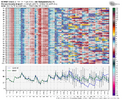
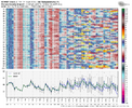
EPS AI looks more wet/active week 2 in a workable pattern....
View attachment 183837View attachment 183838
Look at all that moisture modeled in the SE, wow! With that much blocking up top it's no wonder the snow mean is so high.
I think this might be our next legitimate winter weather threat. It's a ways out but the ingredients might be there for a big event if conditions are right. We will have plenty of time to wait and see if anything materializes. Hopefully areas that miss out on Sunday's storm can cash in on this or something else down the road.Big storm signal from GFS Op and Euro Op Day 9-10 Jan 25th. Looks like a front pushes down and as it's sinking south, several LPs ride along as we get a big Artic push. Probably trend to big Ice Cad areas, with snow on backside. Buries state of VA in snow right now.
Cold today. 35 right now
It hasn't gotten above 7 degrees here today. With the wind, it's a tad chilly.
- Joined
- Jan 23, 2021
- Messages
- 4,602
- Reaction score
- 15,197
- Location
- Lebanon Township, Durham County NC
rburrel2
Member
Cad Wedge NC
Member
Here we go again boys .... this pattern looks a lot better than our current setup.
trackersacker
Member
Weeklies don’t look bad.
Cold end to January, brief break first week of February, then very interesting second and third week of February
Cold end to January, brief break first week of February, then very interesting second and third week of February
SnowNiner
Member
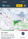
It’s the gfs, too soon. But yeah look at all that high pressure to the north. You love to see it.
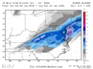
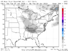
A bit of Nino-like split flow along the west coast with stream phasing here on the Euro AI at month end yields a storm that is on the northern side of things, but an interesting look overall
View attachment 183961
View attachment 183962
View attachment 183963
With the last image there you’d think it would be bigger storm. Maybe more ice around clt. But I would be amazed to get 2 inches of snow right now though. So starved.
AJ1013
Member
Tonight will be the coldest of the winter thus far. The Iguanas won't be happy 


AJ1013
Member
Rather comically the NWS saw fit to issue a "cold weather advisory".


- Joined
- Jan 23, 2021
- Messages
- 4,602
- Reaction score
- 15,197
- Location
- Lebanon Township, Durham County NC
It’s quite a cold night in the SE! Here it’s down to 37 with gusty winds lingering to make it feel like it’s in the 20s. The forecasted low is low 20s, which would be the coldest of the winter so far beating two 25s in Dec. It would easily beat the coldest so far this month of 31.
WolfpackHomer91
Member
Idk how accurate it was but SUV said 28 at 6PM pretty chilly evening
Sent from my iPhone using Tapatalk
Sent from my iPhone using Tapatalk
iGRXY
Member
I didn’t get about freezing today. High was 31.
rburrel2
Member
Messing around, I asked AI was it gonna snow sunday in Asheboro. It says better chance Asheboro sees snow jan 25th. Gave it a 60-70% chance. We shall see.
View attachment 184029
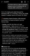 I’m learning to hate AI. I’m guilty of using it but I’ve grown to find it is a toxic echo chamber and it 100% can cause psychosis
Looks like a Brad P. tweetMessing around, I asked AI was it gonna snow sunday in Asheboro. It says better chance Asheboro sees snow jan 25th. Gave it a 60-70% chance. We shall see.
View attachment 184029
Yea i hardly ever use intentionaly. Was actually trying to research what info the AI wx models ingest how they hatch their outputs. Decided to throw this question up. And its answer is just collected verbage and reggurutated out. Probably got the whopping 60-70% chance from some accuweather 15 day forecast.

View attachment 184034I’m learning to hate AI. I’m guilty of using it but I’ve grown to find it is a toxic echo chamber and it 100% can cause psychosis
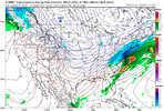
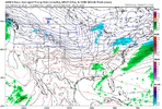
Other models basically agree and only 10 days outJust your run of the mill 1053 dripping into the states! Was only 1040 on yesterday’s runs!!View attachment 184079View attachment 184080View attachment 184081
trackersacker
Member
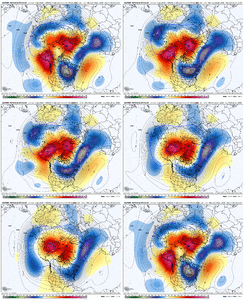
GEFS extended is a wild ride into February.
Euro Weeklies looked like this today too FWIW
Euro Weeklies looked like this today too FWIW

