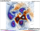
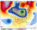
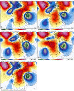
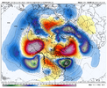
We score way more with tight windows of opportunity, Than we seem to with the wide open Holy Grail looks. Speaking for my own area. Last year would be case in point. Deeper south you go, more it takes the Holy Grail Pattern looks to cook something up. Either way it always takes impeccable timing no matter what.The progged nao blocking at least gives us a chance at something wintry while waiting out the persistent Aleutian ridge, even if the windows are small and the chances are low.
It beats a persistent SE ridge.
-
Hello, please take a minute to check out our awesome content, contributed by the wonderful members of our community. We hope you'll add your own thoughts and opinions by making a free account!
You are using an out of date browser. It may not display this or other websites correctly.
You should upgrade or use an alternative browser.
You should upgrade or use an alternative browser.
Pattern January Joke
- Thread starter SD
- Start date
Believe the PV is splitting again. That's what is shaking everything up. Hopefully for the better.
PV is forecasted to stay in a disruptive state for some time, at least through January into Feb, is vibe I'm hearing. This is what gave us the 20 straight days BN to kick off met winter
PV is forecasted to stay in a disruptive state for some time, at least through January into Feb, is vibe I'm hearing. This is what gave us the 20 straight days BN to kick off met winter
Brother I am not worried about what the last 30 years have done, I am trying to find hope with ending a terrible pattern in early January. I didn't post it saying that it's a Winter storm signal.That just looks like the average pattern for most La Nina Januarys the last 30 years
Last edited:
Webberweather53
Meteorologist
Brother I am not worried about what the last 30 years have done, I am trying to find hope in ending a terrible pattern in early January. I didn't post it saying that it's a Winter storm signal.
Well you should be concerned about what those Januarys produced because that’s where we’re very likely headed.
Webberweather53
Meteorologist
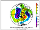
Look how much colder the SE got over one week of EPS runs for late month all due to a strengthening -NAO despite the Aleutian ridge not budging as per my Dec thread post.
I can’t say I didn’t see that coming
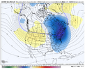
I'm having a hard time being sold on the giant ridge that extends from the Southern Plains to Europe on the weeklies, just using Jan 4 here as an example.
In reality, I suspect we could end up w/ a much more wavy & slow pattern with shortening wavelengths as the blocking high retrogrades just south of Greenland while the upstream Aleutian ridge refuses to budge. May have to be on the lookout for cut-off upper lows.
View attachment 178958
Maybe you're right, maybe you aren't. Either way, I don't really care. I am just here enjoying the weather & trying to figure out things 1-2 weeks at a time. I'm not about to just accept an entire month of Winter is over based off what it did in the past.Well you should be concerned about what those Januarys produced because that’s where we’re very likely headed.
Webberweather53
Meteorologist
That just looks like the average pattern for most La Nina Januarys the last 30 years
The good news is the median snowfall at Raleigh in January from those winters is measurable (~0.5”).
December wasn't too far off from the median either, which hovered around a trace to a dusting.
Webberweather53
Meteorologist
Maybe you're right, maybe you aren't. Either way, I don't really care. I am just here enjoying the weather & trying to figure out things 1-2 weeks at a time. I'm not about to just accept an entire month of Winter is over based off what it did in the past.
Well keep in mind that over the last 30 years worth of La Nina winters, the majority of the time it did snow in places like central NC. Even a standard Nina January would still be ok.
HurricaneSolomon
Member
- Joined
- Dec 6, 2021
- Messages
- 154
- Reaction score
- 276
January 2000 was a strong La Niña. Now I believe that changed later in the month? Then after the halfway mark we had three separate winter storms including the monster January 25, 2000 storm. I know that’s only one January example but that was fascinating to me and always will be. Mainly because at 7:00 am on one of those early first half of January mornings we had a strong thunderstorm at 70 degrees. We had a few 70 degree days before the flip. I guess what I don’t know is if the flip was expected or unexpected. The 25th storm was definitely a surprise here in Central NC.
Sent from my iPad using Tapatalk
Sent from my iPad using Tapatalk
Webberweather53
Meteorologist
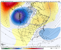
Nice to see AI EPS trying to raise heights in the w-nw.
But ... can we dampen that aleutian ridge just a tad...
View attachment 179543
The -NAO is nice but I don’t know when/if we’re getting rid of the Aleutian ridge.
Besides the Aleutian ridge that seems to be stuck in cement, a positive PNA would open up the Gulf Stream for business and give us a better shot of having moisture available to work with when cold air is available. Even if we didn't get any wintry precipitation, any precipitation at all would be welcome over much of the South which has been under a dry spell that has produced drought in many areas.
There is no doubt the disturbed PV will continue and that is at least something we can look forward to. The last time there was such an early SSW the PV didn't recover according to past data. This should at least keep the colder outbreaks coming. Just need the right disturbance to meet up.Believe the PV is splitting again. That's what is shaking everything up. Hopefully for the better.
PV is forecasted to stay in a disruptive state for some time, at least through January into Feb, is vibe I'm hearing. This is what gave us the 20 straight days BN to kick off met winter
That was the greatest 10 day stretch of winter wx in central NC, at least in my lifetime. You are correct, it was an island of winter in a Sea of warmth. Spent 7 of those days without power unfortunately. That 1st event of .2 minuscule freezing rain, was still on the limbs Monday night, when all that snow blew in. Trees caught every single flake. Got followed up Thursday by another 5 inch pure snow event. Had some single digit lows a few nights, thanks to radiational cooling and all the snow pack lying aroundJanuary 2000 was a strong La Niña. Now I believe that changed later in the month? Then after the halfway mark we had three separate winter storms including the monster January 25, 2000 storm. I know that’s only one January example but that was fascinating to me and always will be. Mainly because at 7:00 am on one of those early first half of January mornings we had a strong thunderstorm at 70 degrees. We had a few 70 degree days before the flip. I guess what I don’t know is if the flip was expected or unexpected. The 25th storm was definitely a surprise here in Central NC.
Sent from my iPad using Tapatalk
HurricaneSolomon
Member
- Joined
- Dec 6, 2021
- Messages
- 154
- Reaction score
- 276
That was the greatest 10 day stretch of winter wx in central NC, at least in my lifetime. You are correct, it was an island of winter in a Sea of warmth. Spent 7 of those days without power unfortunately. That 1st event of .2 minuscule freezing rain, was still on the limbs Monday night, when all that snow blew in. Trees caught every single flake. Got followed up Thursday by another 5 inch pure snow event. Had some single digit lows a few nights, thanks to radiational cooling and all the snow pack lying around
Yes! That’s exactly right. I remember watching one of the conference championship games the Sunday night before the big 25th storm. They were calling for clear skies the following Monday night. Then they changed it to flurries, then to 1-3 inches of snow and then almost two feet fell. That’s a good memory on the smaller storms before that left a little bit of ice which I think was the 23rd? Then the 5” of snow a week or so before that? I still can’t get over how warm it was before all of that the first half of that month and back then I’m sure most thought spring was making an early arrival.
Sent from my iPad using Tapatalk
USC Met Minor
Member
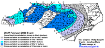
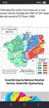
Unreal how Columbia set a new record low when they got absolutely shafted during this storm. I was in 6th grade & it was a wiff on a diabolical level. First heartbreak of my young weather passion career lolView attachment 179554View attachment 179555
I believe this storm came through in a weak la nina/neutral pattern
- Joined
- Jan 23, 2021
- Messages
- 4,602
- Reaction score
- 15,197
- Location
- Lebanon Township, Durham County NC
too much ensemble noise(especially on the euro AI) for me to discount the chances around NYE/first of JAN
Last edited:
NBAcentel
Member
SnowNiner
Member
Cold rain purgatory View attachment 179563View attachment 179564
Grasping post: Normally I'm not at all enthused with no pacific help and all -NAO/wedge related patterns. But perhaps since the cold/PV is on our side of the globe, and Canada's very cold, maybe what's blocked and wedged down will be cold enough to do work this time. Maybe?
Yeh if we are going to score at all over the coming weeks, it's going to be a classic CAD set up.Grasping post: Normally I'm not at all enthused with no pacific help and all -NAO/wedge related patterns. But perhaps since the cold/PV is on our side of the globe, and Canada's very cold, maybe what's blocked and wedged down will be cold enough to do work this time. Maybe?
Bigedd09
Member
Wasn't there a couple minor events that January? I know central/eastern nc had a decent stormCold rain purgatory View attachment 179563View attachment 179564
NBAcentel
Member
Wasn't there a couple minor events that January? I know central/eastern nc had a decent storm
Yeah there was, it’s a pattern that steers to marginal, but with it there’s always that small shot you get a big wet snow event especially with a cutoff
- Joined
- Jan 23, 2021
- Messages
- 4,602
- Reaction score
- 15,197
- Location
- Lebanon Township, Durham County NC
LukeBarrette
im north of 90% of people on here so yeah
Meteorology Student
Member
2024 Supporter
2017-2023 Supporter
And it won’t help us
NBAcentel
Member
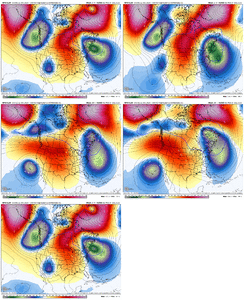
That look on the end of the AI is probably gonna reflect with a lot of big dogs on the means in the upcoming days, it’s likely the ens trying to sniff a cutoff. Good example between the ens/OP, which shows a cutoff with cold rain, but it’s not far off
Take the AIFS ensembles with a grain of salt because the weatherbell maps plot the snow incorrectly and are often over-exaggerated
I've gotten a foot with worse lol Mother Nature just doesn't behave like she used too.Lol whatever helps you cope I guess. I was told the same thing about this Christmas torch a few weeks ago
You can spit all the analogs and indicies that you want. I don't think we can no longer go off historical data anymore. Mother nature is changing and she doesn't behave like she used too. It's always threading the needle. Give me some cold air up in Canada and I'll roll the dice.
tennessee storm
Member
And it won’t help us
Lol
This is the way. I’d even just accept that Aleutian ridge stretching out a bit oven if we can’t totally kill it. If we can get that NAO cooking there will most certainly be more than small pattern ripples.Way way out there, But hopefully we evolve to this kind of look down the road. Nice Ridge Bridge off the CFS
View attachment 179553
And it won’t help us
Jimmy’s 2 pennies. If we can get some sort of favorable AO/NAO combo to dislodge it sometime in early/mid January we’ve got something to work with. Yeah it would be nice to have the PNA, EPO play ball but we may be able to work some magic without it given the cold pool anomolies that would be brought southward into the states. We can work with a rotting airmass sliding south and east as long as its origins are this cold. At least I’d like to think so
NBAcentel
Member
LukeBarrette
im north of 90% of people on here so yeah
Meteorology Student
Member
2024 Supporter
2017-2023 Supporter
That low off the coast of Cali is just gonna sit there isn’t it. Nothing to boot it eastlol GFS shifting the entire ridge out west View attachment 179575
NBAcentel
Member
The more stuck/more retrogression that occurs with it, it could actually prolong the western ridge in a sense, it’s forcing heights to be raised in the westThat low off the coast of Cali is just gonna sit there isn’t it. Nothing to boot it east
NBAcentel
Member
That little Baja cutoff is becoming a bit of a driver. It’s not steepening that ridge enough out west in its own but just enough to send some northern energy eastward. Flow jamming stuff. Could stumble into something later. Or not. But maybe
NBAcentel
Member

