Then order the pizza.Yep was gonna say I am a fan of the AI models consistently throwing some LR bones. Get the pattern, get the noise, narrow down to a window, reel it in
-
Hello, please take a minute to check out our awesome content, contributed by the wonderful members of our community. We hope you'll add your own thoughts and opinions by making a free account!
You are using an out of date browser. It may not display this or other websites correctly.
You should upgrade or use an alternative browser.
You should upgrade or use an alternative browser.
Pattern January Joke
- Thread starter SD
- Start date
Bigedd09
Member
GFS gets ugly later on with a SE ridge. But it's looking better before then
Once again, I like what the UKMET is cooking up in the time frame of interest beyond day-8.
Arctic air is in place with a reinforcing high pressing into the Central US with energy in the SW and Southern Rockies on the move east as the southern lobe of the retrograding TPV in SE Canada rotates out. o
o

Arctic air is in place with a reinforcing high pressing into the Central US with energy in the SW and Southern Rockies on the move east as the southern lobe of the retrograding TPV in SE Canada rotates out.
o
Last edited:
NBAcentel
Member


CNCsnwfan1210
Member

Roughly 8-9 days away with some favorable trends in this timeframe. Love to see where this goes if we keep this up.
Sent from my iPhone using Tapatalk
broken025
Member
AI is learning it gets more clicks when it shows snow storms.
Still too warm for most of us but getting there.
NBAcentel
Member
Euro slowing down the SE Canada vortex more, probably gonna show something wintry once that shortwave out west ejects 
OHHHHHHHHHHHHH LAWD A SHAWN SPECIAL

CNCsnwfan1210
Member
OHHHHHHHHHHHHH LAWD A SHAWN SPECIAL
View attachment 179962
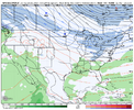
There’s your big cad winter storm in the timeframe we’re looking at, Euro honking the horn today.
Sent from my iPhone using Tapatalk
NCHighCountryWX
Member
- Joined
- Dec 28, 2016
- Messages
- 700
- Reaction score
- 1,921

Cad Wedge NC
Member
That look has Big Dog southern slider written all over it..... Hope it verifies.
NBAcentel
Member
Wut is this 
That's a @Twister special.Wut is this View attachment 179964
Tsappfrog20
Member
OHHHHHHHHHHHHH LAWD A SHAWN SPECIAL
View attachment 179962
Come to papa haha !! Let’s Go!!
Sent from my iPhone using Tapatalk
CNCsnwfan1210
Member
Cad Wedge NC
Member
Aleutian low... Check
PV in Hudson Bay .... Check
+PNA .... Check
-NAO ..... Check
Energy in the southwest coming out .... Check
If I see this look verify, I will pull the trigger and put on the plow attachment.
wow
Member
A LITERAL CLOWN MAP!!
REX Block over W NA and a STRONG NAO/Greenland block ! WOOF!
A VERY defined split flow.. this is textbook right here. The confluence building over the NE may be too strong at first but once it starts pulling N, look out.
Shawn will hate this map lolOHHHHHHHHHHHHH LAWD A SHAWN SPECIAL
View attachment 179962
trackersacker
Member
GEFS has noise around New Years 
Attachments
-
 0169EB61-B056-4250-B668-483D429E61E7.png86 KB · Views: 69
 -
 D994D1F3-DFCD-4E18-A394-9E2A06587D6D.png121.6 KB · Views: 64
 -
 E7796C70-80BC-4B7B-A167-18DFBF1DD986.png120.6 KB · Views: 64
 -
 9C6FA262-B420-45DA-A408-CDECF305FC11.png130.2 KB · Views: 66
 -
 C03E3741-9480-4219-A500-2017DDCBD152.png131.6 KB · Views: 64
NBAcentel
Member
No surprise there from the euro on that system though. Classic miller B/CAD look there. Not truly a snowy look but rather a look that fits into the ice category. If we want to snow you need to scoot the trough over the ATL further west and suppress the vort over the C US

Medium dogWut is this View attachment 179964
Big doggie brewing in the Gulf of Cold Rain

NBAcentel
Member
I don’t know if you can draw this up any better. This is something we used to get with ninos though 
Here’s hoping we keep the cooler than expected temps trend going from DecemberStill too warm for most of us but getting there.
wow
Member
Yes sir. Look at the STJ ripping through TX.. not going to be hurting for storm systems here if this develops as shown. REX block keeping the arctic Highs moving across.I don’t know if you can draw this up any better. This is something we used to get with ninos though View attachment 179974
NBAcentel
Member
GEFS caving ? Who would have thought 
GEFS caving ? Who would have thought View attachment 179976
And here’s the result at the surface: this 4 run gif shows a strong trend toward an Arctic high plunging down Jan 9th:


Prestige Worldwide
Member
Yeh we got something brewing about a week into January.


NBAcentel
Member
Nice trend on the EPS for that system the euro shows as well. If we can get that trough in the Atlantic rooted to some more Arctic troughing around SE Canada we got ourselves something. Headed towards a pretty classic miller B look though. Some encouraging looks for this period

Many people on the board are going to be happy by the end of January.
Sent from my iPhone using Tapatalk
Sent from my iPhone using Tapatalk
85 had the major arctic outbreak a few weeks after that analog
256wx
Member
Maybe we should retitle this thread “Jumping January!”
We can't do that, the weather gods don't like positivityMaybe we should retitle this thread “Jumping January!”
Told yall winter was coming "women and Children first" .
Not only did we jump start Turkey Day through 1st 20 days met winter.
We are fixing to have THE HOLY GRAIL PATTERN, right smack dab in the peak of prime climo.
All we had to trade off is 4-5 days AN at Chtistmas.
Seen flakes fly already on 3 seperate occasions.
Lord only knows what the tab is gonna look like by the time we get to Groundhogs day and look back.
If im a betting man for GSO, I say the airport records 8+ frozen by then and atleast 2 nights with single digit lows.
Last edited:
Wut is this View attachment 179964
The sound of NO hoping for a repeat.
In all seriousness, that is a wild look.
256wx
Member
Could be referencing jumping off a cliff! Cuts both ways! But yes, I meant it the good way.We can't do that, the weather gods don't like positivity