from yesterday, just cray cray:

I can't for the life of me figure out how to use "Post-Image" to post pics. I even signed up for it. Oh well.
Summary of storm at my location: I had freezing rain for like 4 hours (that started 6:15 AM) and then hour+ of sleet. Then went back and forth between sleet and snow. Then finally all snow about 12:30. Total accumulation about 1.5" of sleet and snow plus close to 0.25" ZR. This was easily the biggest winter storm here since 12/1989. After it was finished, I took a very enjoyable walk and really soaked this in.
Congrats Larry!
Thanks, Shawn. For some reason, I'm really struggling with this. I must have a mental block or I'm just too tired. But I at least somehow got one of the pics to show.
Webber I received a dusting here in Chatham Co.
1.3 here. Parents had 4 just west of SanfordFor those in NC where the snow has stopped how much snow have you seen thus far? (I just need it for the reanalyzed map at the end)
Not bad all things considered. At least you still have 42nd st oyster bar if this storm is a fail!!!Thanks! I've received about an inch and change (1.25" ish) here near downtown Raleigh, not bad!!!
1.3 here. Parents had 4 just west of Sanford
Sent from my SM-G955U using Tapatalk
4 inches west of Sanford is a win. Must have been some training over that particular area for a while.
Yeah, if it didn't take so long to the groundWhat could have been for Wake Co... Could only imagine if we had some legitimate snow and these bands to go along with it
Randolph County 1/4 inch here and 1/2 to 1 inch in Randleman. Nada in Archdale which is NW tip of Randolph County line. Seagrove and over to SE side of County saw 2+. Good Luck Webber
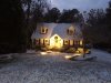
Dang, Larry, that's just perfect for my needs! Freeze that down and it's sledding every night after midnight, lol. Ya'll need a big hill over thereI can't for the life of me figure out how to use "Post-Image" to post pics. I even signed up for it. Oh well.
Summary of storm at my location: I had freezing rain for like 4 hours (that started 6:15 AM) and then hour+ of sleet. Then went back and forth between sleet and snow. Then finally all snow about 12:30. Total accumulation about 1.5" of sleet and snow plus close to 0.25" ZR. This was easily the biggest winter storm here since 12/1989. After it was finished, I took a very enjoyable walk and really soaked this in as who knows how many years it will be before the next one like this.
") Happy for you, man! I got dibs on the next sleet storm though. I'm working on coaxing this next low into the gulf so I can get it Sun/Mon. T
Happy for you, man! I got dibs on the next sleet storm though. I'm working on coaxing this next low into the gulf so I can get it Sun/Mon. TMoore county did great!!
I am traveling to Fort Bragg for work. I got tired of driving and stopped in Sanford. About 5" here.For those in NC where the snow has stopped how much snow have you seen thus far? (I just need it for the reanalyzed map at the end)
Solid 4" hereFor those in NC where the snow has stopped how much snow have you seen thus far? (I just need it for the reanalyzed map at the end)
Lots of reports across Northern East TN of snow showers dropping quick dustings or more.Here's some of the totals I've been able to find thus far across central NC and SC border counties in areas where it has stopped snowing: As mentioned earlier please feel free to add what you saw in your location if you don't see it on here so I can make sure the reanalyzed & archived map of this event is more accurate! The NWS Local Storm Reports & NOWData are very skimpy at best, the last couple events I've relied very heavily on the information given by everyone here on this forum...
Aberdeen:4.5”
Apex: 1.3”
Bethel (NE Person): 1.5"
Carthage: 5.5”
Cary: 1.7"
Cary (West): 1.5"
Chalybeate Springs (NE Harnett): 1.3”
Chapel Hill: 2.5-3”
Chatam County (NW): Dusting
Conway, SC: 3”
Dillon, SC: 6"
Durham: 1.5"
Falls Lake: 0.4"
Fort Bragg: 1.5”
Greensboro: 0.3"
Hamlet: 3”
Haw River (E Alamance): 1"
Hillsborough: 1"
Holly Springs: 0.5"
Knightdale: 1”
Lake Wheeler: 0.5"
Laurinburg: 6”
Masonboro (south-central New Hanover): 2"
Maxton: 4.5”
Moncure: 4.0"
Morrisville: 1"
NWS ILM Office: 3.5"
NWS RAH Office: 0.8"
Pembroke: 3”
Pinehurst: 6”
Pinebluff (Moore): 4.5”
Pittsboro: 3"
Ramseur: 1"
Randleman: 0.5”
RDU: 0.5"
Rockingham: 4"
Roxboro: 1.5”
Sanford: 5.5"
Sanford (2): 5"
Sanford (West): 4"
Saxphaw (SE Alamance): 1"
Seagrove: 2"
Seven Lakes: 4”
Sophia: 0.3”
Surl (SE Person): 1"
Wilmington: 4.5"
I have some friends that live out towards Rocky Mount/Nashville area and told me they received 6 inches. Just wanted you to have it for your list your compiling.
With all the snow cover around, KCHS continues to break daily record lows. 17° on Thursday and 16° at least so far this Fri morning. Summerville has been 12° on both Thursday and Friday mornings!
Here's a short montage of satellite, personal photos and more meteorological stats on a short vid I did for this historical event.
Wow!! Im so happy for you.With all the snow cover around, KCHS continues to break daily record lows. 17° on Thursday and 16° at least so far this Fri morning. Summerville has been 12° on both Thursday and Friday mornings!
Here's a short montage of satellite, personal photos and more meteorological stats on a short vid I did for this historical event.