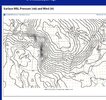
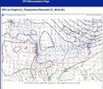
Does this mean anything downstream? Maybe. Maybe just a coincidence. It will be interesting to see if the models change based on obs like this that indicate the ridge might not be as stout. I really would like to learn more about how each model assimilates data given the huge amounts of data in this day and age.I should just mention the warm nose has been overdone in OKC already
-
Hello, please take a minute to check out our awesome content, contributed by the wonderful members of our community. We hope you'll add your own thoughts and opinions by making a free account!
You are using an out of date browser. It may not display this or other websites correctly.
You should upgrade or use an alternative browser.
You should upgrade or use an alternative browser.
Wintry January 23rd-27th 2026
- Thread starter SD
- Start date
StormStalker
Member
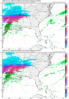
The GFS and RAP are pretty close for ice totals here and moving it deeper into North Alabama.
Pops
Member
Maybe we can get a little sleet and snow in the morning according to hrr and rapThe GFS and RAP are pretty close for ice totals here and moving it deeper into North Alabama.
This doesn’t seem to be a decrease in forecasted ice… because this is accrual / accumulation , not total percip that falls. Over an inch accrual of ice in Greenville is … something else.
BufordWX
Member
I meant for my area of Anderson. Was an 1” plus yesterday.This doesn’t seem to be a decrease in forecasted ice… because this is accrual / accumulation , not total percip that falls. Over an inch accrual of ice in Greenville is … something else.
Brent
Member
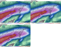
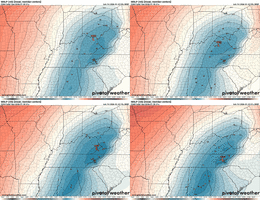
Does this mean anything downstream? Maybe. Maybe just a coincidence. It will be interesting to see if the models change based on obs like this that indicate the ridge might not be as stout. I really would like to learn more about how each model assimilates data given the huge amounts of data in this day and age.
Yeah I do want to caution I don't know if it means anything for east of here but I just wanted to throw that out there
Steady light to moderate rain will help with accruals , ALOTLight/steady freezing rain, colder temps (mid 20s) just awful
Everything freezes, no dripping!
Benholio
Member
Remember, if the map says TOTAL FREEZING RAIN QPF - it isn't an accrual map. So even if it fully verified it wouldn't mean that much ice accrual. A decent guideline is to cut it in half. But obviously it depends on a lot of things (how low surface temp, wind, how heavy precip, CAD characteristics)
It doesn't include all of you, but had some thoughts on Raleigh since a lot of friends live there. A collection of my thoughts and my general final call here:

 open.substack.com

Final Forecast on Fern; Mostly Killer Some Filler
And other thoughts heading into the home stretch
LongRanger
Member
It amazes me at the people that sees these maps and thinks those totals are what accrues.Remember, if the map says TOTAL FREEZING RAIN QPF - it isn't an accrual map. So even if it fully verified it wouldn't mean that much ice accrual. A decent guideline is to cut it in half. But obviously it depends on a lot of things (how low surface temp, wind, how heavy precip, CAD characteristics)
beanskip
Member
yeah but on the other hand, about 40 years ago I experience freezing rain and 18 degress and I can assure you that every drop of it accrued.It amazes me at the people that sees these maps and thinks those totals are what accrues.
Where was this and what year?yeah but on the other hand, about 40 years ago I experience freezing rain and 18 degress and I can assure you that every drop of it accrued.
- Joined
- Jan 2, 2017
- Messages
- 1,566
- Reaction score
- 4,279
That is awesome, love the way you writeIt doesn't include all of you, but had some thoughts on Raleigh since a lot of friends live there. A collection of my thoughts and my general final call here:

Final Forecast on Fern; Mostly Killer Some Filler
And other thoughts heading into the home stretchopen.substack.com
beanskip
Member
Jan. 1985 -- Monteagle Mountain Tenn.Where was this and what year?
iGRXY
Member
Other than the immediate ridge tops, the worst place to live in SC if you want to avoid ice is exactly where I live. From about 3 miles north of downtown Greer up to Landrum and along and west of US221 gets the absolute worst of having fast rising elevation and being immediately adjacent to the highest mountains. Spartanburg and Cherokee counties in SC in general are the prime CAD regions in this state, but within those counties that area gets the worst of the worst when it comes to ice. And the best of the best when trying to fight off the warm nose during snow storms. I fully expect close to an 1” of ice accretion on top of the 2-3” of likely sleetWhile I appreciate Pivotal with the actual measurement of .46 right over MBY, I don't know how the upslope areas of @ForsythSnow to @iGRXY aren't absolutely hammered by this.
On a side note, good grief Mississippi.
Your style of forecast writing is very engaging and I enjoyed reading your thoughts about this storm. You prove that one can entertaining and informative at the same time.It doesn't include all of you, but had some thoughts on Raleigh since a lot of friends live there. A collection of my thoughts and my general final call here:

Final Forecast on Fern; Mostly Killer Some Filler
And other thoughts heading into the home stretchopen.substack.com
- Joined
- Jan 2, 2017
- Messages
- 1,566
- Reaction score
- 4,279
LongRanger
Member
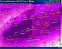
So that's 97% chance of .26"
I'm praying for more sleet than Fzra.Other than the immediate ridge tops, the worst place to live in SC if you want to avoid ice is exactly where I live. From about 3 miles north of downtown Greer up to Landrum and along and west of US221 gets the absolute worst of having fast rising elevation and being immediately adjacent to the highest mountains. Spartanburg and Cherokee counties in SC in general are the prime CAD regions in this state, but within those counties that area gets the worst of the worst when it comes to ice. And the best of the best when trying to fight off the warm nose during snow storms. I fully expect close to an 1” of ice accretion on top of the 2-3” of likely sleet
CJ on wyff was talking about the area and where he's expecting the worst totals!
He said he and his team did extensive research to other events in the region but focused on 2005 and the research showed the worst areas in the region to be was Eastern GVL even dipping below 85 then back up North of Hwy 11 in Spartanburg & Pickens counties!
Essentially the map below is showing the area that gets hit the worst historically.
Attachments
Last edited:
Thrasher Fan
Member
Early 2000's PTSD coming in with these maps.
what are you thinking for cleveland county? i know im probably cooked but it would be interesting to hear what you have to say.Other than the immediate ridge tops, the worst place to live in SC if you want to avoid ice is exactly where I live. From about 3 miles north of downtown Greer up to Landrum and along and west of US221 gets the absolute worst of having fast rising elevation and being immediately adjacent to the highest mountains. Spartanburg and Cherokee counties in SC in general are the prime CAD regions in this state, but within those counties that area gets the worst of the worst when it comes to ice. And the best of the best when trying to fight off the warm nose during snow storms. I fully expect close to an 1” of ice accretion on top of the 2-3” of likely sleet
- Joined
- Jan 23, 2021
- Messages
- 4,602
- Reaction score
- 15,197
- Location
- Lebanon Township, Durham County NC
It has happened in Quebec as well in the mid 90sWhere was this and what year?
- Joined
- Jan 23, 2021
- Messages
- 4,602
- Reaction score
- 15,197
- Location
- Lebanon Township, Durham County NC
what are you thinking for cleveland county? i know im probably cooked but it would be interesting to hear what you have to say.
I think the edges of this storm are absolutely cooked, speaking as a Gaston County native
iGRXY
Member
I’d say 0.75” is a safe bet along and north of 85 and south of I40what are you thinking for cleveland county? i know im probably cooked but it would be interesting to hear what you have to say.
I stopped at the Bucees after work to get some gas and there were a bunch of power trucks gassing up. I’m betting they were about to head east towards Pickens county. This is my first super wedge at the new homestead. We are only 700 feet above sea level so it should help funnel the wedge up the valley.
iwantsouthernsnow123
Member
Yeah, I live in toccoa, in a pretty rough spots for this ice storm. Hoping it ends up being more sleet and FZR especially living around a bunch of pine trees.
Raleighwxauthority
Member
I genuinely believe Raleigh will accrue 1"+ of freezing rain and lose power for a week.
I live in the NW NC mountains and am taking this seriously. I'm going to head to my brother's house tomorrow in Statesville. He has a generator, etc and I don't want to be home alone in my condo for 4 days with no power. The ZR totals are a tad concerning.
mx3gsr92
Member
I stopped at the Bucees after work to get some gas and there were a bunch of power trucks gassing up. I’m betting they were about to head east towards Pickens county. This is my first super wedge at the new homestead. We are only 700 feet above sea level so it should help funnel the wedge up the valley.
Been driving from Orlando to the snow capital of the world, Moyock, all day long. Power truck after power truck heading north. Mostly Pike and Duke. Like droves of trucks together. They're coming for ya boys and girls.
chase223322
Member
Im with you - have a bunch of very large trees surrounding our houseYeah, I live in toccoa, in a pretty rough spots for this ice storm. Hoping it ends up being more sleet and FZR especially living around a bunch of pine trees.
WXinCanton
Member
Wish Lookout was still around he was a genius on these systems.
rburrel2
Member
Hrrr continues to trend deeper and colder with the cold/dry air push tomorrow across the south. Feel like this high pressure is over performing a bit.
My sister is in Boiling Springs, SC and I’m really nervous for them. They lost over thirty 20+ Years old cypress trees during Helene.Other than the immediate ridge tops, the worst place to live in SC if you want to avoid ice is exactly where I live. From about 3 miles north of downtown Greer up to Landrum and along and west of US221 gets the absolute worst of having fast rising elevation and being immediately adjacent to the highest mountains. Spartanburg and Cherokee counties in SC in general are the prime CAD regions in this state, but within those counties that area gets the worst of the worst when it comes to ice. And the best of the best when trying to fight off the warm nose during snow storms. I fully expect close to an 1” of ice accretion on top of the 2-3” of likely sleet
BufordWX
Member
Fountainguy97
Member

