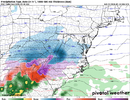
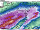
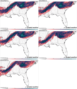
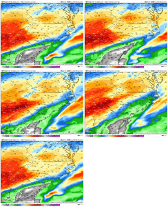
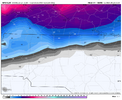
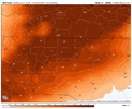
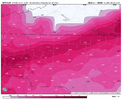
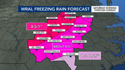
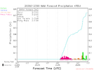
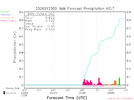
Atlanta is barely below freezing when the heavier precipitation moves through. The earlier 1-inch totals with temps well below freezing have shifted north. The trend toward a nuisance event in the Atlanta area on the previously most aggressive model seems clear to me.lol c'mon now..you might want to include the next panels. 1.5 to 2 inch liquid is not nuisance
View attachment 187811
-
Hello, please take a minute to check out our awesome content, contributed by the wonderful members of our community. We hope you'll add your own thoughts and opinions by making a free account!
You are using an out of date browser. It may not display this or other websites correctly.
You should upgrade or use an alternative browser.
You should upgrade or use an alternative browser.
Wintry January 23rd-27th 2026
- Thread starter SD
- Start date
Yes that's correctSo this is going to be a magic Miller B Extreme CAD apparently. Super cold, dry classic CAD strong well-placed high where a magic low runs up the apps and drags a cold front through the entire Southeast with a line of thunderstorms and bumps temps into the 40s. Cool.
Honestly I’m not trying to be mean or anything I just don’t know either way, this is a rather impressive inversion. I would like to see what a subset of observed similar soundings to this actually verified as p type wise
Winter storm izzy all over again… I’m not sure why models don’t handle slery very well!Tbh, the more I look into this event, the more failure modes I see for big (0.5”+) ZR potential over the Piedmont of NC. I definitely am leaning more towards proportionally more sleet than I was this morning
Awesome. It's fun to witness new stuff!Yes that's correct
what are your thoughts on the qpf being lower on AI models and the nam? i know my area of nc has a history of dryslotting even if it doesn’t look like it so i was wondering what your take on it is.Tbh, the more I look into this event, the more failure modes I see for big (0.5”+) ZR potential over the Piedmont of NC. I definitely am leaning more towards proportionally more sleet than I was this morning
SimeonNC
Member
For those leaving your home for safer harbor. Such as I plan. I recommend you shut off your whole home water valve. Then drain the lines. Usually a bathtub at the lowest level. Just trying to help.
Personally I don't see some red flag on the nam, rgem, icon so far that says nah dog this is going to be suppressed.Awesome. It's fun to witness new stuff!
Im just not sure what folks are expecting at this point to keep this south or snow or whatever.
NWG_WX14
Member
Icon doesn’t have that as rain but okay.NAM has that as rain, it will warm up as the coastal transfers. So only focusing on the overrunning as it has best cold temps.
rburrel2
Member
It is getting 2 to 3 degrees warmer.
The RGEM is a good reliable short range model. Not sure out past 48hrs thoughI like the RGEM…middle of the road between the overly wet and dry. Mix of sleet and frzn.
View attachment 187812
iGRXY
Member
RGEM locked on 0.75-1”+ of ice on the FRAM.
- Joined
- Jan 23, 2021
- Messages
- 4,602
- Reaction score
- 15,197
- Location
- Lebanon Township, Durham County NC
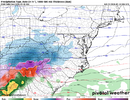
I think we could get lucky and squeeze out a couple inches if the cherries line up.There you are front end thumpView attachment 187820
Prob gonna come out goated again w this one unfortunately
On RGEM…I haven’t taken that model too seriously since it had me getting 37” of snow like 60 hours out when every other one had 5-8 ish and we nickled and dimed our way to 5” in a miller B dryslot. I believe this was Feb 2021
iGRXY
Member

I honestly couldn’t draw a better map as far as footprint or totals than the FRAM RRFS. This feels likely imo.
SnowNiner
Member
So this is going to be a magic Miller B Extreme CAD apparently. Super cold, dry classic CAD strong well-placed high where a magic low runs up the apps and drags a cold front through the entire Southeast with a line of thunderstorms and bumps temps into the 40s. Cool.
I just don’t understand this at all either. I really thought this would trend to a more southern transfer, rather than cutting so far into the wedge, creating a cold front squall line. I guess I’ve just never seen it before. Usually these storms go around the wedge. But ok.
LovingGulfLows
Member
- Joined
- Jan 5, 2017
- Messages
- 1,499
- Reaction score
- 4,100

I honestly couldn’t draw a better map as far as footprint or totals than the FRAM RRFS. This feels likely imo.
Praying that's the case...only has me getting a tenth of an inch of ice accretion...by far the lowest amount I've seen on a model today.
beanskip
Member
At 21z Sunday per the 0z GFS.
Temps:
LaGrange Ga -- 65F
Atlanta -- 32F
They are 67 miles apart.
Temps:
LaGrange Ga -- 65F
Atlanta -- 32F
They are 67 miles apart.
Makeitsnow
Member
lol ok but first of all you would have to buy the icon's precip axis totally while ignoring all other modeling showing a lot falling by sunday pm.Atlanta is barely below freezing when the heavier precipitation moves through. The earlier 1-inch totals with temps well below freezing have shifted north. The trend toward a nuisance event in the Atlanta area on the previously most aggressive model seems clear to me.
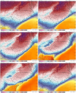
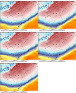
here is the 2 meter temps and totals though late sunday. some of atlantas worst ice storms have occured at 31 or so just fyi. And you know why...subfreezing air up to 950mb and above ...that allows the drops to cool off before contact and freeze faster with temps close to freezing. Here is the icon's latest 950mb temps at 18z sunday and 0z monday. Lastly this is not a perfect representation of conditions. Pretty much ALL modeling misses by 1 to 3 degrees...and erodes the wedge too fast.
I will wager atlanta will have more than it can handle and it will hardly be a nuisance.
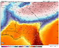
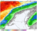
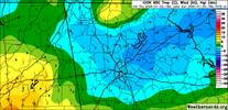
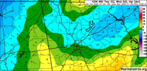
ChattaVOL
Member
Does that indicate more sleet or freezing rain? From what you are saying it seems like sleet.lol ok but first of all you would have to buy the icon's precip axis totally while ignoring all other modeling showing a lot falling by sunday pm.
here is the 2 meter temps and totals though late sunday. some of atlantas worst ice storms have occured at 31 or so just fyi. And you know why...subfreezing air up to 950mb and above ...that allows the drops to cool off before contact and freeze faster with temps close to freezing. Here is the icon's latest 950mb temps at 18z sunday and 0z monday. Lastly this is not a perfect representation of conditions. Pretty much ALL modeling misses by 1 to 3 degrees...and erodes the wedge too fast.
I will wager atlanta will have more than it can handle and it will hardly be a nuisance.
View attachment 187818View attachment 187819
View attachment 187826
View attachment 187828
iGRXY
Member
GFS is still a QPF monster. It flips the upstate over to rain the last 3-4 hours. That will not happen. It drops another 0.5” as rain. That would be ZR and would likely accrue somewhere around 30-50% or an additional 0.15-0.25” of ZR FRAM.
LovingGulfLows
Member
- Joined
- Jan 5, 2017
- Messages
- 1,499
- Reaction score
- 4,100
GFS Ice trend
Even the GFS, one of the worst models for my backyard is slowly reducing ice amounts.
Mpirone12
Member
GFS is so bad…Euro and Ai models dog walked it.
Still 48-60 hours to keep pushing NW.
View attachment 187830
Did that tick up to close to 2 inches in Greensboro?
Sent from my iPhone using Tapatalk
I only get 2.6” there. Boys I think I found the escape hatchDid someone say less precip?View attachment 187823
In all seriousness I just keep watching and waiting on a model suite to take the precip max somewhere else other than straight up the 85 corridor but it just hasn’t happened. Disgustingly consistent.
BufordWX
Member
Not as many people on here are in this area, but MS down to LA are heading for a massive ice storm too. NWS forecasting large swath of 1” ice in these areas.
Teach Lesley
Member
2 inches of snow. 2.5 of sleet and 1.25 freezing rain. At my location. On that map. Should have bought more at the store. This should be fun.00z GFS Snow
View attachment 187829
Sleet
View attachment 187831
Freezing RainView attachment 187832
WxBlue
Meteorologist
Mpirone12
Member

No way GSO gets over an inch QPF of sleet. We’ll be shut down for weeks haha
Sent from my iPhone using Tapatalk

